
A slow-moving cold front that is drifting across the middle of the country will spread rain from the Great Lakes to the Ohio Valley over the next couple of days.
Further south, moisture from the Gulf of Mexico increases the chance for severe weather conditions along the frontal boundary.
On Friday, an enhanced risk of severe weather – which includes tornado, wind and hail threats -- has been issued by the Storm Prediction Center for the Southern Plains into the Lower Mississippi Valley.
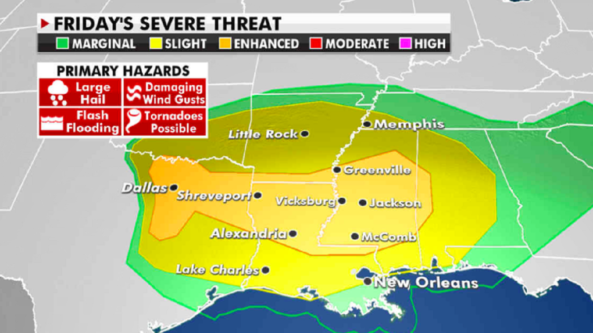
The risk of severe weather for Friday. (Fox News)
NASA GETS FIRST WEATHER REPORT FROM MARS ROVER LANDING SITE
In the Southwest and High Plains, warm temperatures, gusty winds and low humidity will lead to the potential for more dangerous fire weather. Red flag warnings for enhanced fire risks have been issued in the Four Corners region and into the Central High Plains.
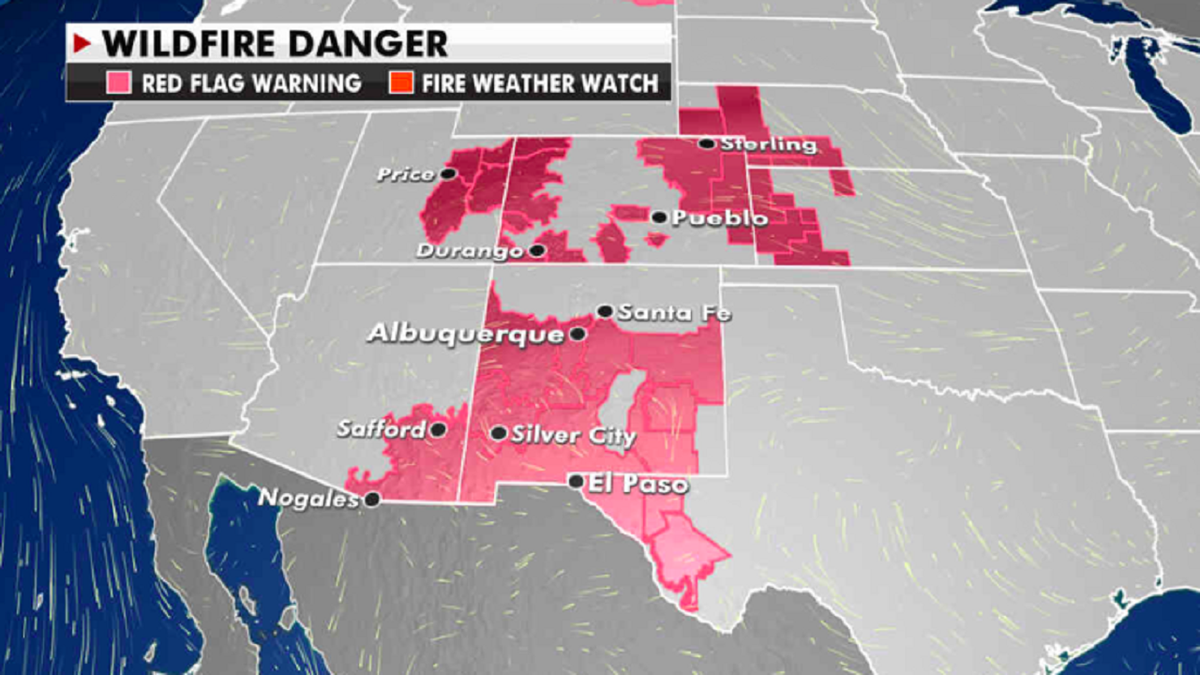
The current risk of wildfires. (Fox News)
Finally, outside of the Pacific Northwest, above-average temperatures continue for most of the lower 48 states.
CLICK HERE TO GET THE FOX NEWS APP
The Great Lakes region will again be 15 to 25 degrees above average as some daily record highs may be set. Buffalo, N.Y., could reach the low 80s.
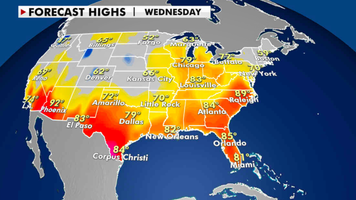
Expected high temperatures for Thursday. (Fox News)
The Southwest and southern Texas will range from the 90s to near 100 for the next few days.

The hottest stories ripped from the headlines, from crime to courts, legal and scandal.
