

Fox News Flash top headlines for January 12<br>
Fox News Flash top headlines are here. Check out what's clicking on Foxnews.com.
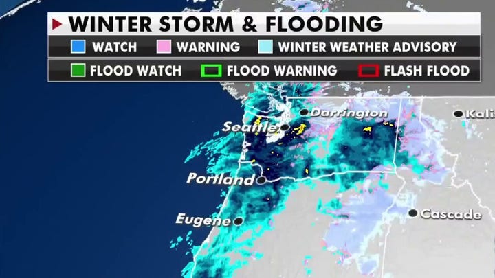
After a chilly winter storm smacked Texas and other parts of the Gulf Coast, a newly-formed atmospheric event will dump snow, rain and more on the Pacific Northwest this week.
Residents can expect to see heavy precipitation and potential flooding over the next couple of days as a slow low-pressure system moves East.
WINTER STORM MOVES INTO THE MISSISSIPPI VALLEY AFTER DUMPING SNOW IN TEXAS
According to the National Weather Service, moderate flash flood warnings are in place for both coastal and inland areas of the Northwest.
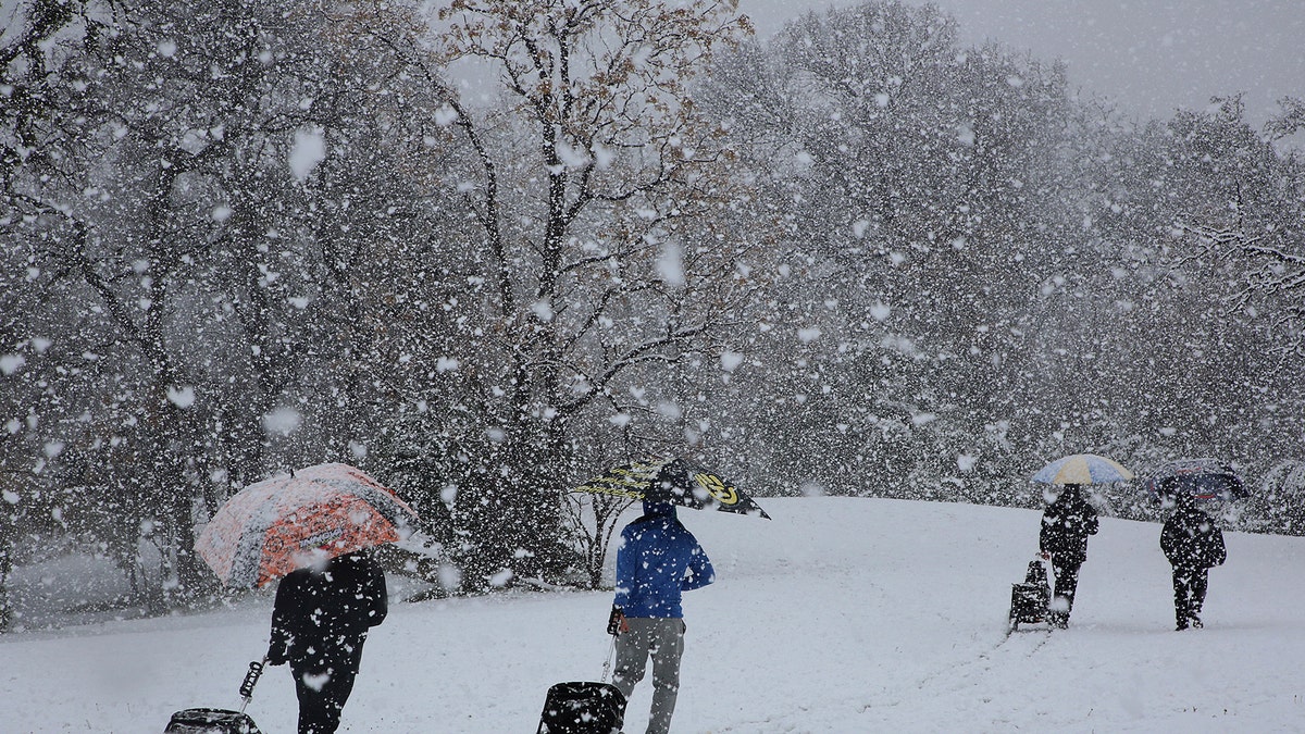
Disc golfers make their way through the snow at their tournament in Cameron Park in Waco, Texas, on Sunday, Jan. 10, 2021. (Rod Aydelotte/Waco Tribune-Herald via AP)
California, Oregon and Washington are all expecting several inches of rain.
Spokane's KHQ reported Tuesday that damaging gusts could fell trees and widespread power outages are possible.
Heavy snowfall will be a concern for the Cascade Range and Northern Rocky Mountains through mid-week, where more than a foot of snow is predicted.
High wind advisories will also take effect for Montana and Colorado's Front Range as the system moves.
To the East, states will see a major warmup, with temperatures shifting to 10 to 20 degrees above average.
Over parts of the Northern and Central Plains, some spots may reach up to 30 degrees above average, with highs in the 50s and 60s.
CLICK HERE FOR THE FOX NEWS APP
Afterward, another cold front is expected to hit the Midwest, Plains and Eastern Great lakes with more wintry conditions.

The hottest stories ripped from the headlines, from crime to courts, legal and scandal.
