


Snow is already in falling across the Mid-Atlantic, and is now moving into the Northeast.
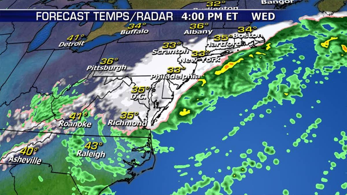
Heavier snow from NYC northward will start around midday and then continue through tonight.
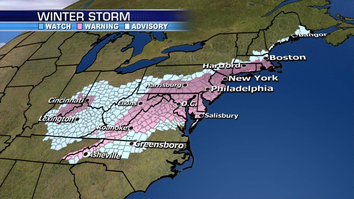
Winter Storm Warnings are in effect from Washington, D.C. to Boston.
Generally speaking, 6-12 inches of snow is forecast for these areas but 10-16”+ are more likely across portions of Maryland, southeastern Pennsylvania, New Jersey, New York, and southeastern New England where we won’t have much rain mixing in. Parts of the I-95 corridor have the potential for 12” or more.
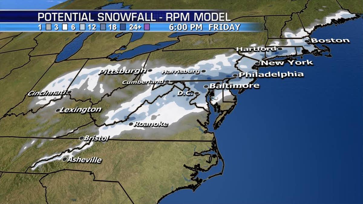
Snow will taper off tonight, lingering across eastern New England Thursday morning. Wind gusts over 40mph are possible near the coast.
Moderate coastal flooding will be a problem, especially for southern New Jersey and Delaware.
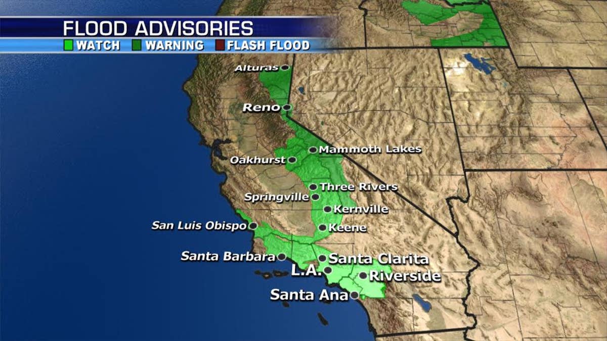
Meanwhile, we have heavy rain in the forecast across the West:
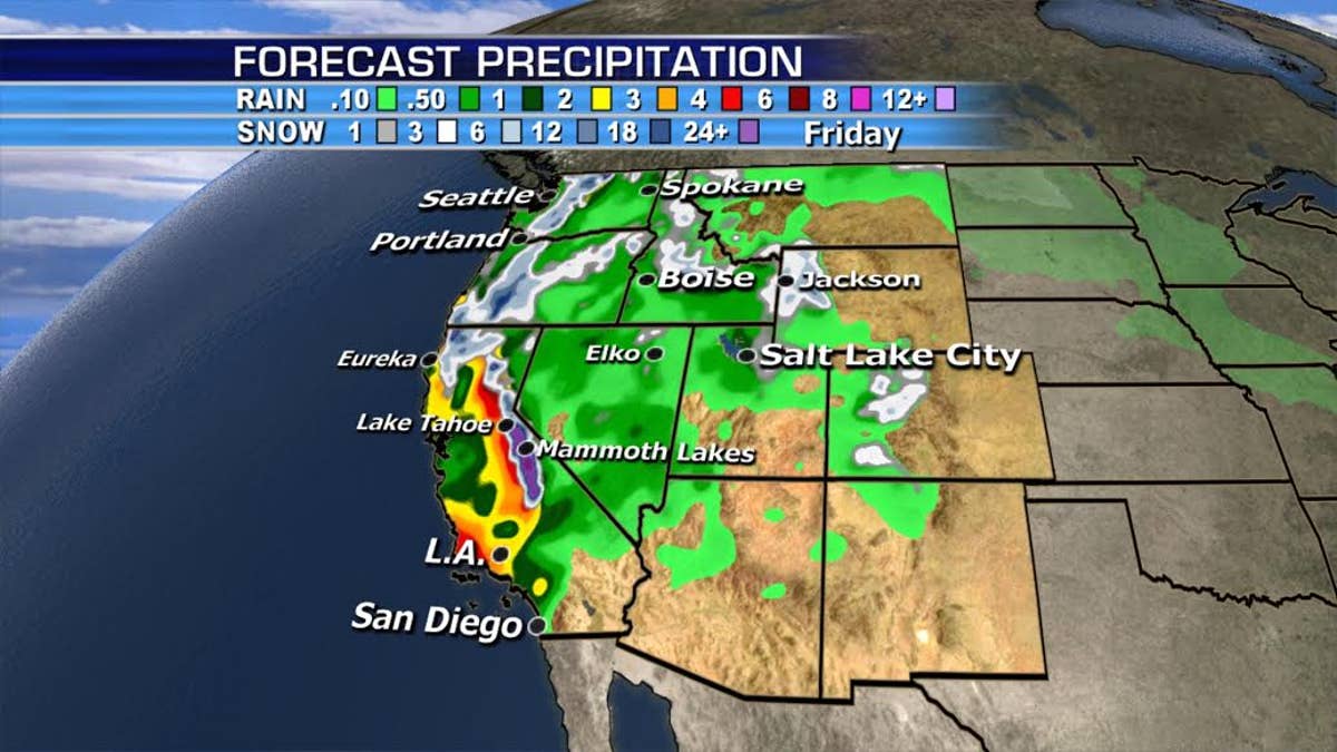
This includes Southern California where the recent burn areas will keep the flash flooding/mudslide threat high through Thursday.