


A destructive event called a derecho is developing in the northern Plains.
FOX Weather said Tuesday that the cluster of thunderstorms – often described as an inland hurricane – will impact the area, along the periphery of a large dome of high pressure.
A wind damage swath must cover a distance of at least 400 miles and include gusts of at least 58 miles per hour (mph), in addition to several well-separated 75-mph of higher gusts, along most of its length.
The National Oceanic and Atmospheric Administration's (NOAA) National Severe Storms Laboratory (NSSL) notes it is associated with a band of rapidly moving showers or thunderstorms.
"Although a derecho can produce destruction similar to that of tornadoes, the damage typically is directed in one direction along a relatively straight swath," the NSSL states. "As a result, the term 'straight-line wind damage' sometimes is used to describe derecho damage."
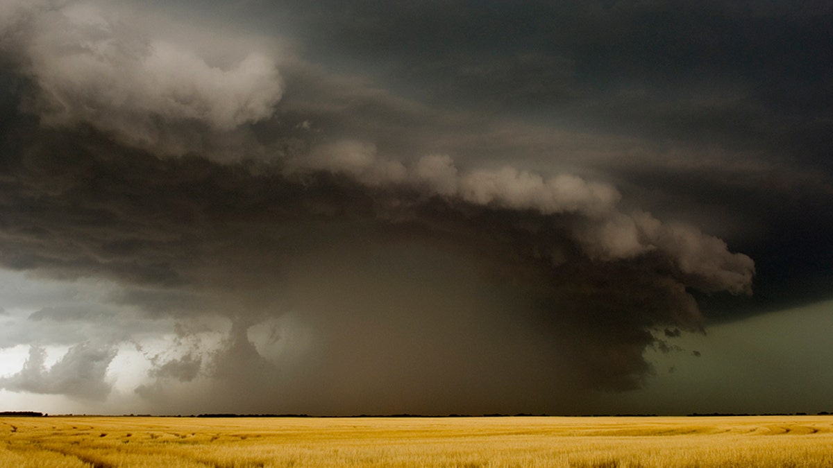
Derechos are known for having a swath of wind damage extend for more than 240 miles and include wind gusts of at least 58 mph, or greater, along most of its length. (Photo by Jim Reed/Corbis via Getty Images)
"While derecho winds typically are less than 100 mph, gusts as high as 130 mph have been recorded – equivalent to those with strong EF2 tornadoes," the National Weather Service's (NWS) Storm Prediction Center (SPC) says.
The word "derecho" was coined by Dr. Gustavus Hinrichs in 1888, based on the Spanish word "derecho," which means "direct" or "straight ahead." Hinrichs coined the term in order to distinguish straight-line wind damage from that produced by tornadoes, according to the SPC.
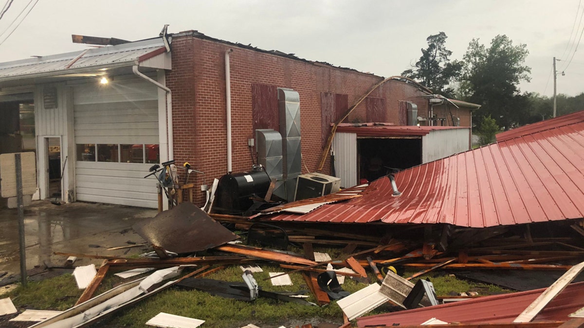
Damage can be seen to the Kittrell Volunteer Fire Department after a derecho blasted Tennessee in May 2020. (Kittrell Volunteer Fire Department)
According to a factsheet from the SPC, the term disappeared from use for nearly 100 years until it was resurrected by severe weather meteorologists in the mid-1980s.
SEVERE THUNDERSTORM DANGERS: WHY YOU SHOULD TAKE WARNINGS SERIOUSLY
The line of storms that develops continues to accelerate over a span of possible hundreds of miles, bringing widespread and persistent wind damage.
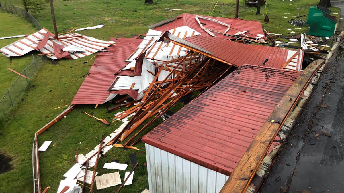
Damage can be seen to the Kittrell Volunteer Fire Department after a derecho blasted Tennessee/ (Kittrell Volunteer Fire Department)
In the past decade, there have been notable derecho events that have impacted millions of Americans.
On June 29, 2012, a derecho swept from the upper Midwest to the central Atlantic coast in a matter of hours, causing 1,200 reports of damaging winds were received with numerous reports of wind gusts at hurricane force (74 mph) or greater, the NWS office in Louisville, Ky. notes.
In May 2020, a complex of severe thunderstorms developed over Kansas before trekking across southern Missouri and western Kentucky in time to reach Nashville.
These storms produced widespread straight-line wind damage and caused the worst power outage in the Nashville area in decades. The thunderstorms that blasted the Nashville area brought winds between 60 and 80 mph. Forecasters said a 72-mph wind gust was reported at Nashville International Airport, the fifth-fastest wind gust officially measured in the city's history.
CLICK HERE FOR THE FOX NEWS APP
According to forecasters at the SPC, those at greatest risk in a derecho are people outside when the thunderstorms strike, especially in city areas. Unlike tornadoes that have localized damage, a derecho with widespread impacts requires "considerably" more resources to respond to.
"It is the vulnerability of overhead electric and communication lines to high winds and falling trees that makes derecho winds especially problematic in urban areas," the SPC says in its fact sheet. "In addition to posing a direct hazard to anyone caught below the falling lines, derecho damage to overhead electrical facilities sometimes results in massive, long-lasting power outages that can affect hundreds of thousands of people; in the worst events, power may not be restored for days."


True Crime
The hottest stories ripped from the headlines, from crime to courts, legal and scandal.
By entering your email and clicking the Subscribe button, you agree to the Fox News Privacy Policy and Terms of Use, and agree to receive content and promotional communications from Fox News. You understand that you can opt-out at any time.
