


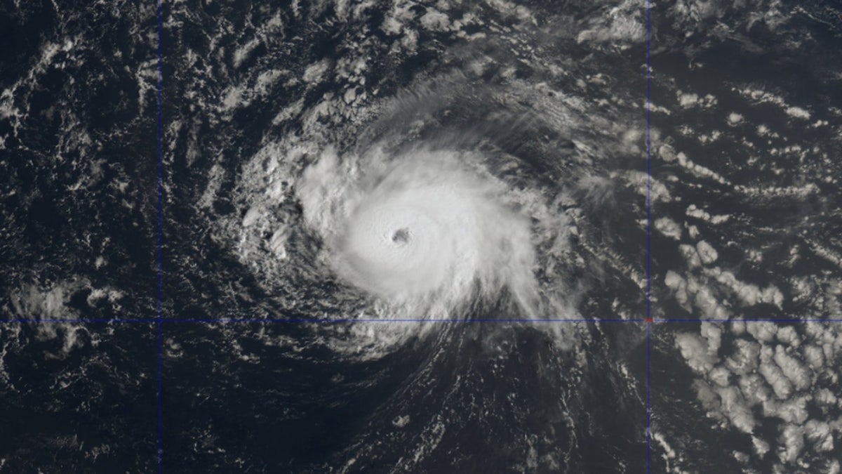
Hurricane Florence is now a category 3 storm with winds are estimated to be 120 mph, according to the National Hurricane Center. (NOAA)
The sixth named storm of the 2018 Atlantic hurricane season gathered strength Wednesday to become the first major hurricane of the year.
The National Hurricane Center said Hurricane Florence has maximum sustained winds that are estimated to be 125 mph, and is located about 1,370 miles east-southeast of Bermuda. Florence, now a Category 3 storm, is moving west-northwest at 13 mph.
"A turn toward the west-northwest with a decrease in forward speed is forecast on Thursday, followed by a turn back toward the northwest early next week," the NHC said it its 11 a.m. ET advisory.
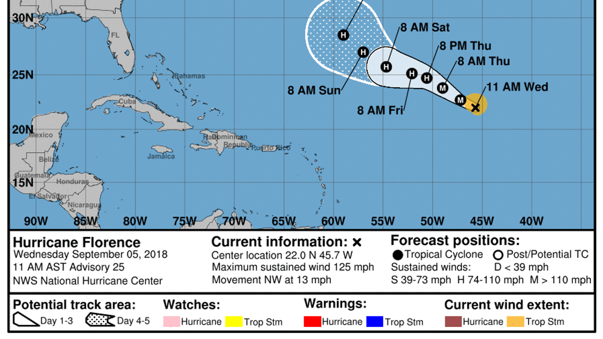
The forecast track of Hurricane Florence. (NOAA)
A forecast track by the NHC shows the storm eventually heading into the central Atlantic by Monday. It's too early to know if the storm will affect any land, but residents and tourists on Bermuda are asked to remain vigilant into next week.
2018 ATLANTIC HURRICANE SEASON NOW TO BE 'LESS ACTIVE' APPROACHING PEAK MONTHS, NOAA SAYS
"Some weakening is possible during the next few days, but Florence is expected to remain a strong hurricane through early next week," the NHC said.
Florence comes as residents along the Gulf Coast are dealing with the remnants from Tropical Storm Gordon, which made landfall early Wednesday.
Hurricane Florence is the basin’s sixth named storm of the year. Last month, the National Oceanic and Atmospheric Administration said the Atlantic hurricane season is now expected to be "less active" as it enters its peak months due a combination of conditions in the ocean and atmosphere helping to limit storm development.
NOAA forecasters are now calling for 9 to 13 named storms with winds of 39 mph or higher, of which 4 to 7 will strengthen into hurricanes. Of those storms, there may be up to 2 major hurricanes, which are classified as Category 3, 4 and 5 with winds of 111 mph or higher.