


Farmers' Almanac: Winter will be 'teeth-chattering' cold
Get ready for a rough winter as The Farmers' Almanac is predicting a 'colder-than-normal' season from the Continental Divide on eastward, complete with 'teeth-chattering' cold arriving in mid-February in the Northeast, Great Lakes, and even into the Southeast.
It's beginning to feel a lot like Christmas — in the northeast, at least.
Temperatures will start to drop dramatically over the next few days, and Thanksgiving Day, in particular, will be extremely chilly in some areas. A "nasty" arctic blast blowing in from the north is set to cause temperatures to plummet 15-to-20 degrees Wednesday night into Thursday in cities such as New York City, Boston and Philadelphia, according to The Weather Channel. Accuweather meteorologists agreed it will feel "more like Christmas Day than Thanksgiving" in most of the northeast.
“Air typical of the heart of winter will anchor across the Northeast on Thanksgiving Day,” AccuWeather Meteorologist Brett Rathbun explained Monday, noting most cities will see highs in the 20s.
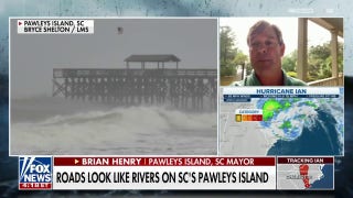
WINTER WILL BE 'TEETH-CHATTERING' COLD, HAVE PLENTY OF SNOW, FARMERS' ALMANAC CLAIMS
The coldest Thanksgiving on record in New York City was 26 degrees, on Nov. 28, 1901, The Weather Channel points out. This year, with a current high of 26 degrees projected for Thursday, the city is potentially on track to beat that 117-year-old record.
“It looks like the cold front tracking across the Great Lakes will move across the area late Wednesday or Wednesday night which will bring temperatures barely reaching freezing,” National Weather Service meteorologist Peter Wichrowski told amNewYork on Sunday.
Fox News meteorologist Janice Dean says Wednesday will be "quiet" across the East as colder air settles into the region.
"Cold winds gusting past 20 mph at times will make it feel even more uncomfortable," Dean told Fox News, adding the wind could also impact balloons at the Macy's Thanksgiving Day Parade. "Some of the balloons might not be able to fly or they might be kept lower than you would typically see."
“Air typical of the heart of winter will anchor across the Northeast on Thanksgiving Day."
Similarly, in Boston, the high Thursday will be a mere 22 degrees — 2 degrees lower than the record, also reportedly set in 1901. That's nearly 30 degrees below the typical high the city sees around this time of the year, CBS Boston says.
"Thanksgiving will be dry and bright, but it will be COLD," veteran meteorologist Barry Burbank warned in a weekend blog post.
Burlington, Vermont, Albany, New York, and Providence, Rhode Island may also see record lows on the holiday, according to The Weather Channel.
Early forecasts claim readings could dip near zero degrees in places across the northeast, with a storm system that could follow.
"A frontal system from the West will then intensify in the Plains on Friday and could develop into a coastal storm for the East Coast during the weekend," the NWS said in a Sunday tweet.
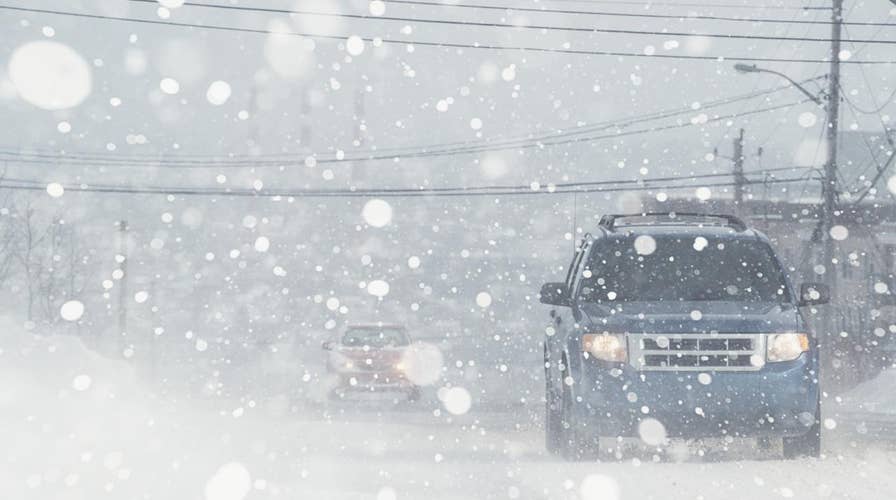
From a light snowfall to rain, some spots will be both cold and wet this week. Snow is likely to start accumulating in Pennsylvania and slowly make its way across the New England area this week, dropping up to 3 inches, though Accuweather says the Catskills of New York and coastal Maine will be hit the hardest with up to six inches.
"Stretches of interstates 84, 87, 90, 91, 93 and 95, as well as other area roads can become slick and treacherous," AccuWeather Senior Meteorologist Kristina Pydynowski said.
The Rockies and Great Plains will have slightly better luck with dry and mild temperatures ideal for traveling, AccuWeather says.
Parts of the Pacific Northwest, however, will see a wintry mix of rain and snow. Northern California, which has recently suffered the deadliest wildfire in the state's history, will start seeing heavy rainfall and some snow starting late Tuesday.
CALIFORNIA WILDFIRE EVACUEES PLUNGED INTO STATE'S HOUSING CRISIS
"A major change in the weather pattern is forecast for mid to late this week," NWS Sacremento said Monday. "This will bring travel difficulties to the region with slick roadways due to summer oil build up & accumulating snow at pass levels."
The NWS says the west systems should help "suppress" the destructive Camp Fire, but there are concerns it could complicate search efforts.
"Recently burned areas could see ash flow, though, and even have the potential for debris-flow if rain intensity is high enough," NWS Sacremento added.
The area around Paradise could get 20 mph sustained winds and 40 mph gusts, which could make it hard for crews to keep making progress against the blaze, the NWS said.
"Rain across both Northern and Southern California may cause flash flooding and mudslides, especially in recent burn areas," Dean warned.
The Deep South, too, could see heavy rainfall.
"While much of the eastern U.S. will be experiencing a very cold air mass associated with an Arctic high-pressure system, this area of low pressure will have the potential to bring flooding rain to portions of Louisiana, Mississippi, Tennessee, Alabama and Georgia," said AccuWeather Meteorologist Brett Rossio, adding those areas could see up to 3 inches of water and possible "strong" thunderstorms.
The Associated Press contributed to this report.