


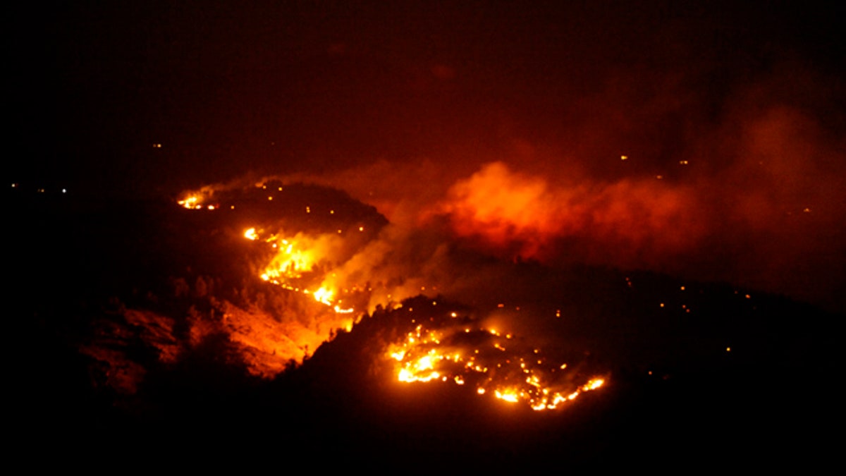
March 21, 2011: In this photo the Indian Gulch fire burns west of Golden, Colo. (AP)
Colorado's high country has experienced headline-grabbing amounts of snowfall this year -- paradise for skiers -- but much of the valuable white stuff is trapped in the mountains.
Elsewhere in the state, it's drier than dry, and that adds up to a whole lot of danger.
The five-state region made up of Colorado, Kansas, Nebraska, South Dakota and Wyoming "is some of the driest country we have in the United States, no question," Rick Cables of the U.S. Forest Service said. "And I think we're getting more fire activity than anywhere else at this point in the year."
"We believe the wake-up call is here," Cable said. "It seems like fire seasons are coming earlier and lasting longer."
Fire crews typically start late in the spring, but the Forest Service and other agencies are "hustling" to get resources pre-positioned earlier, Cables said.
Tim Matthewson, fire meteorologist at the Rocky Mountain Area Coordination Center, said Colorado is at 111 percent of the average for snowpack, but the map is "misleading." The wet stuff " is locked up above 8,000 feet (elevation) and especially west of the (Continental) Divide," Matthewson said, adding the drought monitor "has showed intensifying drought conditions across much of Eastern Colorado, extending into Western Kansas." His statistics indicate it's actually worse right now than the infamous 2002 drought, just not as widespread.
The current dry period started in early August 2010. Grasses did not get compacted by snow and they're now abundant, meaning lots of available fuel.
These older grasses are standing tall and straight up, which will make them burn more readily, according to the experts who recently briefed media about wildfire potential for the season. So far, there's minimal new growth or what's referred to "green-up" because soil moisture is low. And, there's tremendous bark beetle activity, which means lots of diseased trees.
Northeast Colorado typically gets an average of three fires in March, but there have been at least 26 in the area, this month. A fire on March 22 in Stanton County, Kan., burned 144,000 acres in one day, exceeding anything in the database.
The dangerous situation can be turned around, but Matthewson says it will take a few wet storms of longer duration to make a difference. Pre-frontal conditions (increased high winds, above-average temperatures and low humidity) could be an issue.
"The wild card in any forecast is ignition. You can have the worst conditions possible, but if you don't have the ignitions, you don't have the fires," Matthewson said. He said lightning at this time is minimal and human activities are the main source of trouble.
Todd Richardson, a Bureau of Land Management fuel operations specialist, advises people to make their home "a winner."
That means wetting lawns, keeping wood piles away from propane tanks and porches, getting leaves out of the gutters and other basic precautions. If you keep a well maintained property, "we'll put young men and women in front of your house or in that area... to try to assess whether that house is defendable or not. "
Cables says the long-term solution is the condition of the landscape, keeping it in such a way that when a wildfire does break out, it will burn at lower intensity, so "that we have a fighting chance to suppress it." This approach includes thinning, removing fuels from around communities and structures and prescribed burns.
Safety is still a top priority and he thinks science is helping them get better at assessing the degree of risk and exposure for firefighters, plus the public and land they're trying to protect.

True Crime
The hottest stories ripped from the headlines, from crime to courts, legal and scandal.
By entering your email and clicking the Subscribe button, you agree to the Fox News Privacy Policy and Terms of Use, and agree to receive content and promotional communications from Fox News. You understand that you can opt-out at any time.
