


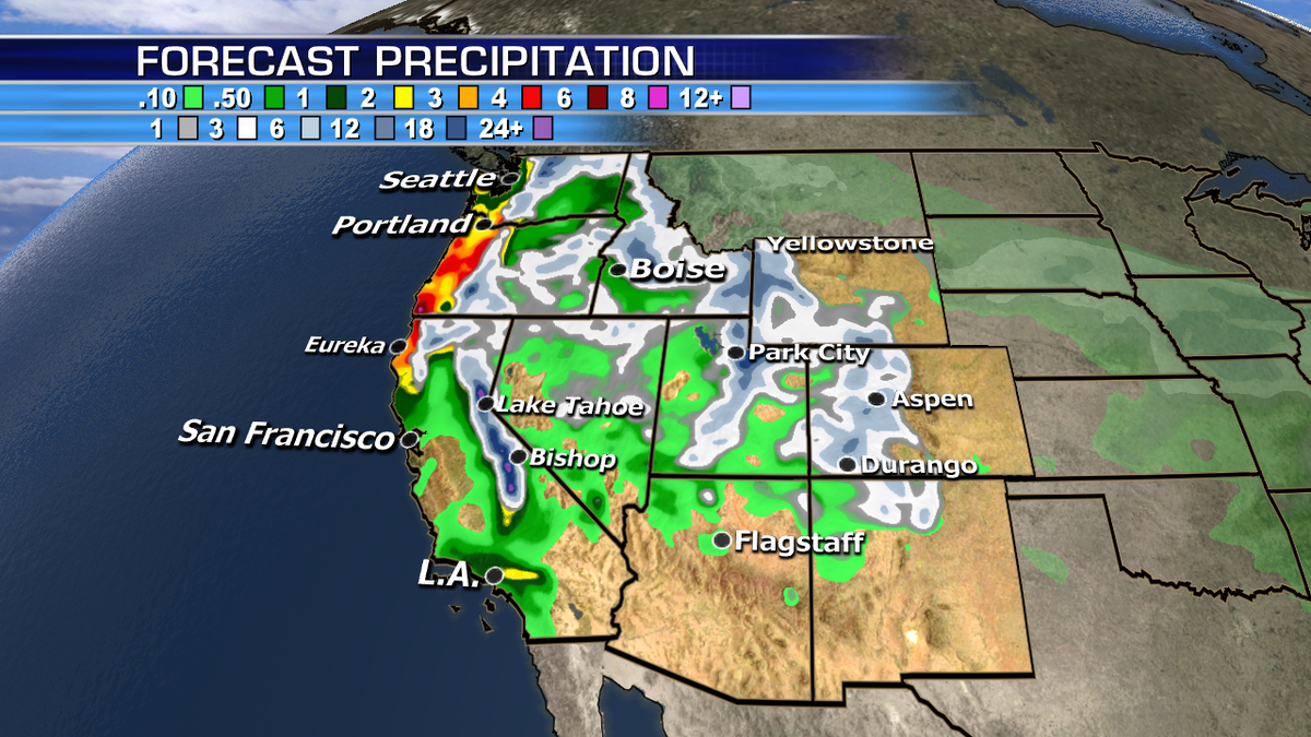
An extremely busy weather pattern is happening across the country with several systems spreading heavy rain, snow and wind across the West. Flash flooding will be possible along the coast while blizzard warnings are in effect for the Sierra range in California.
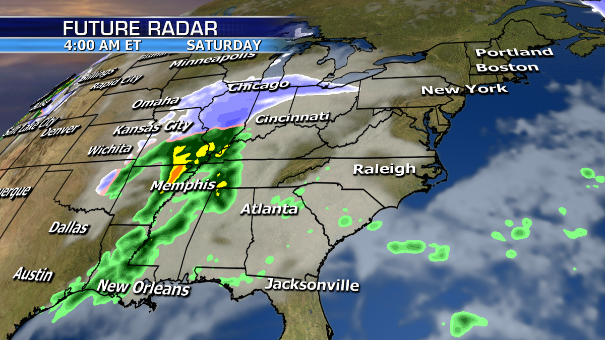
Rain and snow will arrive across the Midwest and Ohio Valley today, spreading to the Northeast and Mid-Atlantic tonight into Friday. This system is overall weak and accumulations will be relatively light.


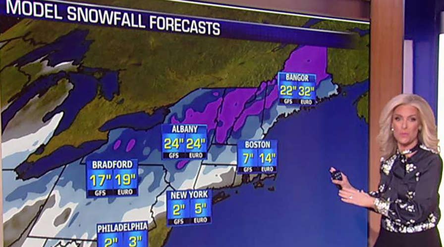
Of higher concern is the second system over this coming weekend, which will be much stronger with heavier precipitation. The highest confidence for the heaviest snow beginning Friday night through Sunday is from the eastern Great Lakes through the interior Northeast and interior New England.
Right now the track of the storm shows the primary low close enough to/over the coast to make for a rain-snow mix near the coast- likely starting as snow switching to rain, then briefly back to snow, keeping I-95 snowfall from D.C. to NYC on the lower side, while heavier snow inland.
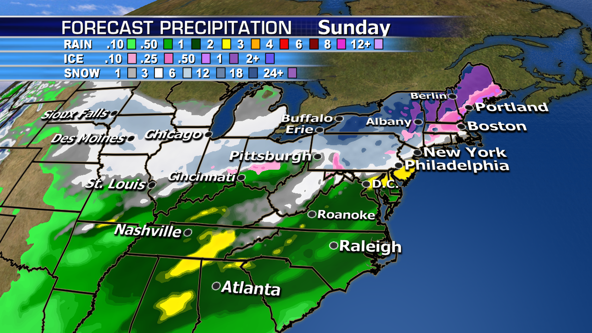
There are still a few days to fine tune this forecast, but as of now there is more concern for greater impact inland over the weekend. Everyone should stay tuned to their local forecast for more details on timing and impacts.
