


National forecast for Friday, August 21
Fox News senior meteorologist Janice Dean has your FoxCast.
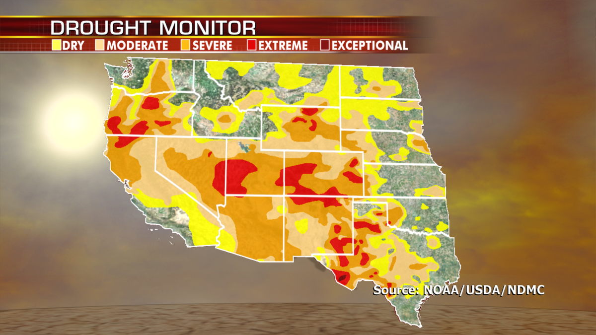
Parts of the West will get a bit of a break in terms of dangerous heat, but the dry conditions persist and wildfire danger remains for the Northwest and Great Basin.
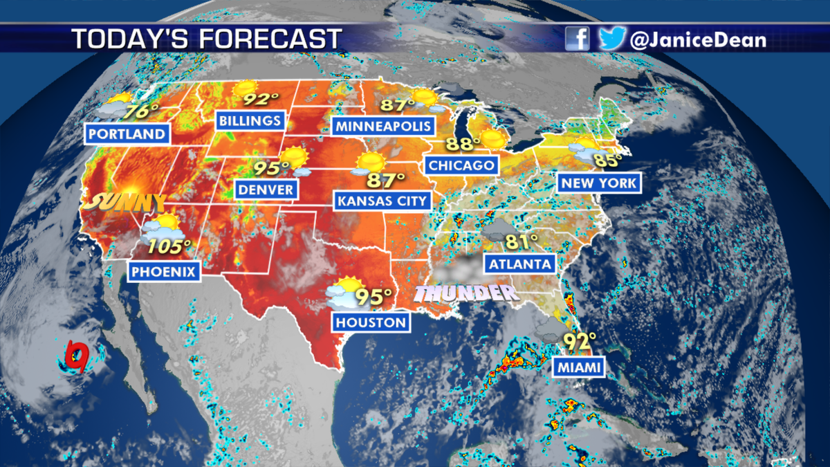
Meanwhile, over the Southeast, a stalled front will be the focus of showers and thunderstorms today through the weekend. We will also see the risk for showers and storms over the Upper Midwest and parts of New England.
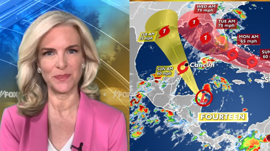
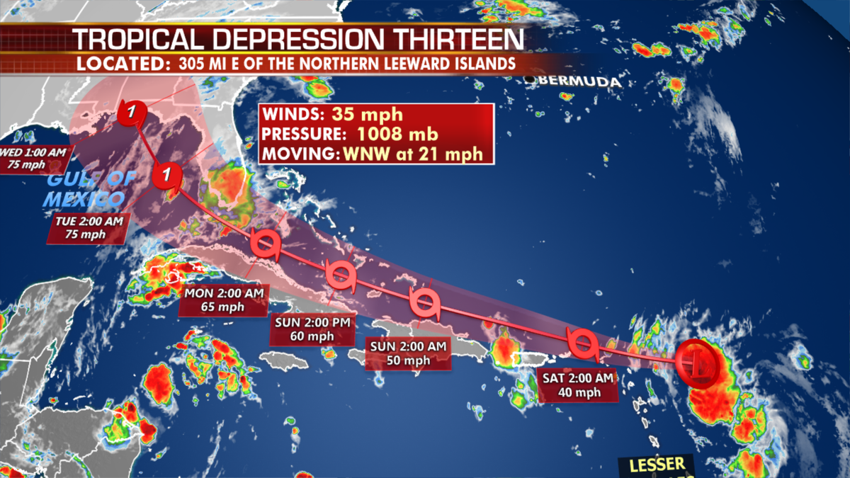
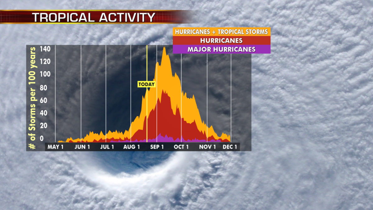
The tropics are incredibly active as we get into peak hurricane season. Tropical Depression Thirteen has developed into Tropical Storm Laura as of Friday morning, and Tropical Depression Fourteen will be named Marco should it strengthen over the weekend.
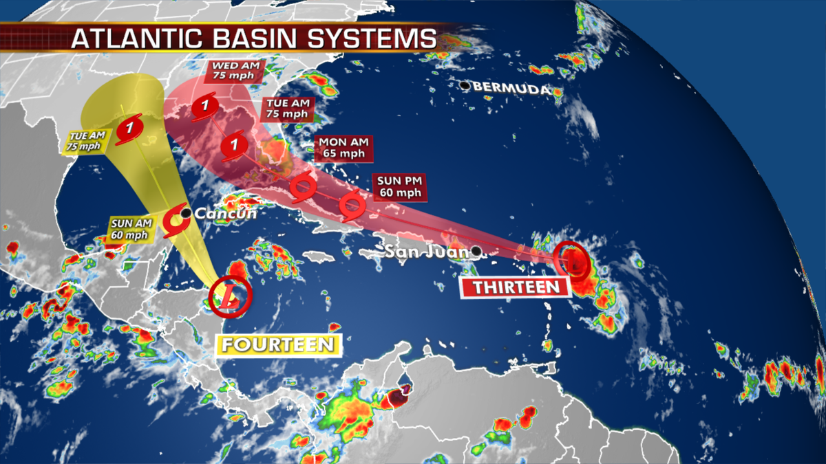
The official forecast takes the system just north of Puerto Rico Saturday, along the northern coast of Hispaniola then close to the Bahamas and Cuba Sunday as a gradually strengthening tropical storm.
South Florida needs to watch the forecast of this storm this weekend and then the track brings it into the Gulf of Mexico for another landfall along the Eastern Gulf next week.
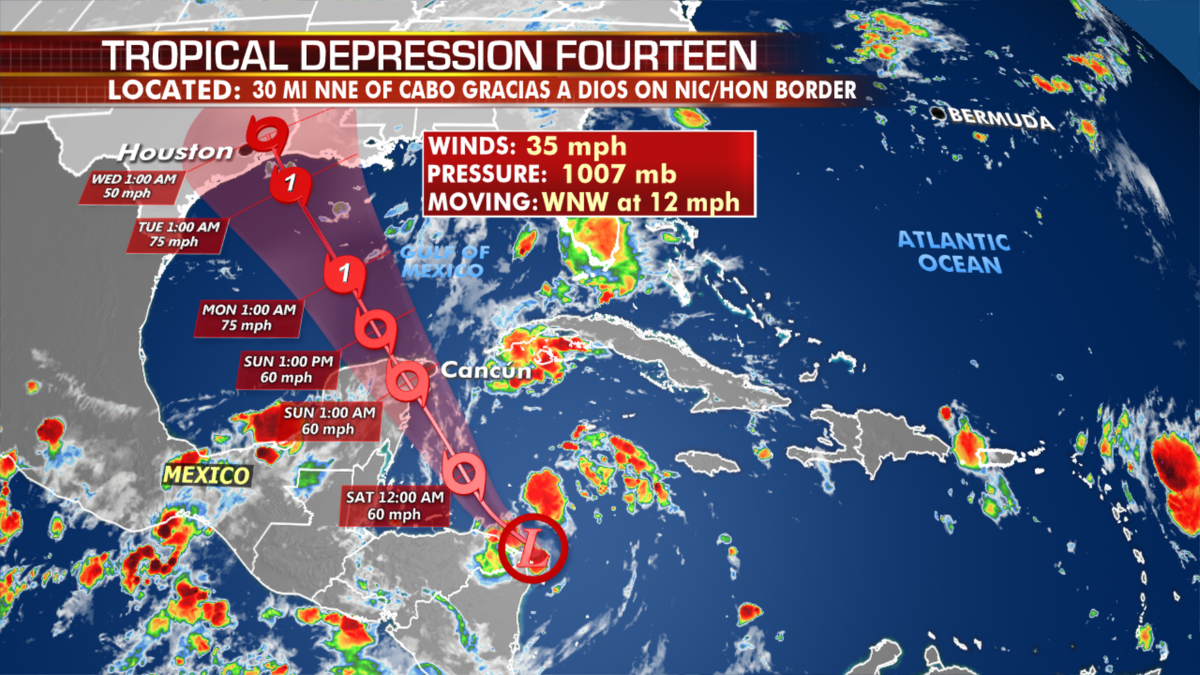
Tropical Depression Fourteen will move close to the Yucatán Peninsula by Saturday evening. Should both systems develop into hurricanes, it will be the first time that the region has seen simultaneous hurricanes.
A moderate-to-strong tropical storm is expected in the Gulf of Mexico as it potentially moves closer to the Northwestern Gulf also next week.
A third disturbance is about to emerge from Africa and will have the opportunity to develop this weekend or early next week.
In the East Pacific just offshore from Cabo San Lucas is a weakening Hurricane Genevieve. Cabo is susceptible to hurricane-force wind gusts, with conditions improving Thursday afternoon.