


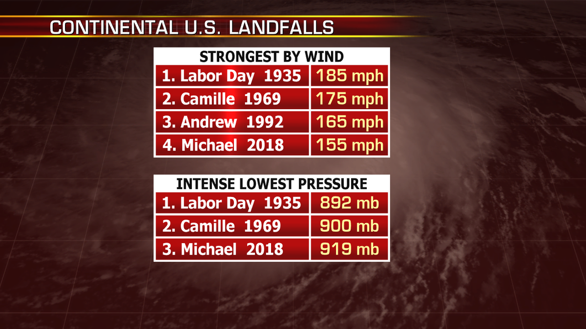
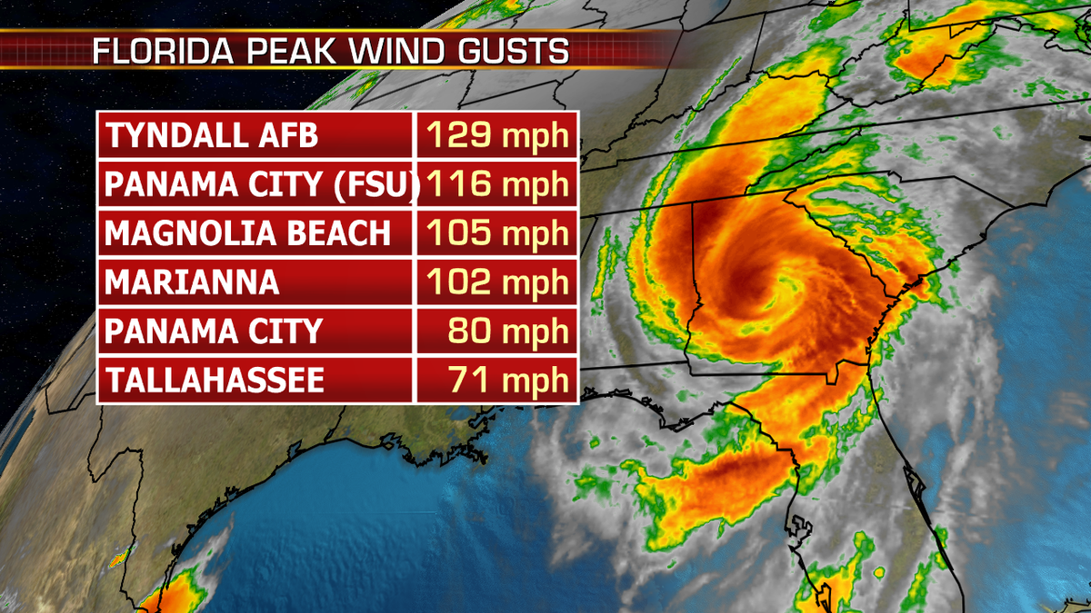
Hurricane Michael is the most powerful hurricane to ever make landfall across the U.S. in the month of October, and the strongest since Hurricane Andrew back in 1992.
In terms of intensity, Michael was third most intense lowest pressure (919 mb) since Camille.
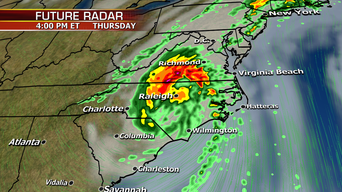
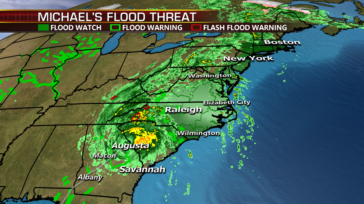
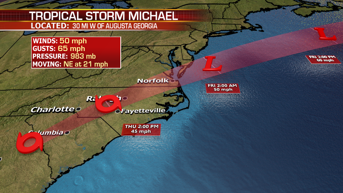
A strong Cat 4 (155mph) when it made landfall across the Panhandle yesterday afternoon, Michael is now a tropical storm and is moving quickly to the Northeast. The Carolinas will be at risk for flooding rainfall and strong winds which could cause more trees and limbs to fall with the risk of power outages.
There is also an isolated tornado risk across the Carolinas and Virginia.
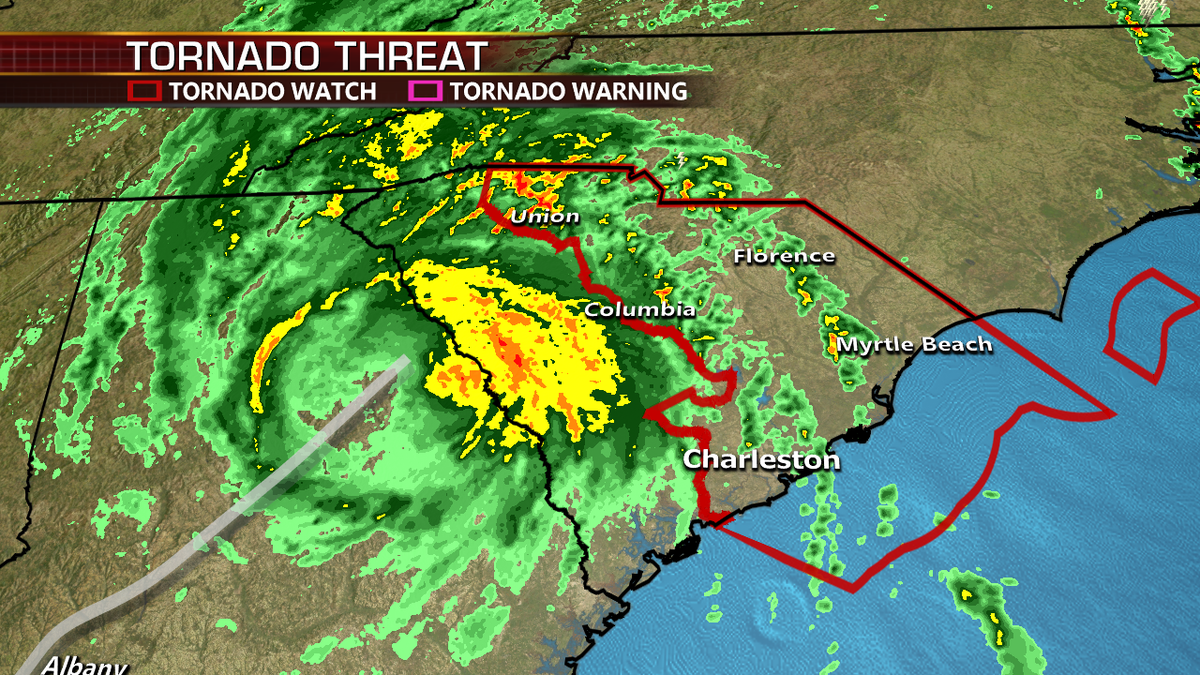
Tropical storm warnings remain in effect for southeastern Georgia and much of the Carolinas.
Additional rainfall of 3-6” is also possible, with isolated higher totals across the Carolinas.
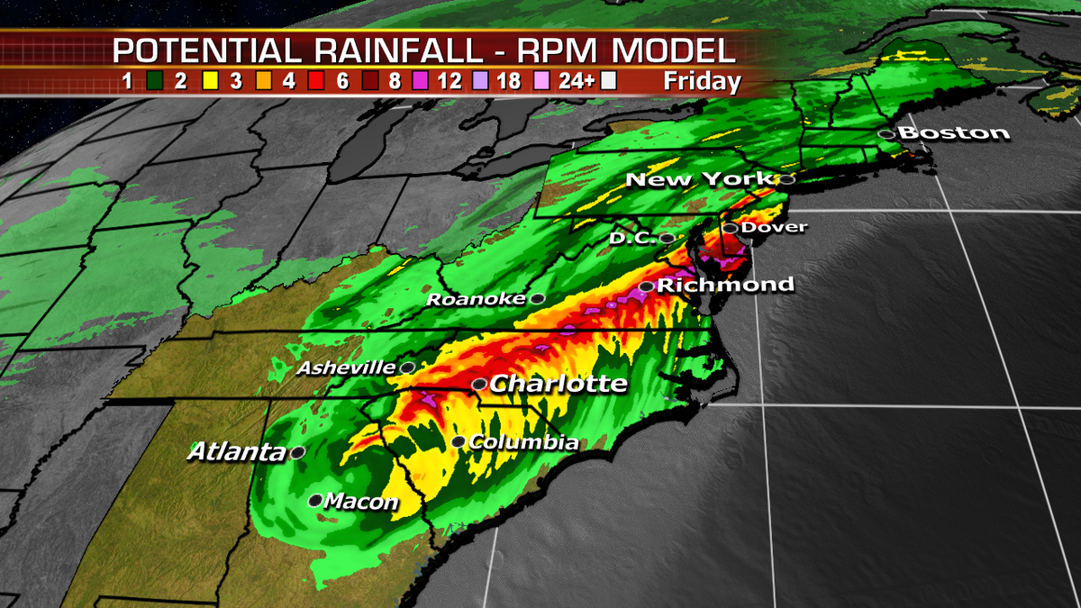
Heavy rain will also spread northward along the East Coast to coastal New England. Flood Watches are posted along much of the East Coast.
Michael will continue weakening and move off the East Coast, into the Atlantic and out to sea late tonight-early Friday.