


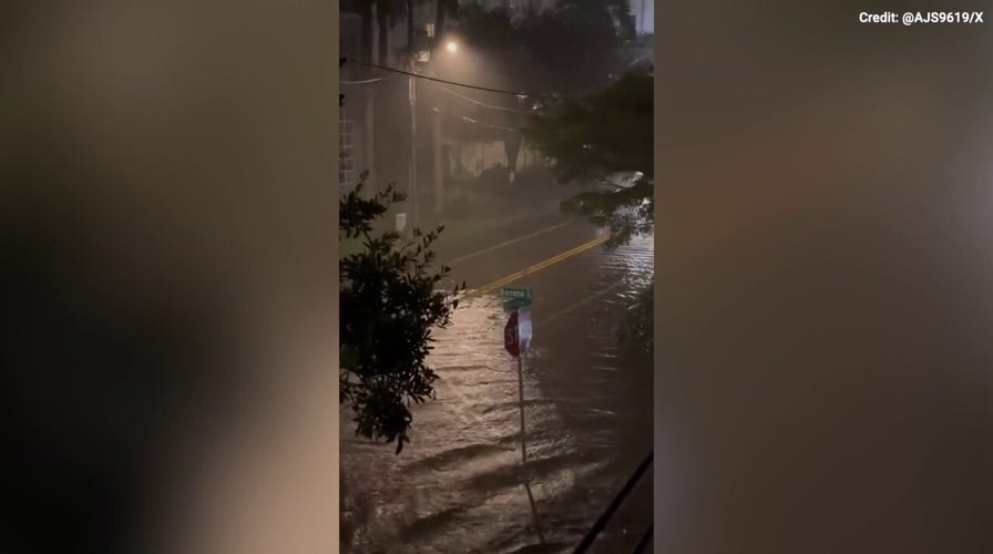
Flooding from Hurricane Idalia is seen throughout Sarasota
Early-morning flooding from Hurricane Idalia begins to wreak havoc throughout Sarasota, Florida as the storm moves north on Wednesday, August 30, 2023.
Hurricane Idalia is threatening Florida as a Category 3 storm with winds at approximately 125 mph with landfall expected imminently, the National Hurricane Center said early Wednesday morning.
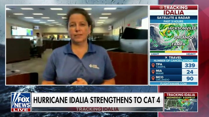
Idalia had been upgraded to a Category 4 storm hours earlier in the Gulf of Mexico, according to FOX Weather. As of 7 a.m. ET, the storm was a strong Category 3 hurricane located about 55 miles northwest of Cedar Key and 65 miles south-southeast of Tallahassee. Idalia was moving to the north-northeast at 18 mph.
At 6:30 a.m. ET, this morning, Florida Gov. Ron DeSantis said "the hurricane will make landfall within the next two hours in and around Taylor County in the Big Bend region of Florida."
"Do not go outside in the midst of this storm," he said, as power flickered at one point inside the room where he was speaking in Tallahassee. "If it's calm where you are, it may be because you are in the eye of the storm. And those conditions will change very, very quickly. So wherever you are, hunker down and don't take anything for granted here. This is a very, very powerful storm."
FLORIDA HURRICANE IDALIA TRACKER: LIVE FUTURE PATH, WATCHES, WARNINGS, SPAGHETTI MODELS AND MORE
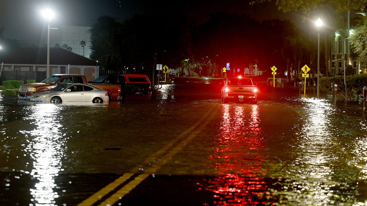
A vehicle drives through flood waters caused by Hurricane Idalia passing offshore on Aug. 30, in St. Petersburg, Florida. Hurricane Idalia is hitting the Big Bend area of Florida. (Joe Raedle/Getty Images)
"When the winds die down to a sufficient level, search and rescue efforts will begin. We have eight urban search and rescue teams staged, ready to go. Thirty-three ambulance strike teams. Fifty-five hundreds National Guardsmen," DeSantis continued. "We also have the Coast Guard on standby should that be necessary. There will be an immediate effort to restore power to people who lose power."
Kevin Guthrie, the executive director of the Florida Division of Emergency Management, said its "looking like Keaton Beach is going to be the location in which we have landfall."
"We are seeing 2 to 3 feet of storm surge in the Tampa Bay area," he also said. "We're seeing about four feet of storm surge right now at Cedar Key because of this high tide."
"Because of the high tide which is coming, the tide is starting to come back in throughout the all the way from Tampa Bay, all the way up through Apalachicola Bay. Storm surge will dramatically increase over the next couple of hours."
FOX Weather says "the storm surge along Florida's west coast continues to increase as the storm pushes water onshore. Tampa and Tampa Bay are expected to see dangerous storm surge up to 6 feet, which will inundate major areas."
"Life-threatening storm surge up to 16 feet is forecast from Aucilla River, Florida to Yankeetown, Florida. Hurricane Warnings and Storm Surge Warnings are in effect for most of the west coast of Florida," it added. "Five to eight inches of rain is expected across North Florida, with up to 12 inches possible in a few spots."
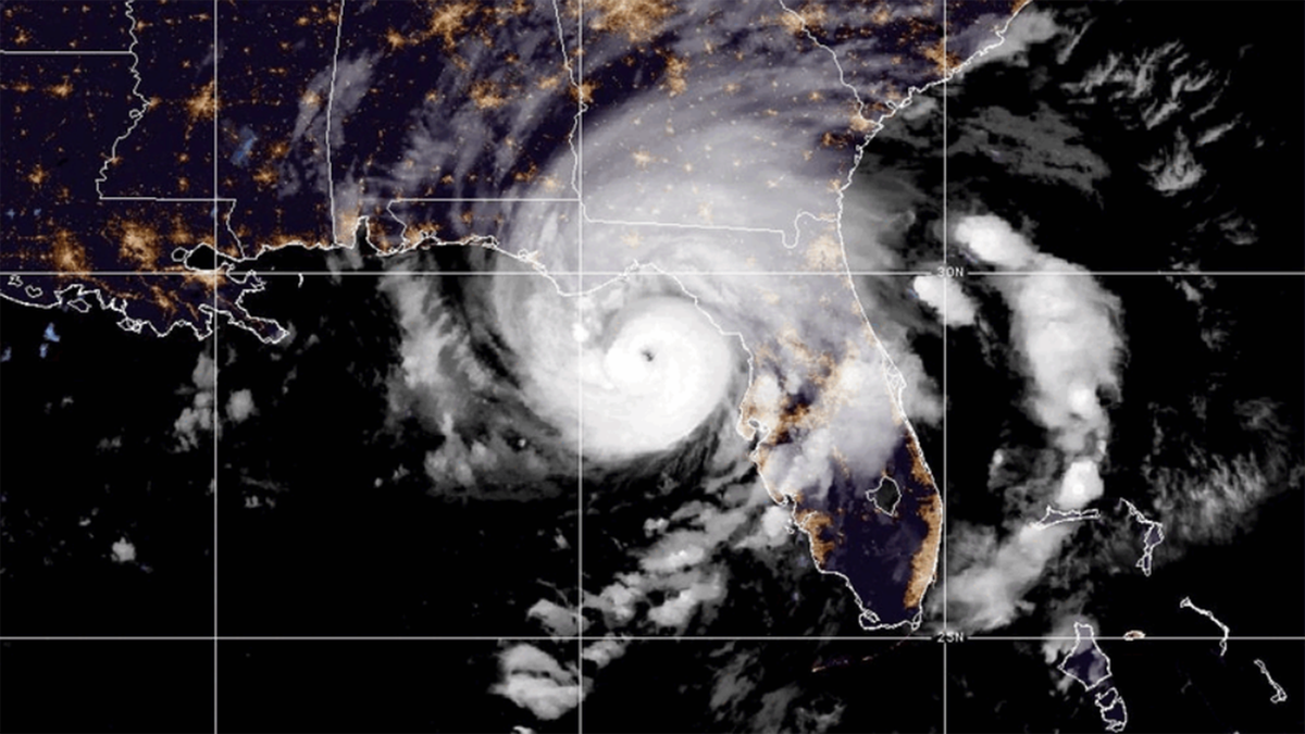
Hurricane Idalia, called an "extremely dangerous" Category 4 intensity storm, will make landfall in Florida Wednesday morning. (NOAA)
HURRICANE IDALIA EVACUATIONS IN FLORIDA: THE DANGERS, STORM SAFETY TIPS AND EMERGENCY SUPPLY PACKING
The National Weather Service in Tallahassee called Idalia an "unprecedented" storm as it upgraded over the warm waters of the Gulf of Mexico before it entered Florida's Big Bend region, where the peninsula merges into the Panhandle, directly impacting Jefferson, Taylor, Dixie and Levy counties. It continues producing catastrophic storm surge, damaging winds, and historic freshwater flooding.
The Florida cities of Cedar Key, Chiefland, Newberry, Cross City, Apalachicola, Perry, Gainesville, which is home to the University of Florida, are directly in the storm's path. The school has canceled classes at this time. It is also projected to impact as far south as Crystal River and Tampa.
The storm is heading east-northeast and is expected to continue its northeastern trajectory toward Jacksonville and then to Georgia.
No major hurricanes on record going back to 1851 have passed the Apalachee Bay and made landfall over the Big Bend region.
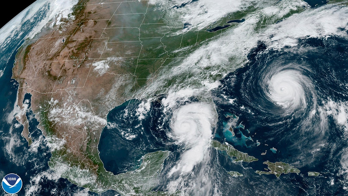
This Tuesday, Aug. 29, 2023, 1:31 p.m. EDT satellite image provided by the National Oceanic and Atmospheric Administration shows Hurricane Idalia, center, approaching Florida's Gulf Coast, and Hurricane Franklin, right, as it moves along the East coast of the United States, southwest of Bermuda. (NOAA via AP)
DeSantis has warned residents in the storm’s path to leave immediately: "You really got to go now. Now is the time." He added, "If you stay hunkered down tonight, it's going to be too nasty tomorrow morning to be able to do it."
The major storm's arrival to Florida coincides with a Blue Moon, a celestial event that occur once every two to three years, on Wednesday, August 30. The full moon brings higher high tide than usual.
Late Tuesday evening, the National Hurricane Center warned of the storm's destructive and deadly potential.
"Catastrophic storm surge and destructive winds will begin soon in the Florida Big Bend near where the core of the hurricane makes landfall," the National Hurricane Center said. "There is the potential for destructive life-threatening winds where the core of Idalia moves onshore in the Big Bend region of Florida, with hurricane conditions expected elsewhere in portions of the Hurricane Warning area along the Florida Gulf Coast."
It added: "Residents should heed advice & evacuation orders by local officials in these areas."
The governor also announced the ride-share service Uber would be providing residents with free transport to storm service centers.
Hurricane Ian in 2022, which made landfall over Florida's Gulf Coast as a Category 4, was the last major storm to hit Florida.
CLICK HERE TO GET THE FOX NEWS APP
Hurricane Ian was the costliest hurricane in Florida’s history and the third-costliest in United States history. It contributed directly and indirectly to 150 deaths and caused over $112 billion in damage.