


WATCH LIVE: Hurricane Idalia set to hit Florida coast
Millions are under threat as experts warn of potential tornadoes, storm surge.
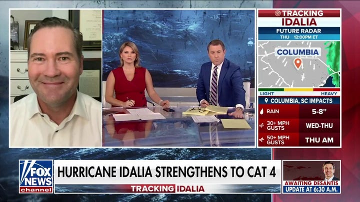
Hurricane Idalia is forecasted to be an "extremely dangerous" Category 4 intensity storm when it makes landfall in Florida Wednesday morning.
Idalia has been upgraded to a Category 4 storm as it continues to rapidly intensify in the Gulf of Mexico, according to FOX Weather. As of 6 a.m. ET, the storm is located about 60 miles west of Cedar Key and 90 miles south of Tallahassee, with maximum sustained winds remaining at 130 mph. Idalia is moving to the north-northeast at 18 mph.
At 6:30 a.m. ET, this morning, Florida Gov. Ron DeSantis said "the hurricane will make landfall within the next two hours in and around Taylor County in the Big Bend region of Florida."
"Do not go outside in the midst of this storm," he said, as power flickered at one point inside the room where he was speaking in Tallahassee. "If it's calm where you are, it may be because you are in the eye of the storm. And those conditions will change very, very quickly. So wherever you are, hunker down and don't take anything for granted here. This is a very, very powerful storm."
AUTHORITIES WARN GULF COAST RESIDENTS TO LEAVE AS IDALIA APPROACHES: ‘UNPRECEDENTED EVENT’
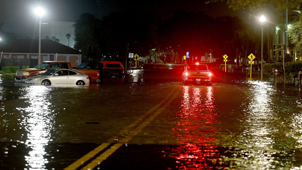
A vehicle drives through flood waters caused by Hurricane Idalia passing offshore on Aug. 30, in St. Petersburg, Florida. Hurricane Idalia is hitting the Big Bend area of Florida. (Joe Raedle/Getty Images)
"When the winds die down to a sufficient level, search and rescue efforts will begin. We have eight urban search and rescue teams staged, ready to go. Thirty-three ambulance strike teams. Fifty-five hundreds National Guardsmen," DeSantis continued. "We also have the Coast Guard on standby should that be necessary. There will be an immediate effort to restore power to people who lose power."
Kevin Guthrie, the executive director of the Florida Division of Emergency Management, said its "looking like Keaton Beach is going to be the location in which we have landfall."
"We are seeing 2 to 3 feet of storm surge in the Tampa Bay area," he also said. "We're seeing about four feet of storm surge right now at Cedar Key because of this high tide."
"Because of the high tide which is coming, the tide is starting to come back in throughout the all the way from Tampa Bay, all the way up through Apalachicola Bay. Storm surge will dramatically increase over the next couple of hours."
FOX Weather says "the storm surge along Florida's west coast continues to increase as the storm pushes water onshore. Tampa and Tampa Bay are expected to see dangerous storm surge up to 6 feet, which will inundate major areas.".
The current forecast track of Hurricane Idalia. (FOX Weather)
"Life-threatening storm surge up to 16 feet is forecast from Aucilla River, Florida to Yankeetown, Florida. Hurricane Warnings and Storm Surge Warnings are in effect for most of the west coast of Florida," it added. "Five to eight inches of rain is expected across North Florida, with up to 12 inches possible in a few spots."
The National Weather Service's Tallahassee office says Idalia "will likely be an unprecedented event for many locations in the Florida Big Bend.
FLORIDA HURRICANE IDALIA TRACKER: LIVE FUTURE PATH, WATCHES, WARNINGS, SPAGHETTI MODELS AND MORE
"Looking back through recorded history, NO major hurricanes have ever moved through the Apalachee Bay," it is warning. "When you try to compare this storm to others, DON'T. No one has seen this."
The National Hurricane Center said around 11 p.m. Tuesday night that Idalia is expected to be an "extremely dangerous Category 4 hurricane at landfall."
"Strong winds will also spread inland across portions of northern Florida and southern Georgia near the track of the center of Idalia where Hurricane Warnings are in effect," the NHC continued. "Residents in these areas should be prepared for long-duration power outages. Damaging hurricane-force winds are possible in portions of eastern Georgia and southeastern South Carolina where Hurricane Watches are in effect."
Fort Myers Beach sustains floodwaters from Hurricane Idalia as the storm makes its way up the Gulf of Mexico and prepares to make landfall in Florida’s northern peninsula on Tuesday, August 29, 2023. (Dane Owens)
Local officials have urged residents in impacted areas to evacuate. DeSantis warned earlier on Tuesday that first responders would be unable to reach people who stay until after the storm has passed. DeSantis said 49 of Florida's 67 counties are in a state of emergency, including 30 counties issuing evacuation orders.
"Storm surge of this magnitude is not something we've ever seen in this part of Florida in any of our lifetimes," DeSantis said. "So, please, please take the appropriate precautions."
At least 50 school districts have announced that they will remain closed for at least the next few days, and 29 state colleges and seven universities have canceled classes, FOX Weather reported. Multiple airports in Florida closed Tuesday afternoon and SunRail service in Orlando has been suspended until further notice. Bridges will also begin to close when winds reach 40 mph.
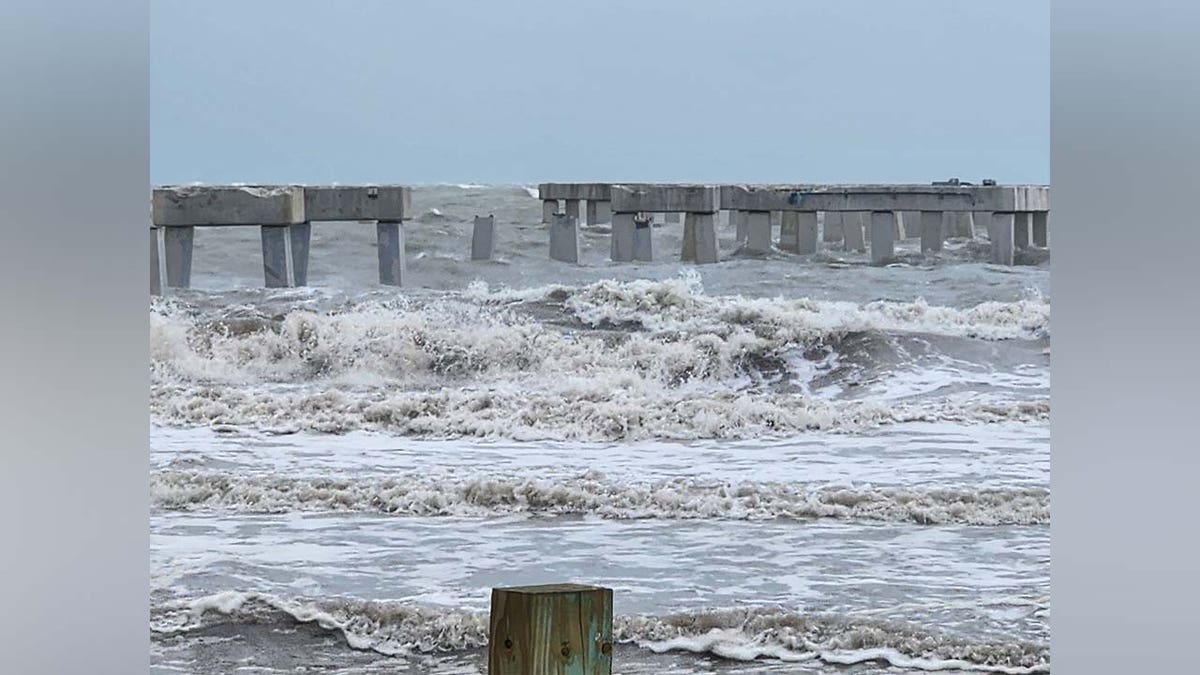
Fort Myers Beach sustains floodwaters from Hurricane Idalia as the storm makes its way up the Gulf of Mexico and prepares to make landfall in Florida’s northern peninsula on Tuesday, August 29, 2023. (Dane Owens)
South Carolina Republican Gov. Henry McMaster declared a State of Emergency for the state on Tuesday.
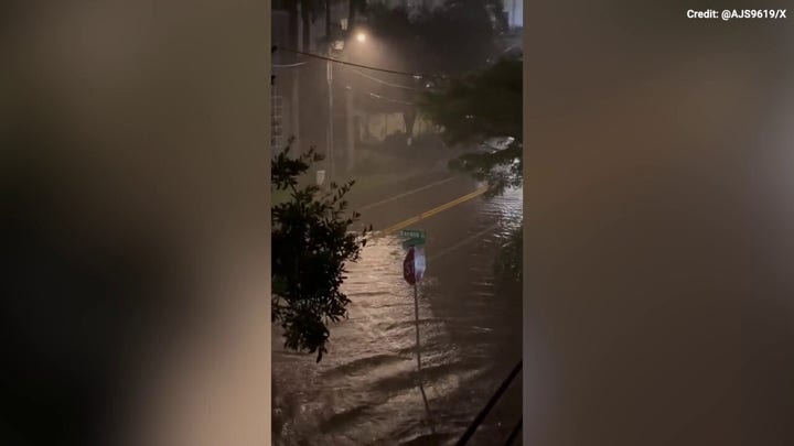
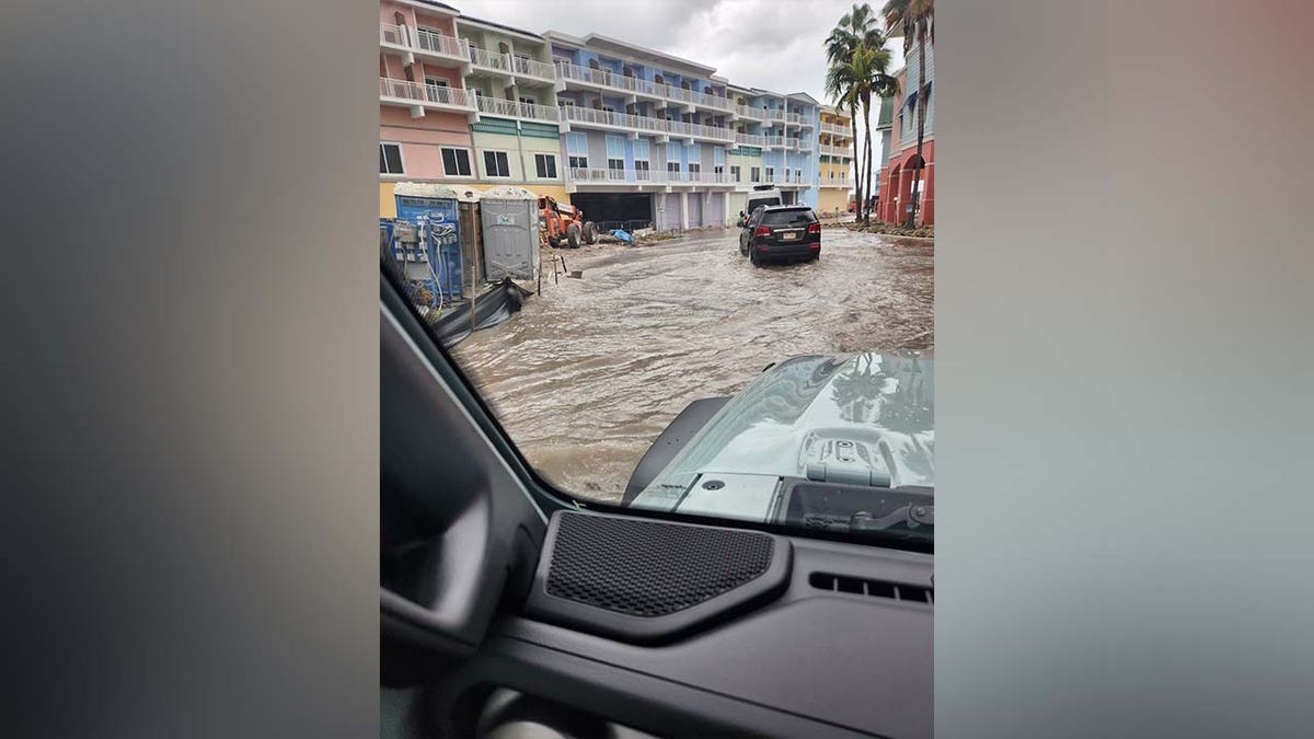
The storm produced rainfall leading up to its landfall that began to flood parts of Florida, FOX Weather reported. Vehicles in Charlotte County were observed driving through shallow floodwater.
CLICK HERE TO GET THE FOX NEWS APP
The first significant rain band moved onshore in Florida Tuesday evening, resulting in heavy rain, 30 to 50 mph wind gusts and a few tornado warnings, according to the Fox Forecast Center.