


Fox News Flash top headlines for September 3
Fox News Flash top headlines for September 3 are here. Check out what's clicking on Foxnews.com
As Hurricane Dorian churns ominously near the southeast U.S. coast after ravaging the Bahamas with wind, pounding rain and flooding, the storm's gigantic size can be seen in new images released by NASA.
The storm weakened to a Category 2 on Tuesday, but it's still very dangerous and actually getting bigger. According to the National Hurricane Center, hurricane-force winds now extend outward up to 60 miles from the center, while tropical-storm-force winds extend outward up to 175 miles.
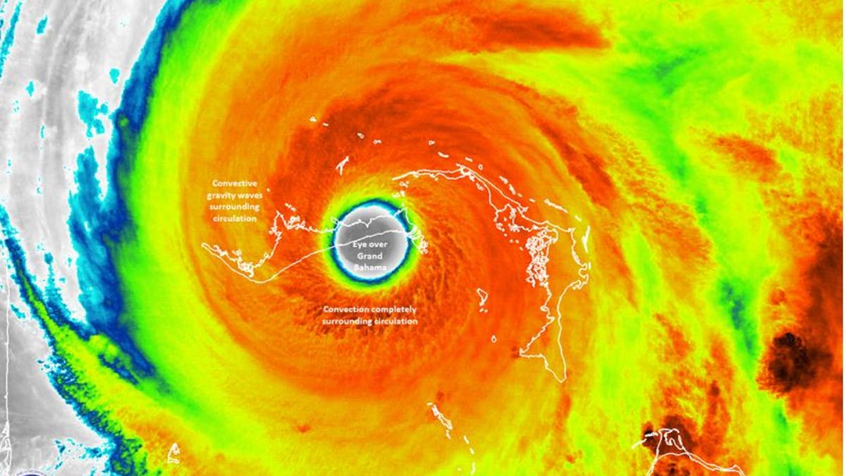
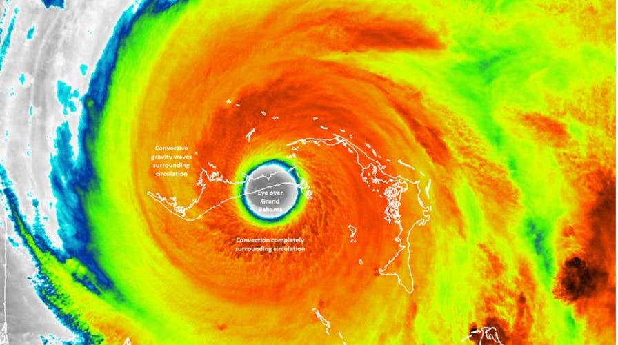
NASA NOAA’s Suomi NPP satellite image provided a very clear, very detailed image of Dorian’s eye in this image taken on Sep. 02, 2019 at 2:13 am EDT. (NASA/NOAA/UWM-SSEC-CIMSS/William Straka III)
The International Space Station flew over Dorian on Sept. 2 and astronaut Nick Hague snapped this stunning image of the hurricane's eye. The eye of a hurricane is at the center of the storm and known for being a respite from the prevailing wind and rain.
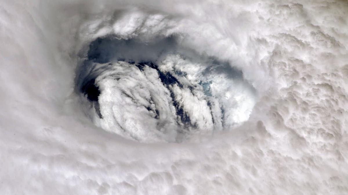
The eye of Dorian as seen from the ISS. (NASA/Nick Hague)
The National Weather Service captured this image of Dorian slowly inching away from Grand Bahama Island around midday on Tuesday.
NOAA’s Hurricane Hunter aircraft flew through the eye of the storm in the video below:
Another image captured and shared by the ISS shows the storm's gigantic scope.
Some of the first aerial images coming in from the Bahamas show what one meteorologist called "catastrophic damage."
It will likely be some time before rescue crews are able to fully access the Bahamas.