


Fox Business Flash top headlines for January 18
Fox Business Flash top headlines are here. Check out what's clicking on FoxBusiness.com.
Strong winds ahead of a system that will bring much-needed rain to Southern California this week have elevated fire danger and brought the risk of power outages. High wind warnings are in effect for much of the area, with gusts as high as 80 mph in the mountains that could cause damage.
NWS says these powerful winds can impair drivers and cause power outages
"Gusty to high winds could bring down trees and power lines, and bring elevated to critical fire weather conditions across much of central and southwest California Monday and Tuesday," tweeted the National Weather Service late Sunday.
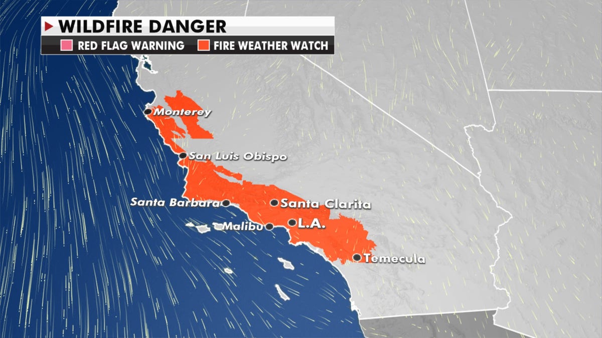
Experts have warned of potential wildfires. (Fox News)
That storm will move in Tuesday and bring rain to parts of southern California and southern Arizona. There could be the potential for flooding to the region.
Heavy mountain snow is expected across the Southern Rockies over the next few days.
LAKE EFFECT SNOW: HERE'S HOW IT IMPACTS THE GREAT LAKES
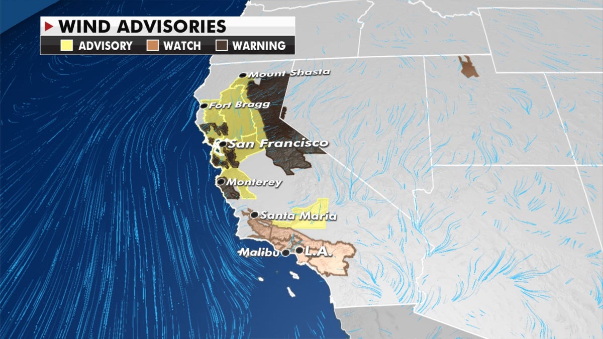
Wind advisories, watches and warnings have been issued for some areas. (Fox News)
Meanwhile, lake effect snow will pile up over cities downwind of Lake Erie, Ontario and Superior with significant accumulations for parts of New York and Michigan.
CLICK HERE TO GET THE FOX NEWS APP
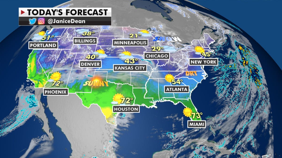
Forecast for Jan. 18, 2021. (Fox News)
Lake effect snow is a common occurrence in the Great Lakes region during winter and late fall, according to the National Weather Service.
"Lake Effect snow occurs when cold air, often originating from Canada, moves across the open waters of the Great Lakes," it explains, on its website. "As the cold air passes over the unfrozen and relatively warm waters of the Great Lakes, warmth and moisture are transferred into the lowest portion of the atmosphere." The air rises and clouds form, growing into a narrow band that produces snow, the National Weather Service added.
Related Article


True Crime
The hottest stories ripped from the headlines, from crime to courts, legal and scandal.
By entering your email and clicking the Subscribe button, you agree to the Fox News Privacy Policy and Terms of Use, and agree to receive content and promotional communications from Fox News. You understand that you can opt-out at any time.
