


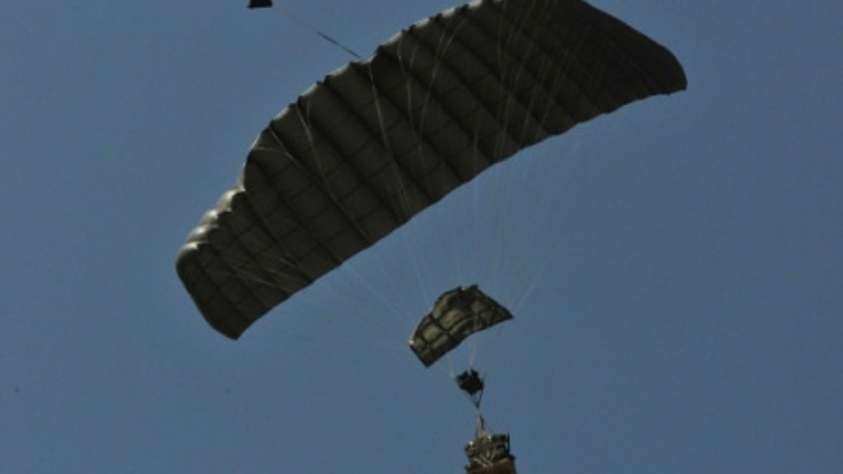
File photo - A joint precision airdrop system (JPADS) guides itself to the ground following its drop from a C-130 aircraft at Normandy Drop Zone in Fort Bragg, N.C., May 23, 2013. (U.S. Army photo by Sgt. Amanda Tucker/Released)
The U.S. Army is testing a high-tech airdrop system that uses a sophisticated video navigation system to locate its target. The system could prove invaluable for airdrops in difficult terrain and urban environments, researchers say.
The military has been working for years to boost the accuracy of its airdrops when resupplying troops. As part of this effort, the Joint Precision Airdrop System (JPADS), which uses GPS, an onboard computer and a steerable parachute, was developed in 2006. The technology was deployed in the field three years – it accounted for about 1 percent of the total airdrops conducted by the U.S. Air Force in Afghanistan.
Related: DARPA teases X-Plane concept that can take off vertically
Now, the U.S. Army Natick Soldier Research, Development and Engineering Center (NSRDEC) is working on an even more accurate airdrop alternative to GPS as part of an ambitious multi-service project.
"In some terrains, such as steep canyons, or urban settings with tall buildings, you can lose GPS - these are gliding systems, so they can't fly up in altitude." Richard Benney, Director of the Aerial Delivery Directorate at NSRDEC, told FoxNews.com. “We're researching and testing what we call a video navigation system – currently it's simply a camera that's looking down and out towards the ground in the direction of flight."
Related: High-tech 'bazooka' fires a net to take down drones
Benney explained that the video navigation system picks up ‘targets,’ such as reference points or features in the local landscape. “We will probably feed the JPADS an image just before it's deployed out of the aircraft from the USAF JPADS mission planner,” he said. “The image can come from a satellite, UAS [Unmanned Aerial System] or other sources - it will tell the JPADS 'your job is to land on that pixel'.”
The as-yet unnamed video navigation system is currently being tested in desert environments and there are plans to upgrade the JPADS fleet with the new technology over the next three to five years.
Related: New tech gives US helicopter pilots 'Superman-style' vision
The video navigation technology will eventually guide a wide range of payloads to their intended targets. There are two variants of JPADS – a 2K version that handles weights from 700 pounds up to 2,200 pounds and a 10K version for weights from 5,000 pounds to 10,000 pounds.
Benney explained that 2Ks can be dropped from as low as 3,500 feet and up to 25,000 feet, whereas 10Ks are dropped between 18,000 and 25,000 feet.
Related: Air Force unveils initial B-21 long range bomber design
Cambridge, Massachusetts-based Draper Lab, under contract with the U.S. Army, developed the JPADS flight software and is one of the lead partners on the flight vision software.
Initial indications suggest that video navigation airdrops offer an extremely high level of accuracy. “The 2K requirement is to be within 150 meters [492 feet] of the target, but it's considerably better than that,” Benney told FoxNews.com. “[The] 10K target is [to be within] 250 meters [820 feet] for the target, but it's significantly better than that."
Follow James Rogers on Twitter @jamesjrogers