


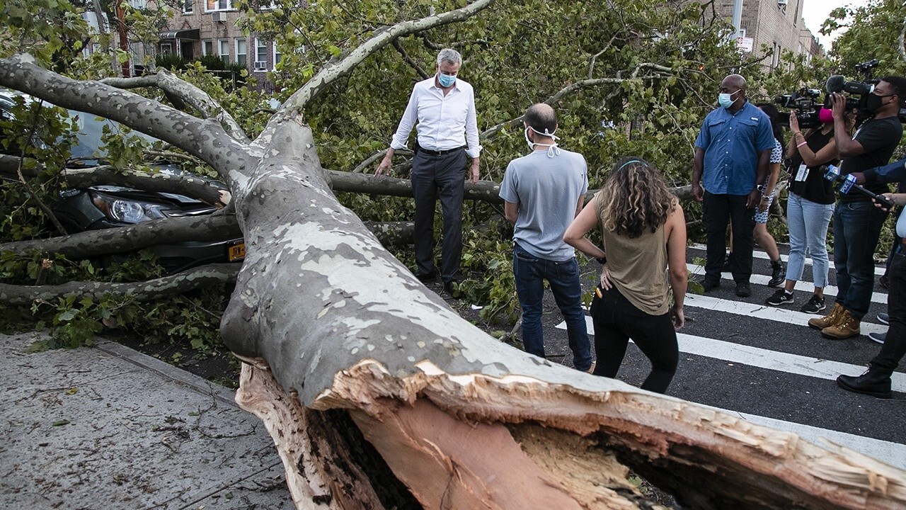
Isaias' powerful winds topple 2,000 trees in NYC
Aishah Hasnie reports from Queens on the aftermath of the deadly storm in the Northeast.
Nearly two weeks after Tropical Storm Isaias roared up the East Coast killing several people and knocking out power for millions of households, the storm left behind a unique remnant on New York's Long Island.
The National Weather Service (NWS) forecast office in Upton, N.Y., said Sunday on Twitter that meteorologists have noticed an "interesting phenomenon" that's affecting trees on Long Island in the wake of the tropical storm.
A photo was taken by one of the NWS meteorologists on Saturday, 11 days after the storm, which shows several trees and bushes with withered, brown leaves on one side while the other side of the trees appears a normal green.
ISAIAS TRIGGERED DEADLY TORNADO OUTBREAK WHILE ROARING UP EAST COAST THAT BROKE RECORDS
"You can very clearly see that much of the south side of the vegetation looks as if it has progressed into late autumn with much of it turning brown," the NWS tweeted. "However, the north side of the trees and the bushes are still green!"

Several trees have withered, brown leaves on one side and are a normal green on the other on New York's Long Island after Tropical Storm Isaias. (NWS New York)
So what is causing these two-faced trees?
According to the NWS, forecasters believe this "weird occurrence" was due to the blowing of ocean spray containing sea salt onto the south side of any exposed vegetation by strong winds.
"Tropical Storm Isaias had strong winds associated with it on Long Island, but not much rainfall," the NWS said.
CORONAVIRUS COMPLICATES FIXES AS SEVERE WEATHER KNOCKS OUT POWER ACROSS PARTS OF US
Strong winds out of the south that were gusting up to and exceeding 70 mph off the Atlantic Ocean picked up sea salt off the ocean surface and battered Long Island's South Shore.
"With little to no rain to wash the salt off of trees and bushes in the wake of these strong winds, the south sides of the vegetation that experienced the brunt of the winds (and thus most exposure to the sea salt) seems to have begun to wither and wilt," the NWS said.
In addition to the ocean spray, much of Long Island is currently under a moderate drought, with some areas seeing a little more than six inches of precipitation below average for the year so far.
"This may at least partially enhance these withering effects," forecasters said.
CLICK HERE FOR MORE WEATHER COVERAGE FROM FOX NEWS
A similar instance was reported in Hurricane Sandy in 2012 and the "Long Island Express" Hurricane in 1938, though forecasters noted both of those storms happened much closer to the fall season, and not in early August like Isaias.
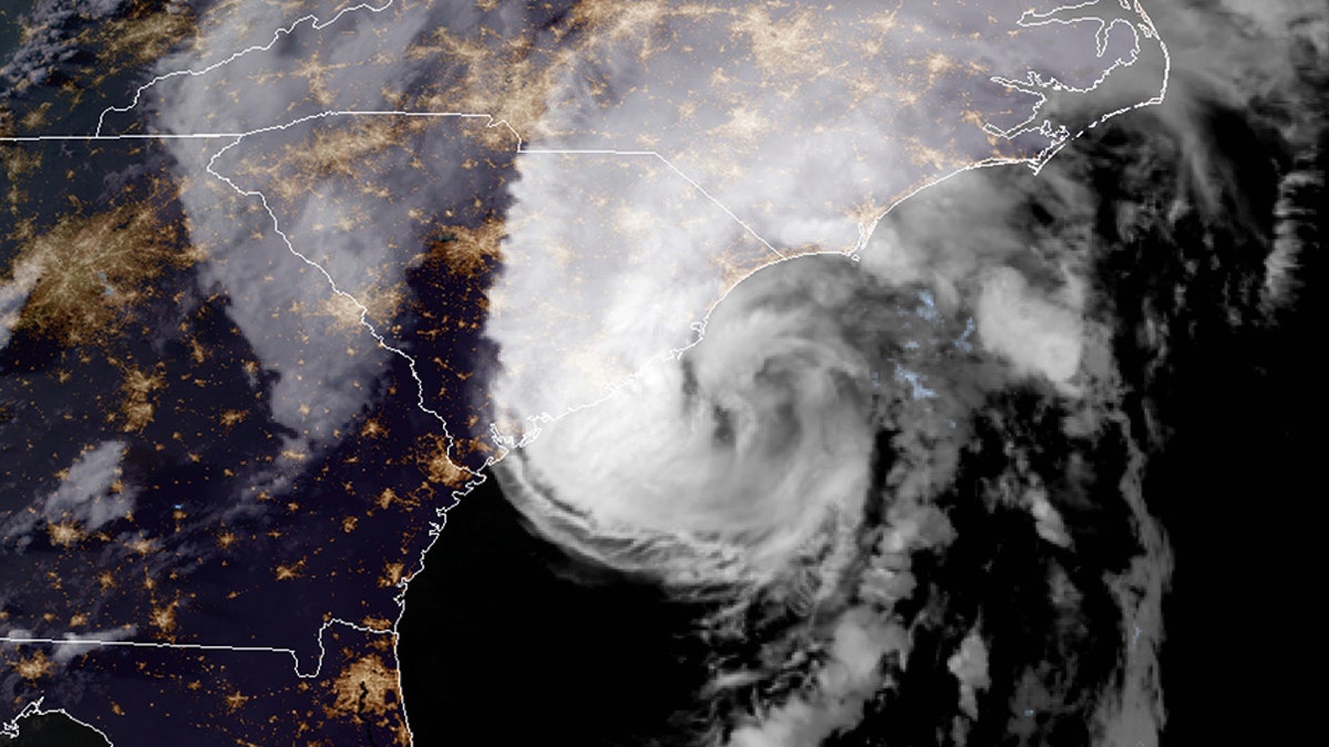
Hurricane Isaias is seen traveling up the coast on Aug. 3, 2020. (NOAA)
Isaias, the ninth named storm of the 2020 Atlantic hurricane season, made landfall near Ocean Isle Beach, N.C., on Aug. 3 after it broke the record for the earliest "I" storm in the Atlantic basin.
CLICK HERE FOR THE FOX NEWS APP
NOAA forecasters are now calling for up to 25 named storms with winds of 39 mph or higher; of those, seven to 10 could become hurricanes. Among those hurricanes, three to six will be major, classified as Category 3, 4, and 5 with winds of 111 mph or higher.

The names for the 2020 Atlantic hurricane season. (Fox News)
That's far above an average year. Based on 1981 to 2010 data, that is 12 named storms, six hurricanes, and three major hurricanes. So far this year, there have been 11 named storms, including two hurricanes.
The most active stretch of the hurricane season is from late August to early October, when most storms and major hurricanes are seen.
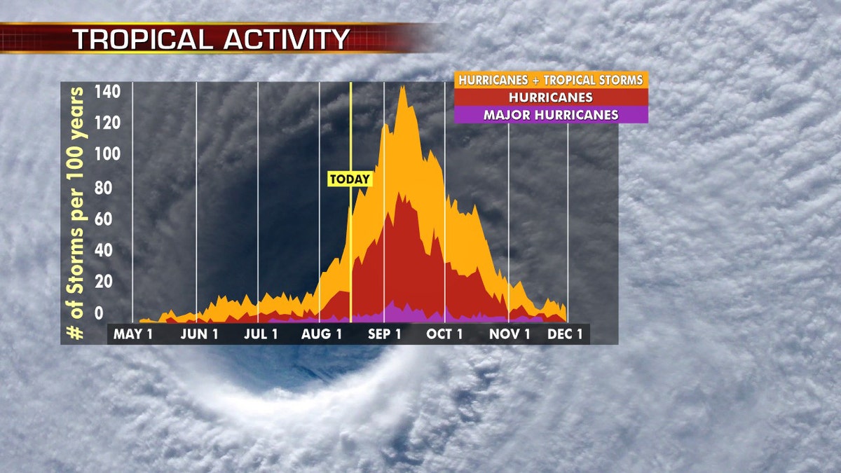
Hurricane season peaks from late August into early October. (Fox News)
The 2020 Atlantic Hurricane Season runs from June 1 to Nov. 30 and includes the names: Arthur, Bertha, Cristobal, Dolly, Edouard, Fay, Gonzalo, Hanna, Isaias, Josephine, Kyle, Laura, Marco, Nana, Omar, Paulette, Rene, Sally, Teddy, Vicky and Wilfred.
Fox News' Adam Klotz contributed to this report.
Fox News Artificial Intelligence
Stay up-to-date on the latest AI technology advancements and learn about the challenges and opportunities AI
By entering your email and clicking the Subscribe button, you agree to the Fox News Privacy Policy and Terms of Use, and agree to receive content and promotional communications from Fox News. You understand that you can opt-out at any time.