


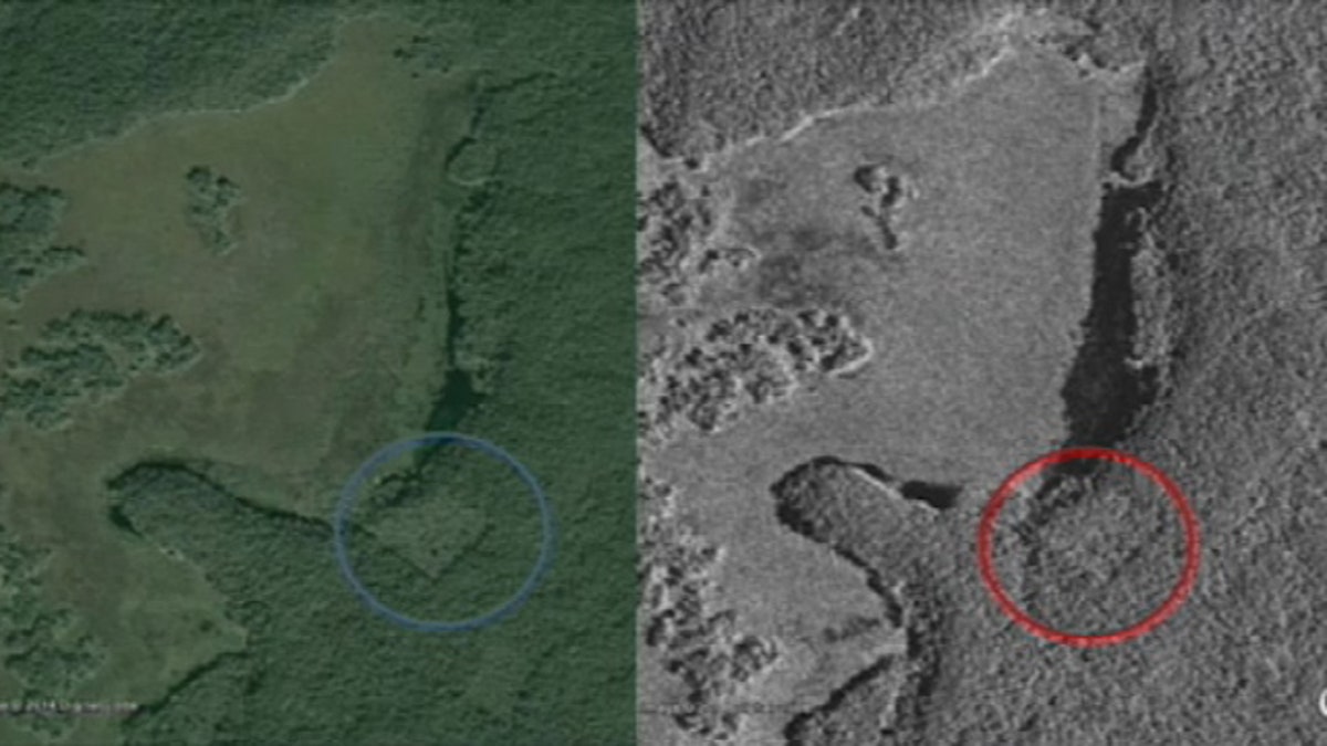
These undated images show possible man-made structures in Mexico's Yucatan Peninsula that may be a lost Mayan city (Canadian Space Agency)
A Canadian teenager believes he has discovered the ruins of a lost Mayan city in Mexico's Yucatan Peninsula — with the assistance of Google Maps and a star chart.
William Gadoury, of Saint-Jean-de-Matha, Quebec, has had a longstanding interest in Mayan civilization, particularly where they chose to build their towns and cities.
"The Mayans were extremely good builders, but they often built in places that made little practical sense — far from rivers, far from fertile areas. It seemed strange for a civilization that was so intelligent," Gadoury told CBC News. "I knew they were good at astronomy, so I tried to make the link."
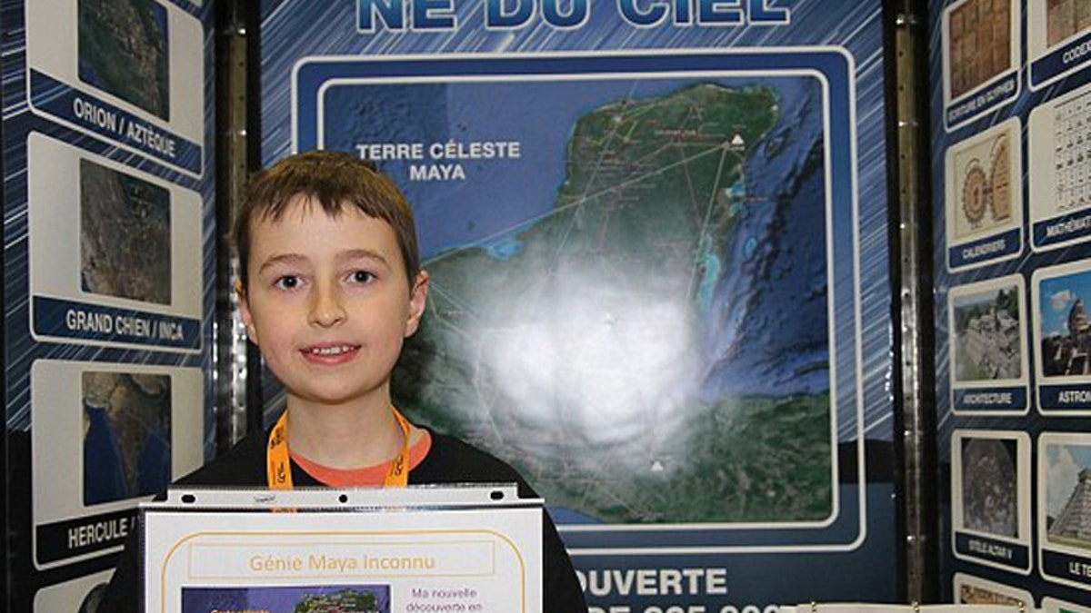
This undated photo shows William Gadoury presenting a school science fair project on Mayan cities (Hydro-Quebec)
Gadoury studied 22 Mayan constellations and found the stars matched the locations of 117 known ancient cities when overlaid on a map. He then realized that one star in a 23rd constellation didn't have a corresponding Mayan city.
That's when the teen got the Canadian Space Agency involved. After meeting CSA project officer Daniel De Lisle at a school science fair and presenting his theory, Gadoury was given access to high-definition satellite images which he cross-referenced against Google Earth.
Underneath the Yucatan's dense vegetation, Gadoury located possible man-made structures where the astronomical data suggested the missing city would be. He believes the objects to be the remains of pyramids. The CSA's De Lisle is cautiously optimistic.
"There are linear features that would suggest there is something underneath that big canopy," De Lisle told The Independent. "There are enough items to suggest it could be a man-made structure."
Gadoury has tentatively dubbed the ancient city K'aak Chi, or Mouth of Fire. His findings will be published in a scientific journal and he has been invited to present them at a conference in Brazil next year.
Click for more from CBCNews.ca.