The heat is on in Denver as a Labor Day weekend heatwave may break more records on Sunday, but an abrupt return to winter is on the way.
The National Weather Service (NWS) said Denver set a new monthly and daily record high temperature on Saturday of 101 degrees Fahrenheit as the Colorado capital could see more record heat on Sunday.
But a polar plunge is on the way.
SUMMER SNOW IN PARTS OF WYOMING, MONTANA AMID 'FREEZING' TEMPERATURES IN REGION
The NWS said Sunday morning that a winter storm watch is now in effect for some 4.2 million along much of Colorado's Front Range.
"Winter will make an early arrival as a strong system from the north will bring much colder temperatures as well as accumulating snow to the region," the NWS said.
A cold front passing through the area Monday night will set the scene for snow starting shortly after midnight in higher terrain and foothills.
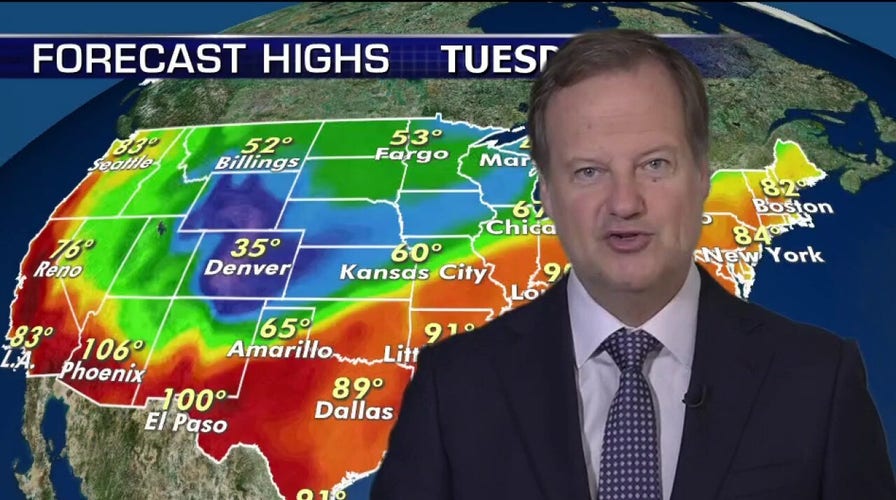
"Tuesday is the big cool down," Fox News Chief Meteorologist Rick Reichmuth said on "Fox & Friends Weekend."
"[In] Denver you have winter storm watches in effect," Reichmuth said Sunday. "So you're going from almost 100 degrees today to a winter storm watch, still in summer."
By Tuesday morning, snow levels will drop with accumulating snow possible along the Front Range, the Interstate 25 corridor, and the Metro Denver area.
Up to 6 inches of snowfall is possible in the Denver metro area, with higher elevations seeing up to 14 inches.
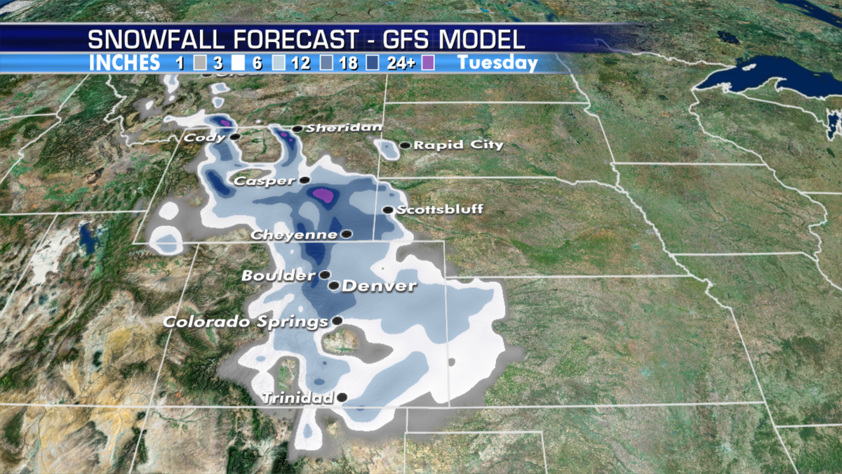
Denver is forecast to see several inches of snowfall on Tuesday. (Fox News)
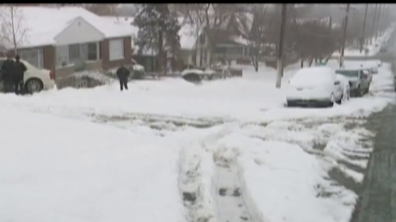
"Snow falling on trees in full leaf may cause branches to break or other tree damage," the NWS said. "Roadways could become slippery and slushy across the higher terrain."
WINTER LOOKS 'COLD AND SNOWY' WITH SOME 'CRAZY IN-BETWEEN,' FARMERS' ALMANAC CLAIMS
Scattered power outages in the area will be made worse by temperatures dropping well below freezing by Tuesday night, which could also harm crops and plants.
Forecasters also warned that the "abrupt change" from 100-degree heat to snow will have a "significant impact" on outdoor animals.
"Heavy snow and record-breaking cold temperatures Tuesday night," the NWS said.
The last time the Denver area had a measurable snowfall in September was in 2000, according to FOX31.
The system will move out by Wednesday with snowfall coming to an end and conditions improving.
This latest early arrival of snow comes a week after parts of Wyoming and Montana received frozen precipitation last week.
CLICK HERE FOR MORE WEATHER COVERAGE FROM FOX NEWS
The flakes out West may be a precursor to what could be a rough winter ahead.
The Farmers’ Almanac recently released its extended forecast for the 2020-2021 season, which shows this upcoming winter could be brutally cold and snowy for much of the country.
“Based on our time-tested weather formula, the forecast for the upcoming winter looks a lot different from last year, quite divided with some very intense cold snaps and snowfall,” editor Peter Geiger said in a statement.
CLICK HERE FOR THE FOX NEWS APP
Long-range forecasts from the periodical are calling for normal to below-normal temperatures in areas from the Great Lakes and Midwest stretching westward over the Northern and Central Plains and into the Rockies.

The hottest stories ripped from the headlines, from crime to courts, legal and scandal.
