

Fox News Flash top headlines for December 8
Fox News Flash top headlines are here. Check out what's clicking on Foxnews.com.
Winter weather alerts are in place from the Plains to the upper Midwest as a cold front cuts through the middle of the country.
ENDANGERED SEABIRD AT HAWAII VOLCANOES NATIONAL PARK CAUGHT ON CAMERA FOR FIRST TIME
On the warm side of the front, heavy rain is dropping from the southern Plains to the Ohio River Valley.
The heaviest rain on Thursday is expected across Tennessee and Kentucky.
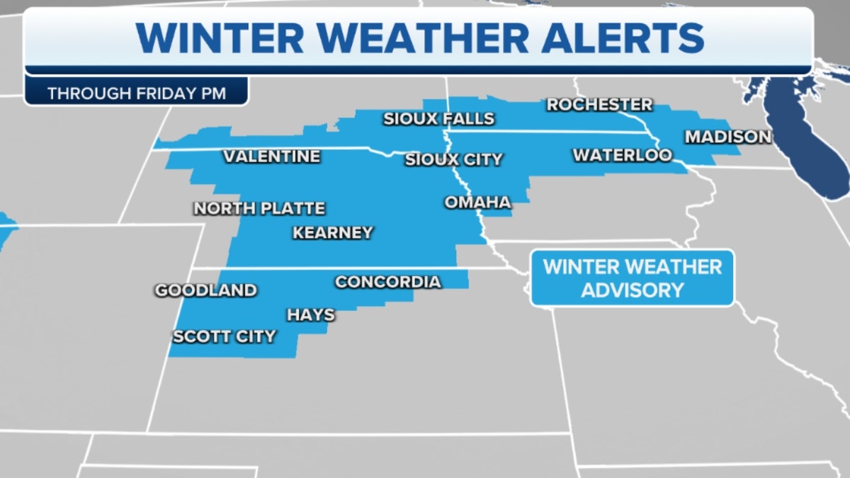
Winter weather alerts through Friday afternoon in the Plains, upper Midwest (Credit: Fox News)
Back on the cold side of the front, snow is spreading from the Plains to Michigan.
Widely 1-3 inches of snow is expected.
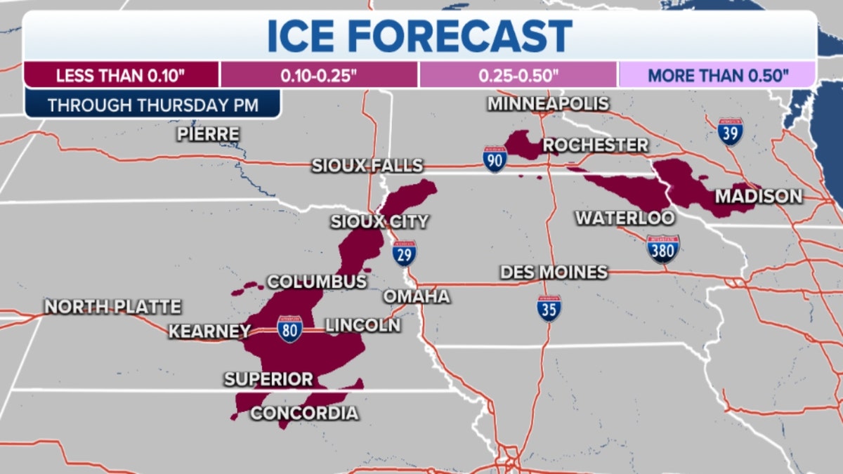
Ice forecast through Thursday afternoon from the Plains to Michigan (Credit: Fox News)
Additionally, ice is forecast from Kansas and northeastward to portions of Wisconsin.
Meanwhile, unsettled weather is forecast for the West Coast.
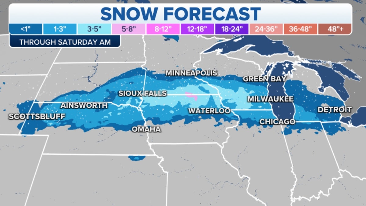
Snow forecast through Saturday morning from the Plains to Michigan (Credit: Fox News)
Several systems are expected over the next few days, the first bringing coastal showers and high-elevation snow beginning Thursday morning in the Pacific Northwest.
CLICK HERE TO GET THE FOX NEWS APP
A second, larger system will reach into northern California over the weekend.

The hottest stories ripped from the headlines, from crime to courts, legal and scandal.
