Dorian to continue strengthening as it moves through Bahamas to Florida
By Janice Dean
Published August 30, 2019
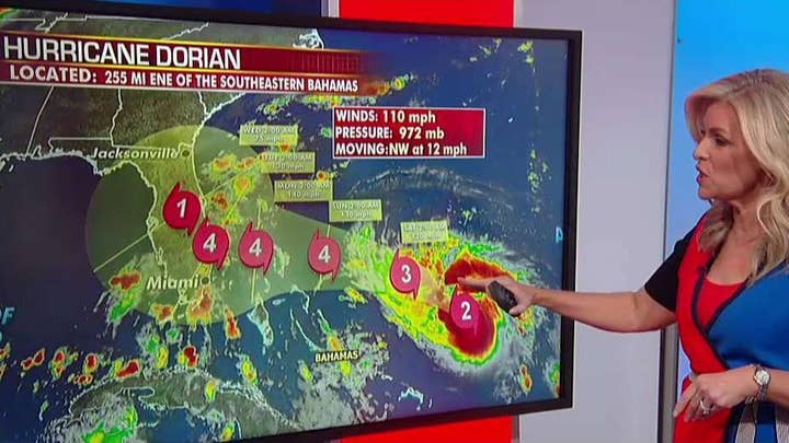
After spending much of yesterday unable to organize more, considerable strengthening is underway since last night. Maximum sustained winds are now 105mph with higher gusts. With a favorable environment ahead, Dorian is still forecast to continue strengthening over the coming days and maintain major hurricane status as it moves through the northwestern Bahamas and near Florida’s east coast.
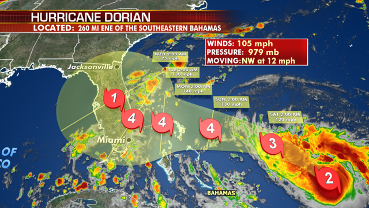
A significant slowing of Dorian’s forward speed appears more likely Sunday into Monday. This would place Dorian near the Northern Bahamas Sunday midday-pm, so hurricane watches have been issued there.
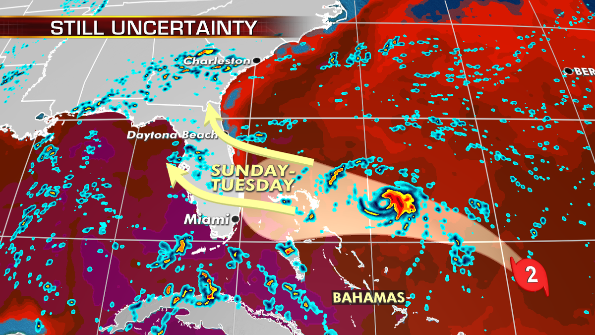
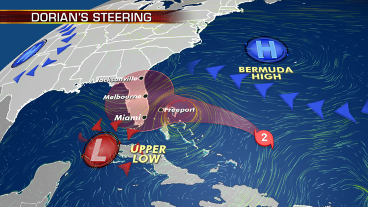
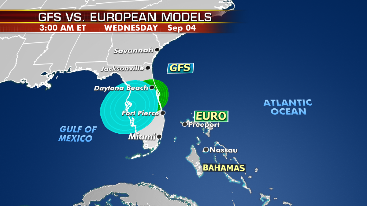
As for the east coast of Florida, this dramatic slowdown presents us with several forecasting complications. Not only are we now looking at Dorian’s center just offshore from Florida later Monday pm, but Dorian will also likely turn to the north at some point Monday. IF this occurs before landfall, Dorian’s center/eye could run northward along the coast without making a technical landfall. The better scenario would be for this turn to occur after the center moves over land so the system can weaken as it moves northward over the entire Florida Peninsula.
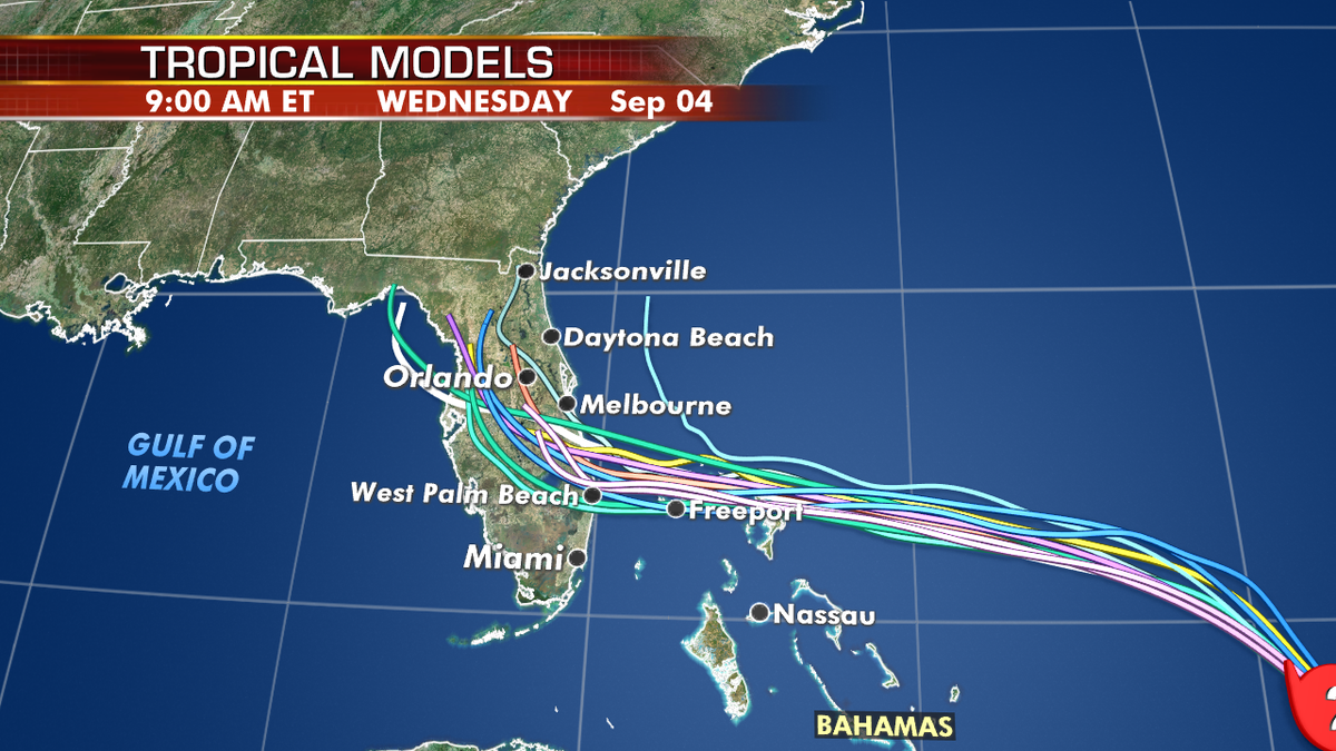
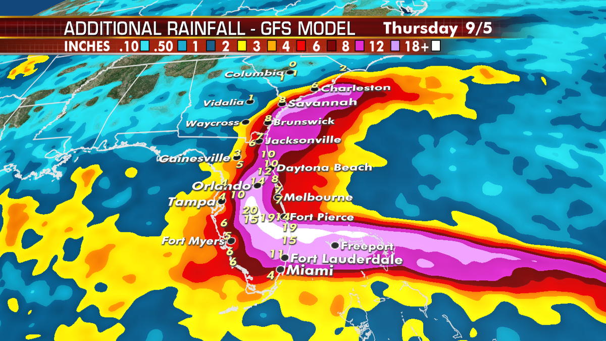
The slow motion of Dorian will present a number of prolonged threats. Dangerous storm surge may last for days and impact a large portion of Florida’s east coast. Little movement will create widespread flooding across the Florida Peninsula that will spread northward into Georgia and the Carolinas into later next week. We may be dealing with Dorian late into next week.

Dorian is expected to bring devastating major hurricane-force winds, surge and flooding to Florida and portions of the Southeast Coast late this weekend into next week. Residents should have their hurricane plan in place, know if they are in a hurricane evacuation zone, and listen to advice given by local emergency officials.
https://www.foxnews.com/weather/dorian-to-continue-strengthening-as-it-moves-through-bahamas-to-florida