Tropical Storm Marco is heading toward Louisiana, as forecasters issue storm surge warnings and hurricane watches for the region.
Marco is nearing hurricane strength as it crosses the southeastern Gulf of Mexico, the National Hurricane Center said 8 a.m. EDT Sunday. It is expected to hit Louisiana's coast around midday Monday.
Another tropical storm, Laura, is also projected to hit Louisiana, possibly as a hurricane, later this week. Laura is expected to make landfall in the same general area as Marco Wednesday.
TROPICAL STORMS MARCO, LAURA NEAR GULF, EXPECTED TO STRENGTHEN INTO HURRICANES

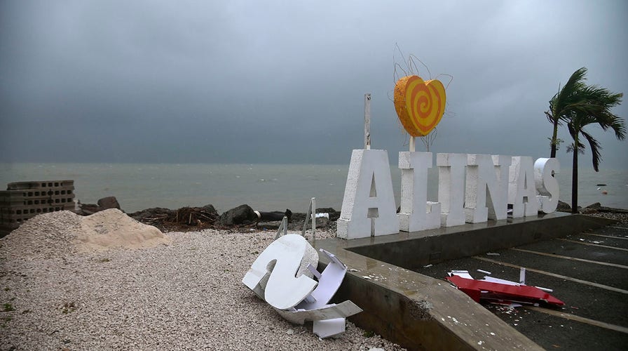
Remnants of a city sign lay on the beach damaged by Tropical Storm Laura in Salinas, Puerto Rico, Saturday, Aug. 22, 2020. Laura began flinging rain across Puerto Rico and the Virgin Islands on Saturday morning and was expected to drench the Dominican Republic, Haiti and parts of Cuba during the day on its westward course. (AP Photo/Carlos Giusti)
Forecasts project both storms to be together in the Gulf Monday. It would be the first time two hurricanes could appear in the Gulf of Mexico simultaneously, according to Colorado State University hurricane researcher Phil Klotzbach, citing records dating to at least 1900.
“Hurricane conditions, life-threatening storm surge, and heavy rainfall are expected from Marco along portions of the Gulf Coast beginning on Monday, and Hurricane and Storm Surge warnings have been issued,” explains the National Hurricane Center, on its website. “Interests in these areas should follow any advice given by government officials.”
TROPICAL STORMS POSE RARE DOUBLE THREAT TO GULF COAST
The area was battered by Hurricane Katrina pummeled in August 2005.
“Impacts still expected across the area from Tropical Storm #Marco,” tweeted the National Weather Service New Orleans/Baton Rouge early Sunday.
Some aspects of Marco are proving difficult to predict, according to the National Hurricane Center. “The intensity forecast remains tricky with Marco due to its small size and marginal environment,” it explained in a statement issued at 5 a.m. EDT Sunday. “There are some models that briefly relax the shear today, which will likely be enough of a change to allow Marco to reach hurricane strength.”
2 TROPICAL SYSTEMS TRACKING TO HIT GULF OF MEXICO BY SUNDAY, COULD DEVELOP INTO DOUBLE STORM
“Later on, while the cyclone is near the coast of Louisiana, the shear is forecast to increase, but it is unknown exactly how close to landfall this will occur,” the National Hurricane Center added. “Our best forecast at this time is that the strongest winds will be confined to the coast, and that Marco will then weaken faster than most hurricanes do over the swamps of Louisiana due to the shear.”
Wind shear, which is a change in the wind’s speed and direction over a short distance, is critical in the formation of hurricanes.
Forecasters are also closely monitoring Tropical Storm Laura, which knocked utilities out as it battered Hispaniola early Sunday, following a track forecast to take it to the same part of the U.S. coast, also as a hurricane.
“Impacts still very possible from Tropical Storm #Laura later this week,” the National Weather Service New Orleans/Baton Rouge tweeted.
Laura dropped heavy rain over parts of Puerto Rico on Saturday, according to the National Weather Service.
CLICK HERE TO GET THE FOX NEWS APP
Fox News’ Brie Stimson and The Associated Press contributed to this article. Follow James Rogers on Twitter @jamesjrogers

The hottest stories ripped from the headlines, from crime to courts, legal and scandal.
