Wow. Did you feel it yesterday if you live in the Northeast?
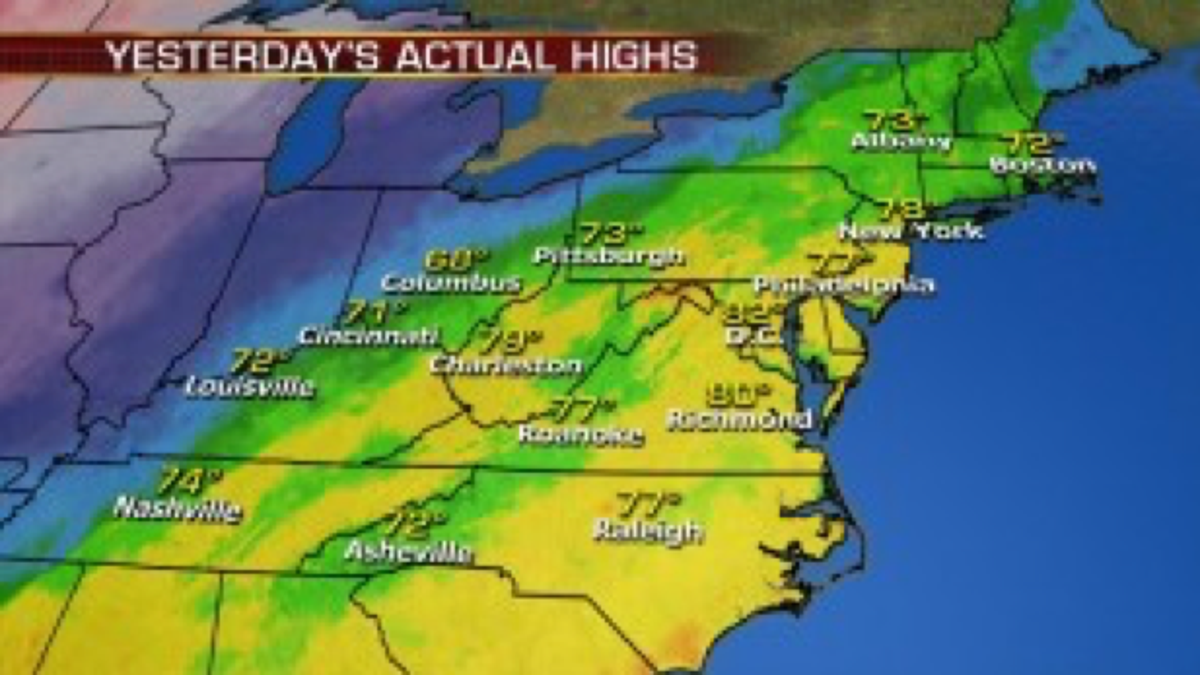
Full on late spring-summertime temperatures! High temperature records were shattered.
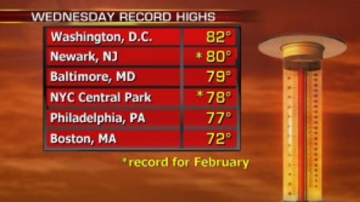
Now back to reality! Following record highs yesterday from the eastern Ohio River Valley to the Northeast and Mid-Atlantic, today temperatures will be a full 30+ degrees cooler than Wednesday.
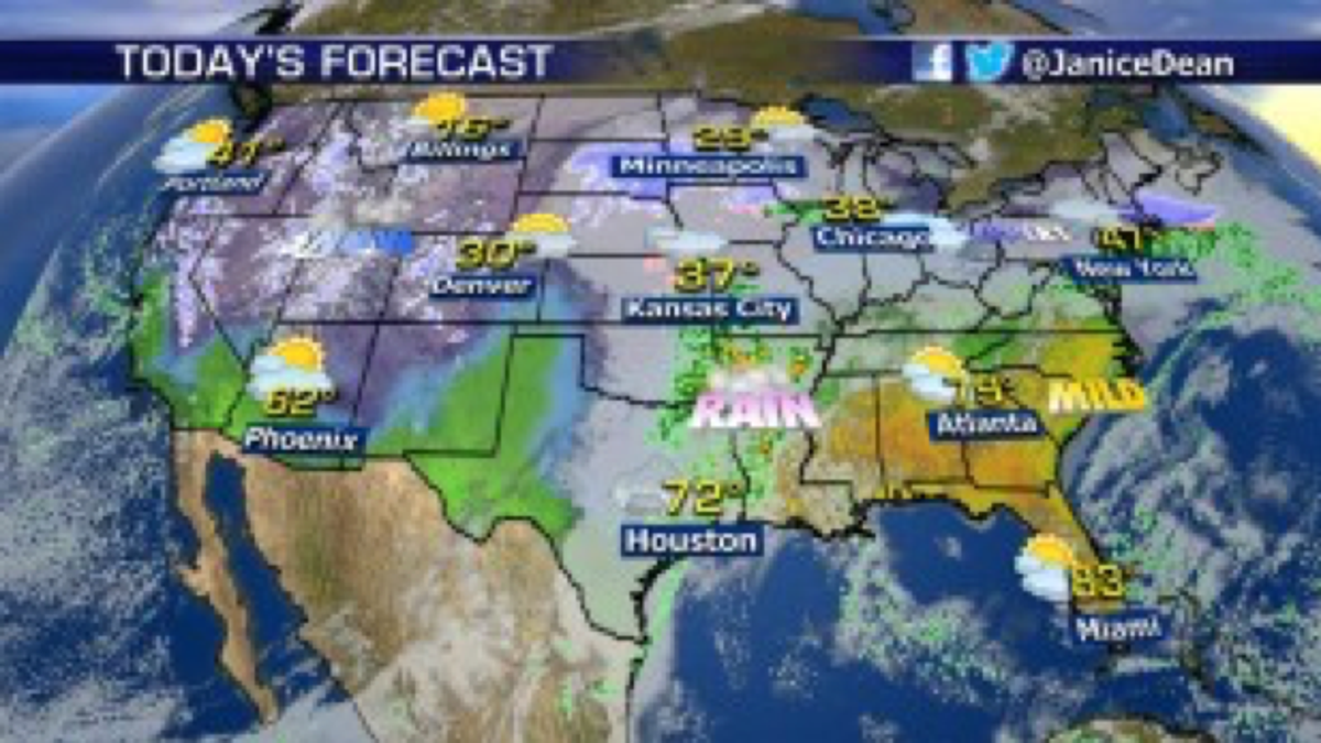
Temperatures across the Southeast will remain above average while the Plains and West remain cooler than average
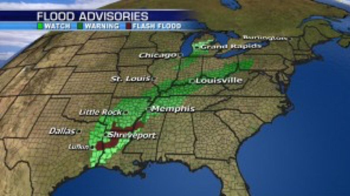
A stalled front will bring a range of weather including the threat for flooding rain, freezing rain and ice on the northern side of the boundary from North Texas up into the Great Lakes and Interior Northeast where temperatures are below freezing at the surface.
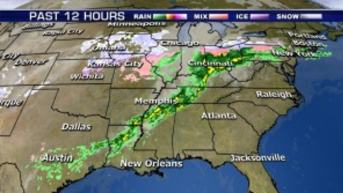
Heavy rain on the southern edge of the boundary will bring very heavy rain with flood watches and warnings posted from the southern Mississippi Valley into the Ohio Valley.
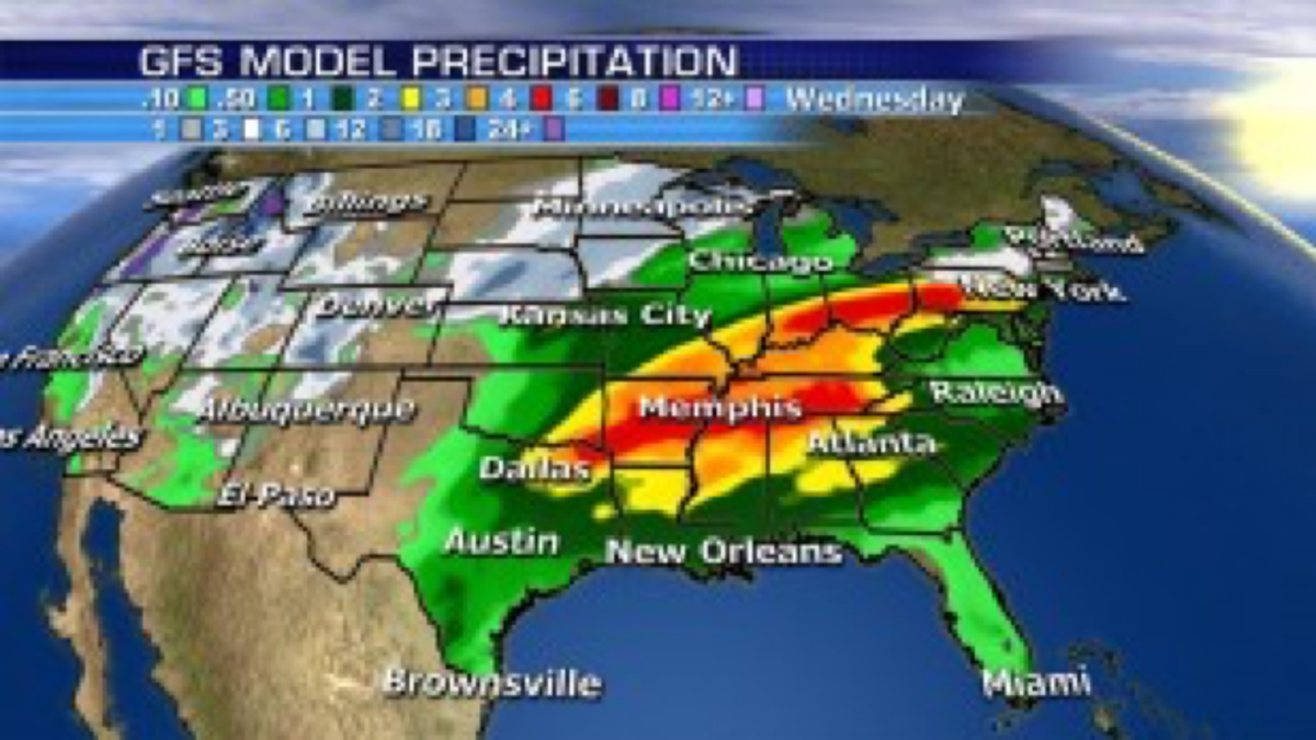
Here's a look at some of the potential rainfall totals over the weekend. Notice the big snow across the West!
More details coming up on Fox and Friends. I'm buying coffee!
JD

The hottest stories ripped from the headlines, from crime to courts, legal and scandal.
