


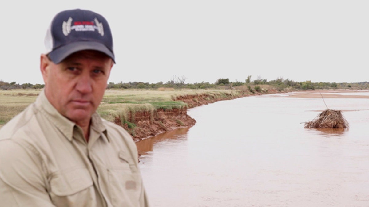
Ken Aderholt is pictured here along the bank of the Red River in Wilbarger County, Texas.
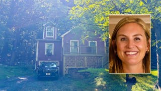
In 1941, Ken Aderholt's grandfather built a single-story brick house along the banks of the Red River – a shallow and serene waterway serving as the boundary between Texas and Oklahoma – where the Aderholts have farmed wheat and raised cattle for generations.
The federal government is now claiming the land the house sits on is public. It declared hundreds of thousands of acres of private land along the 116-mile stretch of river that Oklahoma and Texas share as government property.
The sandy river has eroded and shifted – up to two miles in some places – over the last 100 years, and dry land where the river once flowed belongs to the government, according to the Bureau of Land Management.
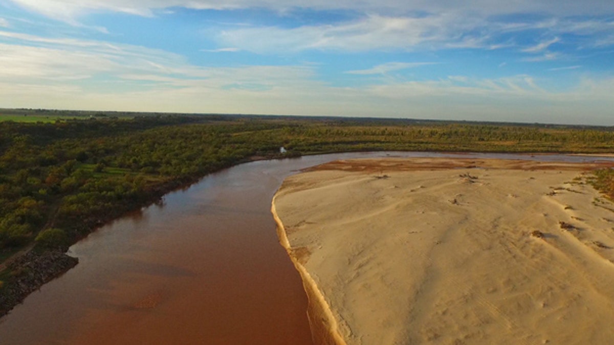
(The Red River has long served as the boundary between Texas and Oklahoma.)
That decision has the federal government in a tug-of-war with a handful of landowners over who rightfully owns thousands of acres of property along the Texas-Oklahoma border. The landowners believe this is a classic example of aggressive land grabbing by the federal government and government officials say they are just taking back what rightfully belongs to them.
Texas landowners claim the government's argument runs at odds with a 1923 Supreme Court ruling that sets the Texas-Oklahoma state boundary as following the meandering of the river.
"My grandfather bought this land and I have the deed for it," Aderholt, of Wilbarger County, Texas told Fox News. "I’ve paid taxes on this property for decades."

The government, meanwhile, says its motive is not to force property owners from their land.
The Red River has served as a critical dividing line for centuries. It was the boundary between Spain and the United States before it divided Texas and the U.S. and later, Oklahoma and Texas.
Ownership of the river bottom is more complex.
The U.S. Supreme Court ruled in 1923 that the northern half of the river bottom was Oklahoma's and the southern half belonged to the government.
In 2007, during the Bush administration, officials from the Bureau of Land Management began surveying the river bottom to define Indian lands.
Pat Canan, of Clay County, who lives with his family on 2,000 acres abutting the river, said he allowed government surveyers onto his land in 2008.
"They told us they had been hired by the Bureau of Indian Affairs to look for old Indian allotments," Canan said of the government surveyors.
What happened next stunned Canan, whose family settled on the land in 1963.
Following their interpretation of the gradient boundary survey method, the BLM extended what it believes to be part of the riverbed, setting the boundary line more than a mile onto dry land into Texas.

Wichita Falls TX photographer Meegan Weaver photography (Pat Canan is pictured with his family on his 2,000-acre property along the Red River.)
The move affects an estimated 30,000 acres of federal land potentially coinciding with private land, according to the government. But lawyers for the land owners claim it impacts some 90,000 acres.
Canan said one day in 2008 he discovered a government monument in the middle of his pasture identifying the Texas-Oklahoma border. Based on the markers, the government claims roughly 1,400 of the 2,000 acres he has owned and paid taxes on for decades, he said.
"It's our belief that it's private property," Canan, a petroleum engineer and Texas game warden, told Fox News.
"That land was originally deeded by the state of Texas to the landowners. There’s never been any disagreement between the state of Texas and Oklahoma over who owns it," he said.
In 2015, Canan and other landowners as well as the three Texas counties affected – Wichita, Clay and Wilbarger – filed suit against the Bureau of Land Management and the Department of Interior.
"The United States' ownership of property is limited to bottom-half of the sandy riverbed outside of Texas," the lawsuit states. "Nonetheless, BLM asserts that its boundary extends well past the riverbed into Texas and, in some instances, more than a mile outside of its lawful territory. In doing so, BLM has seized private property, infringed upon the sovereignty of the local county governments, and interfered with law enforcement’s ability to discharge its duties arising under Texas law.
Robert Henneke, a lawyer with the Texas Public Policy Foundation who represents the landowners, told Fox News there have been "no productive talks in terms of a settlement" and said a trial is set for July in a federal court in Wichita Falls. There is no word on whether the Trump administration will intervene.
"Without exaggeration, this is the Bureau of Land Management taking people's homes," Henneke said.
"In addition to the federal government unlawfully claiming title to private property owned by the Texas families living along the Red River, BLM’s actions violate the landowners Fourth Amendment rights to be free of unreasonable seizure of their property," he said.
Texas Lawmakers, like Sen. John Cornyn and Rep. Mac Thornberry, both Republicans, have sided with the landowners in the dispute. The two introduced a bill before Congress last month in an attempt to resolve the matter.
"With a long overdue survey of the land in question, this bill can finally end the baseless claims the federal government has made over privately owned property along the Red River," Cornyn said in a statement on Jan. 10.
"Texas families who have lived along the river for generations deserve to know they’re protected from a federal land grab, and this bill is a critical first step towards providing these folks certainty," he said.
The government notes there are decades of debate over how to correctly survey the land.
In 1867, an Indian reservation was created along the Red River for three Native American tribes through a treaty between the U.S. and the tribes. The reservation was later superseded by allotments, meaning Native Americans were permitted to own individual acres. The remainder of the land became homesteaded by non-Indians.
BLM officials say they have tried to make clear they have no intent to force current landowners from their properties. Instead, the government says landowners can purchase land belonging to the U.S. if it coincides with their deed.
But landowners say they shouldn't have to "buy back" property they believe they’ve rightfully owned and diligently paid taxes on for decades. And their attorneys say the government has never made such a proposal.
"The U.S. Supreme court case is clear in that it established the boundary of federal territory at the south bank of the Red River," Henneke said. "Beyond that is my clients' private property and it is outrageous for the government to suggest they should have to buy back what they already own."