While there’s nothing wrong with the tattered stack of interstate guides you’ve got in the truck, these innovative maps offer new ways to see the world. Whether you’re navigating a Super Mario-themed subway system or geolocating tweets from local food trucks, these eight maps will make travel so much cooler.
1. 8-bit Maps
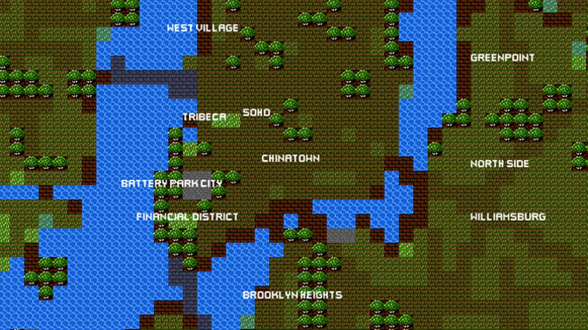
(8-Bit Cities)
Ever wonder what the world would look like if you were trapped in a 1980’s video game? Well, thanks to an April Fools’ joke by Google back in 2012, you can travel around an 8-bit version of the world. Unfortunately, the original site for 8-bit Google Maps is long gone, but you can still access retro-themed versions of major cities at 8-Bit Cities. So take a look around and don’t forget your parachute pants.
2. Super Mario-Themed Subway Map
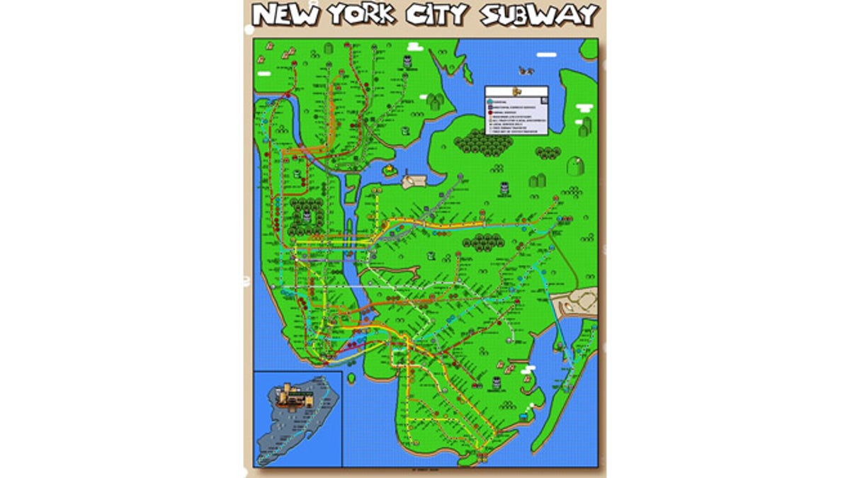
(RIPT Apparel)
Sometimes cities are just more fun if you treat them like a game. In the case of designer Robert Bacon, the game can be Super Mario Brothers, Zelda or Donkey Kong. The artist created a series of videogame-themed subway maps for Ript Apparel. Seen above is his Super Mario version of the New York City subway.
3. Google's DIY Street View
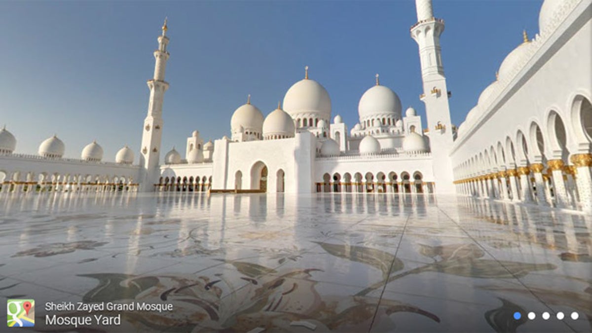
(Google Maps)
A new version of Google Maps's Street View, called Photo Sphere, will allow travelers to create their own street views with photographs taken from their mobile device or DSLR camera. The new mapping feature brings sites like the Machu Picchu and Mount Everest to life. Take a look or add your own here.
4. Instahood
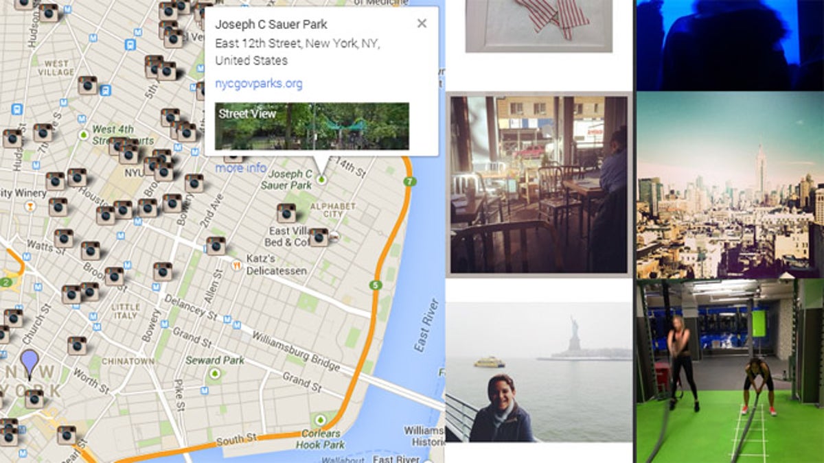
(Instahood)
This is Google Street View with a twist. Rather than just look at sidewalks and building facades, you can see any images from Instagrams that have been geotagged in a given location. Some are especially helpful, like food shots from popular restaurants. And some are less helpful, like selfies from night club bathrooms. It’s still worth a look around, click here to scope out your own Instahood.
5. Tweat.it
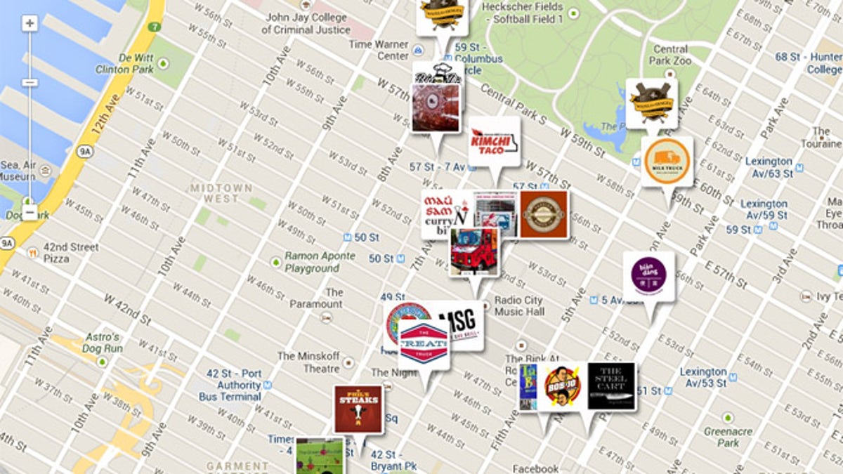
(Tweat.it)
With more food trucks popping up in cities across the country, it’s hard to keep track of them all. That’s where Tweat.it comes in. The website maps food trucks based on where their latest tweets came from, showing you exactly where to find your favorite moving grub.
6. Sumus Transit Maps
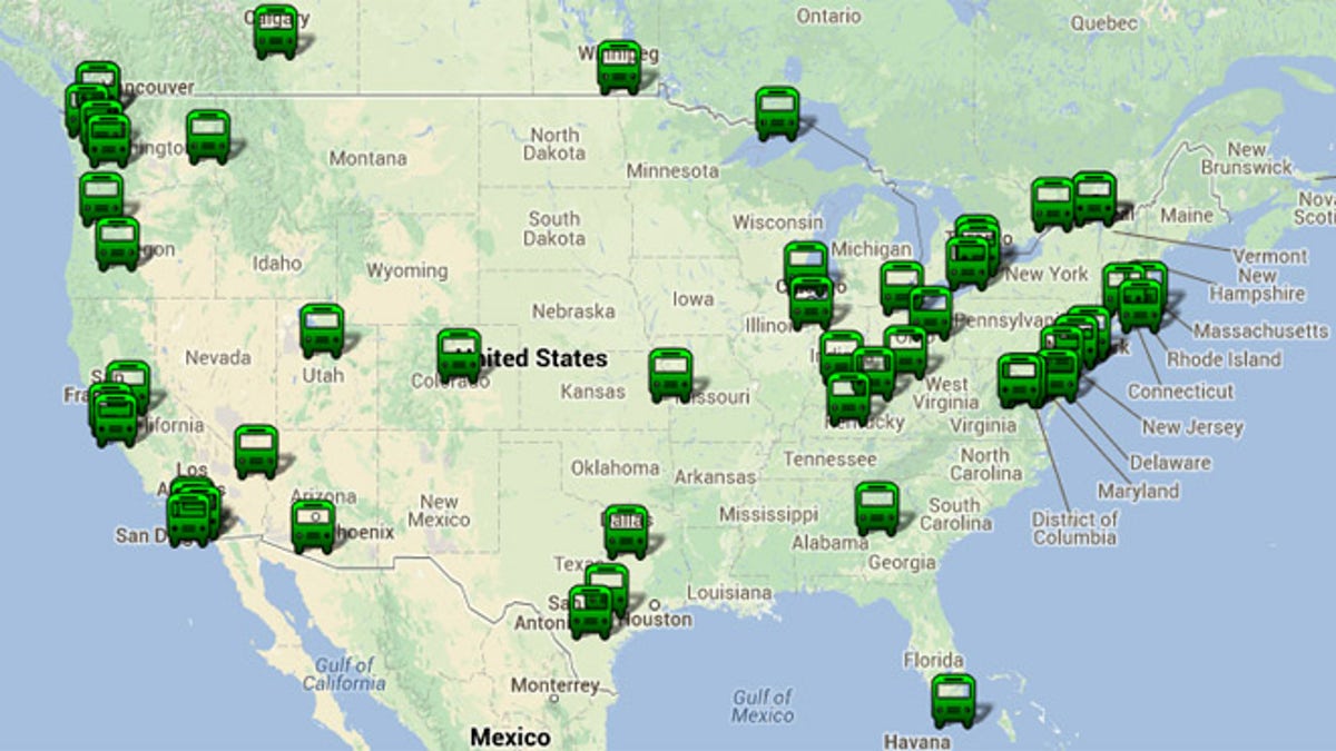
(Sumus Technology)
For those who want more than just a map of a city’s transit system, Sumus lets you visualize the movements of an entire urban population. Using data from the General Transit Feed Specification (GTFS) data, each spot on the map shows how a city moves, one day at a time. To try it out, visit the Sumus website and click on any of the green buses on the map.
7. Thunder and Lightning Maps
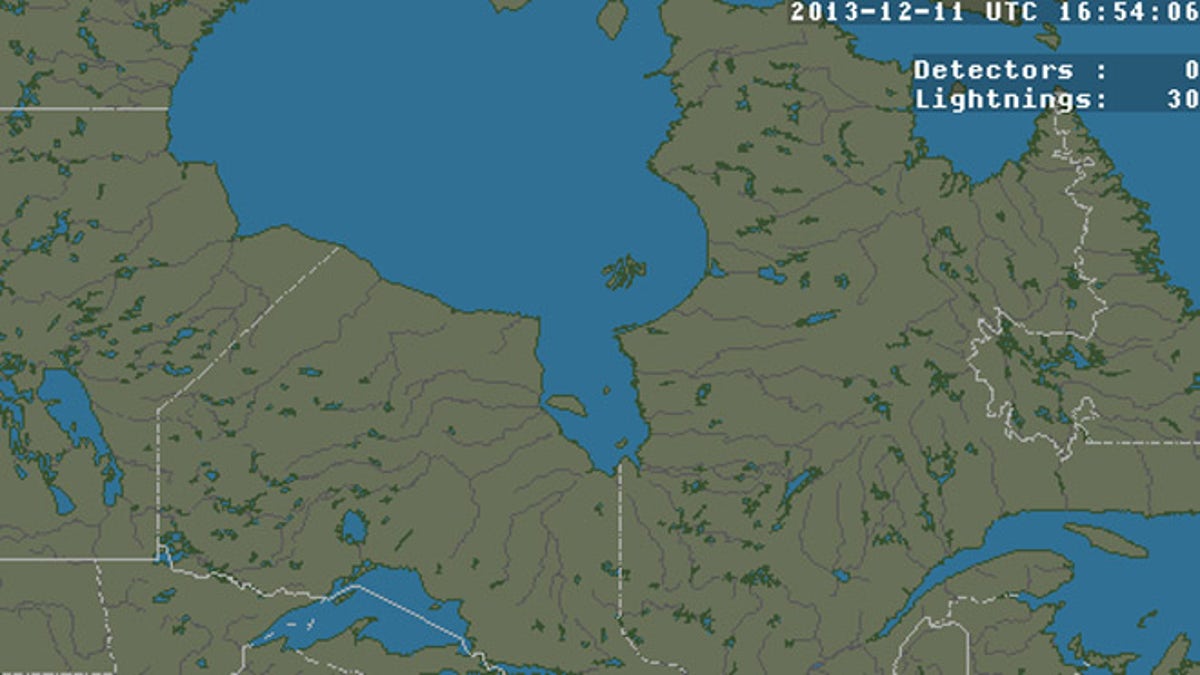
(Blitzortung)
Let’s be real, you probably aren’t going to navigate based on where thunderstorms are, but with Blitzortung you can. This site charts where lightning is striking in any given region at any given time. Want to make sure it doesn’t strike twice? Take a look.
8. Lifemaps
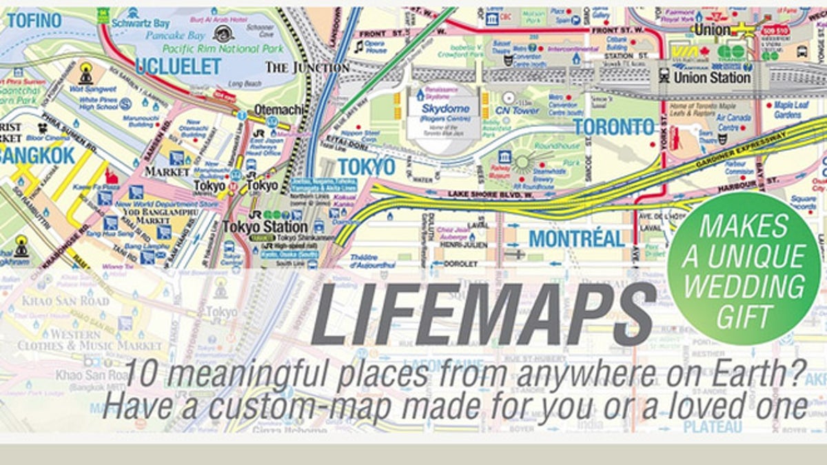
(AndrewMaps)
For the sentimental cartographers of the world, Andrew Alfred-Duggan’s Lifemaps chart literal trips down memory lane. The artist creates personalized maps for clients who want to mark significant locations from their lives. From “first date” to “first child,” the maps offer a chance to see the world in a more intimate way.
Fun stories about food, relationships, the great outdoors and more.