


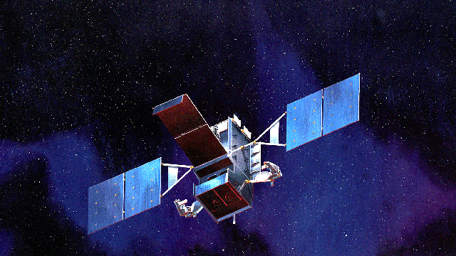
An artist's conception of one of the satellites that makes up the Space Based Infrared System, an network of satellites that will help the military track and destroy incoming missiles. (Lockheed Martin)
Star Wars is back! Sort of.
The Air Force will launch a key satellite for its space-based missile alert system Friday, hoping to overcome years of developmental delays in the dogged pursuit of an eye-in-the-sky threat-warning system.
The Space Based Infrared Systems (SBIRS) program -- fraught for 15 years with mistakes, delays and congressional reviews -- hinges on satellites hovering 2,000 miles in space, watching the globe for missile launches by North Korea, Iran or others. The planned May 6 launch of SBIRS GEO-1 marks the first launch in that long-delayed plan.
But this isn't the "Star Wars" space defense net Ronald Reagan envisioned in the 80s, said Col. Roger Teague, commander of the Infrared Space Systems Directorate at Air Force Space and Missile Defense in Los Angeles.
“Back in the early 80s, the moniker Star Wars [described] lasers in space and space war capabilities," Teague told FoxNews.com -- all ways of knocking out threats from the cold, airless reaches of space. Unlike the abandoned Strategic Defense Initiative, SBIRS satellites serve only to boost our detection system. They will pick an incoming missile out of the inky blackness and beam its location to warfighters -- not blast it to smithereens by themselves.
“The SBIRS system will remain the golden standard for missile warning. It will be the backbone of the important mission we do to provide that early warning for hostile missiles and threats for our nation and allies,” Teague said. With it, "we can see much more, much earlier, much sooner,” he said.
Friday's launch aboard an Atlas V rocket of the first of four SBIRS geostationary satellites -- which orbit the planet in a fixed spot relative to Earth -- will add to the two highly elliptical satellites already in place. Those change orbits to watch different targets; SBIRS GEO-1 will provide persistent surveillance of just one hotspot, warzone or hostile nation -- which one exactly is classified -- for the Department of Defense (DoD) from a stationary orbit above the Earth.
After its launch, the satellite will take nine days to achieve its orbit. It could take another six months before it starts providing intelligence data, however. The satellite will then undergo a certification process that will take roughly 17 months, whereupon it should receive approval to participate in integrated warning assessments and operations, providing 24/7 persistent surveillance with its unblinking, sleepless infrared sensors.
The fourth and final SBIRS satellite is scheduled for launch in 2016, Teague said.
Teague acknowledged that the launch of SBIRS GEO-1 is the beginning of the end of a long road fraught with technical and cost challenges for the U.S. Air Force and its contractors, which include Lockheed Martin, Northrop Grumman, and Aerospace Corp.
Defense officials conceived of SBIRS in 1995 as a means to update the Defense Support Program satellites, first launched in 1970. While the Strategic Defense Initiative envisioned refashioning such satellites with space-based defense weapons to blast incoming missiles from the sky, SBIRS took a more conservative approach of fitting more advanced sensors to the new satellites.
But even the costs of that comparatively modest goal ballooned to the point where the program is estimated to run about $17.6 billion, nearly three times the original projections.
Despite the massive cost overruns, the basic specifications for the two infrared sensor packages onboard GEO-1 remained stable, said Jeff Smith, SBIRS program manager at Lockheed Martin, which built the satellite.
A scanning sensor will conduct sweeps for information on missile launches, while a staring sensor will analyze a fixed location, Smith explained. The scanning sensor likely would pick up threat information first due to its wider range but the staring sensor could provide more detailed information on a threat.