


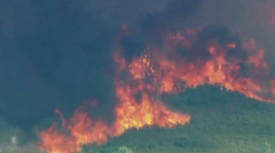
Deadly Carr wildfire swells to nearly 100,000 acres
Jeff Paul reports from Redding, California on the containment and devastation.
New satellite imagery reveals thick blankets of smoke over California and Oregon from the raging wildfires that have incinerated hundreds of thousands of acres across the U.S. this summer.
Persistent, record-breaking heat and an extremely dry landscape set the stage for the Carr Fire—one of the most dangerous infernos that has claimed six lives and destroyed 874 structures across more than 98,000 acres.
In an image taken by a NASA satellite, there aren’t many clouds visible and those that can be seen are bright and white. The thick patches of smoke from the wildfires, typically grayish and tan in color, can be seen across a wide area of California and Oregon.
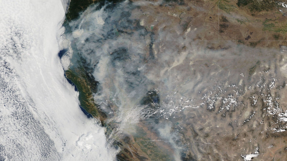
An image captured by NASA shows wildfires raging over California and Oregon. (NASA)
According to the National Interagency Fire Center, 90 fires have already burned nearly 1 million acres of land in 14 different states. California, Oregon and Colorado account for about half of the land where fires are still blazing.
The Carr fire has been particularly ferocious.
“It's ripping trees off the ground and throwing them across the street into homes,” Chad Carroll, a spokesman for CalFire, said Friday. “That's pretty strange and unusual.”
Although wildfires are a regular feature in the western U.S., scientists have said that climate change is impacting the frequency and severity of the blazes.
“You see roads melting, airplanes not being able to take off, there's not enough water,” Katharine Hayhoe, director of the Climate Science Center at Texas Tech University, told the Chicago Tribune. “Climate change hits us at our Achilles' heel. In the Southwest, it's water availability. On the Gulf Coast, it's hurricanes. In the East, it's flooding. It's exacerbating the risks we already face today.”
The Associated Press contributed to this report.