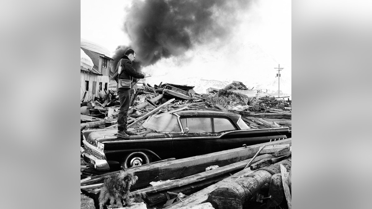
FILE - In this March 29, 1964 file photo, a photographer looks over wreckage as smoke rises in the background from burning oil storage tanks at Valdez, Alaska. On Monday, Feb. 1. 2016, federal scientists say they've pinpointed the cause of tsunami waves following the 1964 Great Alaska Earthquake, the second-largest ever recorded, at magnitude 9.2. (AP Photo/File)
For 50 years, scientists struggled to understand what sparked a devastating tsunami that leveled a remote village in Alaska following the 1964 Great Alaska Earthquake.
But thanks to detailed seafloor images, they have solved the mystery. Scientists from the U.S. Geological Survey now believe a series of underwater landslides as deep as 1,150 feet were responsible for the massive waves that swept through the village of Chenega in Prince William Sound in 1964, destroying all but two buildings and killing 23 people.
Related: Scientists warn Yellowstone supervolcano could kill millions
Nine people died in Anchorage, Alaska’s largest city, from the 9.2 magnitude quake, the second largest in recorded history, according to the Associated Press. The earthquake caused a trans-ocean tsunami that brought waves to the Alaskan towns of at devastated Valdez, Seward and Whittier and down the West Coast. Four campers on a beach died at Newport, Oregon. A dozen died in the Northern California community of Crescent City.
“It is exciting to see the technology evolve so we can now get high-resolution images of the seafloor that we could not back then and to pinpoint the most likely source for the waves. After 50 years, this new work confirms our original inference that it was probably landslide-generated waves that devastated Chenega so many years ago, but we had no adequate submarine data to define either the size or location of the landslide sources,” USGS geologist emeritus George Plafker who, with colleague Larry Mayo, was one of the first responders and wrote some of the early geological field reports on surface effects of the Chenega waves in 1965, said in a statement.
Related: Stunning NASA image shows the power of tropical cyclone Kate
Scientists had long suspected landslides were to blame for what has become known as the Chenega tsunami. But at the time of the disaster, they didn’t have the technology to prove it.
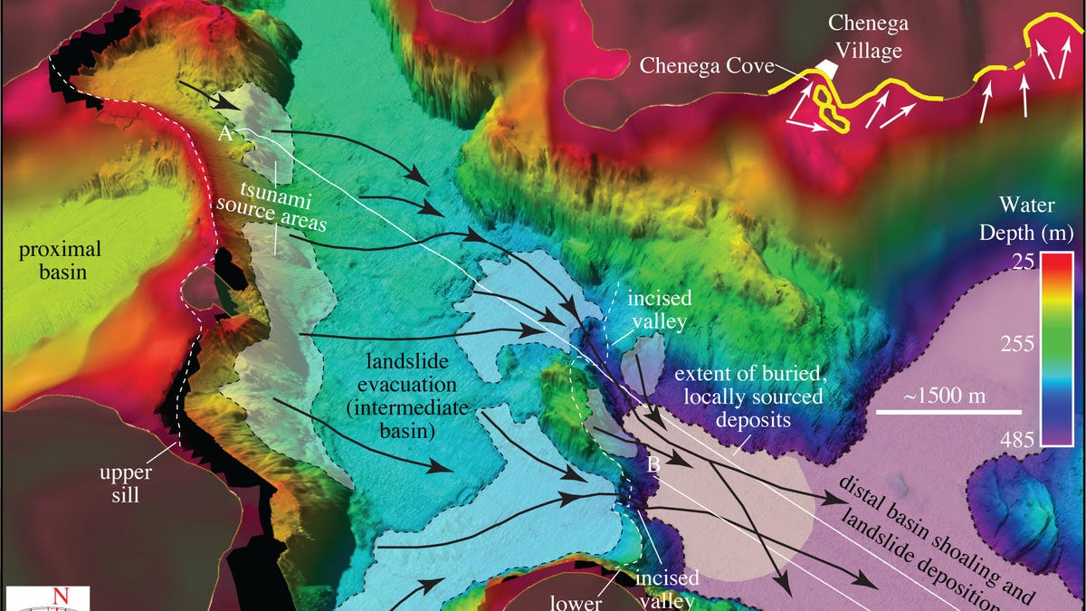
3-D perspective view of shaded relief bathymetry offshore Chenega village. Shaded patches of seafloor depict areas that experienced dramatic changes in water depth between 1957 and 2014. Patches within the intermediate basin (light blue to green) are sites of sediment evacuation and deepening; the floor of the farthest (distal) basin (purple and blue) is a site of sediment deposition. The proximal basin (yellows to red) is where the landslide originated in 1964. Black arrows are interpreted sediment flow pathways. White arrows indicate the inferred 1964 tsunami travel direction and yellow lines mark areas surrounding Chenega Village that experienced significant tsunami runup. (USGS)
“A bathymetric survey at the time, which only imaged relatively shallow seafloor, down to 180 meters (330 feet) deep, did not reveal evidence of a landslide in nearby Dangerous Passage or the other waterways around Chenega,” said Daniel Brothers, USGS geophysicist and lead author of the study in the journal Earth and Planetary Science Letters that describes the latest research done with colleagues from Boise State University and the Alaska Department of Fish and Game.
“Alternate explanations involving seafloor movement during the earthquake did not fit the timing and severity of the Chenega tsunami as described by eyewitnesses,” he said.
Unraveling the mystery started with Brothers mapping a large submarine landslide complex in nearby Dangerous Passage, mostly in water deeper than what had been studied in 1964.
The scientists used multibeam sonar technology to collect high-resolution bathymetric (seafloor depth) data, and a single-channel seismic-reflection system to collect sub-bottom profiles (cross-sectional views of sedimentary layers and other features beneath the seafloor).
Related: Could worsening heat make the Persian Gulf uninhabitable?
As a result, the researchers were able to calculate the time it would take for a tsunami triggered by a large landslide in the mapped areas to reach the village of Chenega and found a good fit with eyewitness reports: a tsunami wave triggered in the areas where they found landslide evidence would take three to four minutes to reach the village, consistent with the arrival time of the most destructive waves.
The bathymetric data disclosed three sedimentary, bowl-like basins located at progressively deeper levels toward open waters of Prince William Sound. Originally carved by descending glaciers when sea level was lower, the basins over time filled with sediment washed off the land as sea levels rose and the glaciers retreated after the last ice age.
“The intermediate basin filled up with sediment, setting the stage for this instability, and the trigger that occurred when this earthquake struck," Brothers told the AP.
Researchers said the findings underscore the tsunami threat posed by submarine landslides in fjords around the world, often where communities and ports are located.

Get a daily look at what’s developing in science and technology throughout the world.