National forecast for Tuesday, July 7
Fox News senior meteorologist Janice Dean has your FoxCast.
A strong storm system moving through the Pacific Northwest will bring the risk for severe thunderstorms throughout the day on Tuesday across the Northern Plains.
As the severe storms develop, they bring the risk of large hail, damaging winds, and even tornadoes.
The Storm Prediction Center (SPC) says that an enhanced risk of severe storms is possible across Montana and into the western portions of the Dakotas.
FIREFIGHTERS IN CALIFORNIA COUNTY BATTLED 67 FIRES ON FOURTH OF JULY, SOME SPARKED BY FIREWORKS
Flash flooding will also be a concern with heavier pockets of rain in some spots.
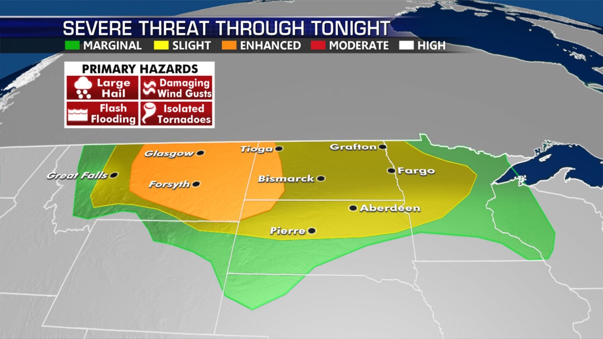
Severe weather can be expected on Tuesday across the Northern Plains. (Fox News)
Scattered thunderstorms will also be possible across the Southeast along a stalled frontal boundary.

Scatted thunderstorms will also bring rain across the Southeast. (Fox News)
In between the two systems, warm temperatures in the 80s and 90s will stretch from the Midwest through to western New York and Pennsylvania.

The national forecast for July 7, 2020.
Critical fire weather out West

Elevated fire danger remains out West on Tuesday. (Fox News)
Fire danger will be elevated over the Great Basin and interior West.
CLICK HERE FOR MORE WEATHER COVERAGE FROM FOX NEWS
Temperatures remain warm and conditions are dry with some gusty winds, allowing any fires that develop to quickly grow.
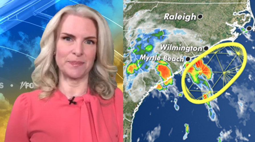
Eye on the tropics
Across the tropics, things are quiet for now.

Forecasters are keeping their eye on a system that may develop off the Southeast coast. (Fox News)
We'll watch an area of low pressure over the Southeast that could potentially develop along the Southeast Coast over the next few days.

The hottest stories ripped from the headlines, from crime to courts, legal and scandal.
