
Nor'easter vs. Alberta Clipper: Here's the difference
In winter you’ll often hear meteorologists refer to two types of snowmakers, a Nor’easter and an Alberta Clipper. But just because these winter storms make snow, doesn’t make them the same.
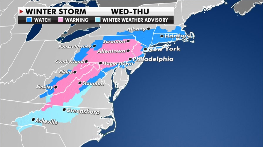
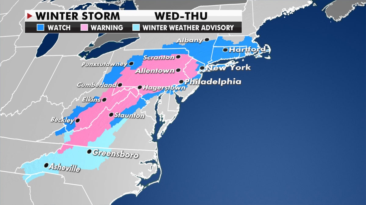
All eyes are on the Northeast as a significant winter storm is going to develop and bring epic snowfall totals, possible blizzard conditions and ice from the Mid-Atlantic to New England.
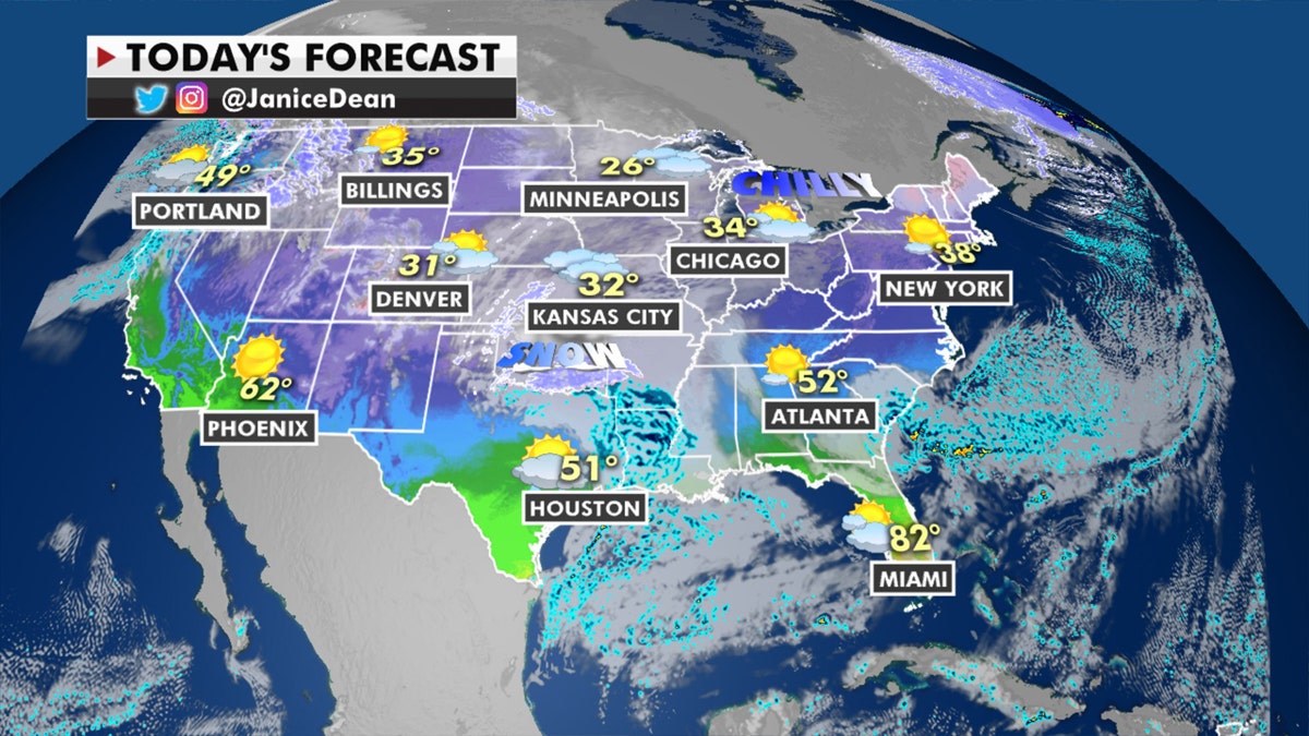
A system moving across the Plains will bring measurable snow to parts of Oklahoma and Texas. Travel will be difficult in some of these areas and winter weather advisories are posted.
That same area of low pressure will move off the southeast coast and become our nor’easter Wednesday into Thursday. A wintry mix will start over North Carolina and Virginia with the risk of freezing rain and accumulating ice, which could cause big problems on the roads and on the trees and power lines.
POTENTIAL 'BLOCKBUSTER' NOR’EASTER SET TO HIT THIS WEEK
Winter storm forecast. (Fox News)
Heavy snow will move into areas east of the I-95 corridor later Wednesday, but depending on where that low positions itself will mean the difference of a lot of snow or not so much. A jog to the north or south will make snowfall totals very difficult to pinpoint. New York City, for example, is right on that line of rain/snow, and if it’s more of a rain event then that will cut back on the snow totals.
The heaviest amounts are forecast right now for western Maryland and south- central Pennsylvania where 2 feet of snow could fall and lead to dangerous travel and/or power outages. Everyone should pay close attention to the local forecasts in their area for the latest information.
CLICK HERE TO GET THE FOX NEWS APP
Forecast for Dec. 15, 2020. (Fox News)
The Pacific Northwest continues to be unsettled with two more systems moving in, bringing rain along the coast and mountain snow.

The hottest stories ripped from the headlines, from crime to courts, legal and scandal.
