New Orleans bracing for prospect of a foot of rain as a Gulf system grows stronger
Louisiana is under a state of emergency; Casey Stegall reports from the scene.
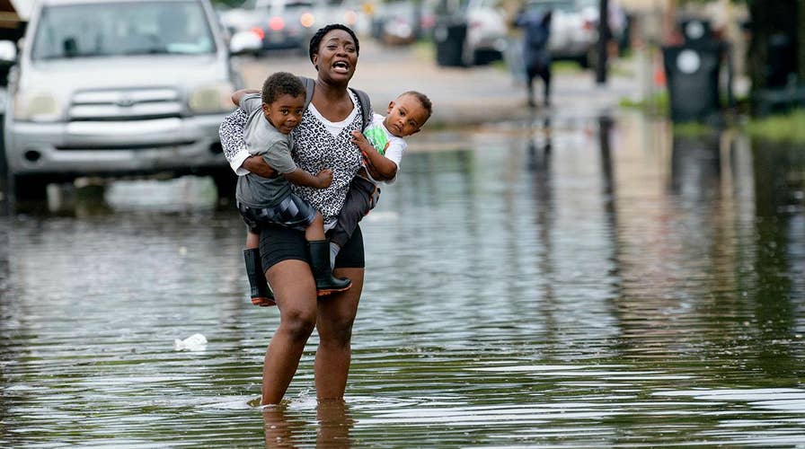
New Orleans’ improved post-Katrina flood defenses are expected to face an extreme test as Tropical Storm Barry threatens to turn into the first hurricane of the season and blow ashore with torrential rains.
Barry could have winds of about 75 mph, just barely over the threshold for a hurricane, when it comes ashore, making it a Category 1 storm, forecasters said.
It is expected to bring more than a foot and a half of rain in potentially ruinous downpours that could go on for hours as the storm passes through the metropolitan area of nearly 1.3 million people and pushes inland.
HERE ARE THE DEADLIEST AND COSTLIEST HURRICANES TO HIT THE US MAINLAND
As of late Thursday afternoon, Barry was about 90 miles south of the mouth of the Mississippi, with winds around 40 mph. A hurricane warning was posted for a 100-mile stretch of the Louisiana coastline just below Baton Rouge and New Orleans.
Gov. John Bel Edwards has asked the Trump administration for a federal declaration of emergency ahead of Barry’s expected landfall late Friday or early Saturday.
In a letter Thursday to President Trump, Edwards asked that the state receive supplementary federal resources as soon as possible should they be needed. His letter noted that in the past 24 hours, 28 parishes have issued emergency declarations and 14 are in the process of doing so.
Trump tweeted Thursday evening: “To everyone on the Gulf Coast: As you make preparations to protect your homes & loved ones from flooding & the coming storm, it is imperative that you heed the directions of @FEMA, State & Local Officials. We are working closely w/ them. Please be prepared, be careful, & be SAFE!”
The Louisiana National Guard said Edwards has authorized activating up to 3,000 soldiers and airmen ahead of the storm. Officials said high-water vehicles and boats have been staged and helicopters are ready to provide support as needed.
HURRICANE HEALTH RISKS: 3 THINGS TO WATCH OUT FOR
Edwards declared an emergency earlier in the week as the storm brewed in the Gulf of Mexico.
The storm’s blow could form a dangerous combination with the already-high Mississippi River, which has been swelled by heavy rain and snowmelt upriver this spring.
“There are three ways that Louisiana can flood: storm surge, high rivers and rain,” Edwards said. “We’re going to have all three.”
Meteorologist Benjamin Schott said the chief concern is not the wind: “Rainfall and flooding is going to be the No. 1 threat with this storm.”
Edwards said authorities do not expect the Mississippi River to spill over its levees, but cautioned that a change in the storm’s direction or intensity could alter that.
Hurricane Katrina caused catastrophic flooding in New Orleans in 2005, and was blamed for more than 1,800 deaths in Louisiana and other states, by some estimates.
In its aftermath, the Army Corps of Engineers began a multibillion-dollar hurricane-protection system that isn’t complete. The work included repairs and improvements to some 350 miles of levees and more than 70 pump stations that are used to remove floodwaters.
CLICK HERE FOR THE FOX NEWS APP
The National Weather Service said it expects the Mississippi to rise to 19 feet by Saturday morning at a key gauge in the New Orleans area, which is protected by levees 20 to 25 feet high.
The National Hurricane Center said as much as 20 inches of rain could fall in parts of eastern Louisiana, including Baton Rouge, and the entire region could get as much as 10 inches. The New Orleans area could get 10 to 15 inches through Sunday, forecasters said.
The Associated Press contributed to this report.

The hottest stories ripped from the headlines, from crime to courts, legal and scandal.
