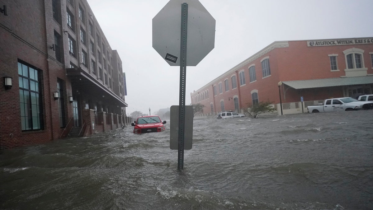
Strong winds cause destruction as Hurricane Sally moves across Gulf states
Residents warned to stay inside; Charles Watson reports from Mobile, Alabama.
A weakened Sally is bringing the risk of flooding across the Southeast on Thursday as another storm in the Atlantic Ocean is gathering strength.
The National Hurricane Center (NHC) issued its final advisory on Sally early Thursday, saying the center of the storm was located near Montgomery, Ala., packing 30 mph winds with movement northeast at 12 mph.
"Tropical Depression Sally still producing torrential rains over eastern Alabama and western and central Georgia," the NHC said.
2020 ATLANTIC HURRICANE SEASON IS RUNNING OUT OF NAMES, SO WHAT HAPPENS NEXT
Sally continues to weaken as it moves across the Southeast and into the Mid-Atlantic before it gets picked up by a cold front and out to sea on Saturday.
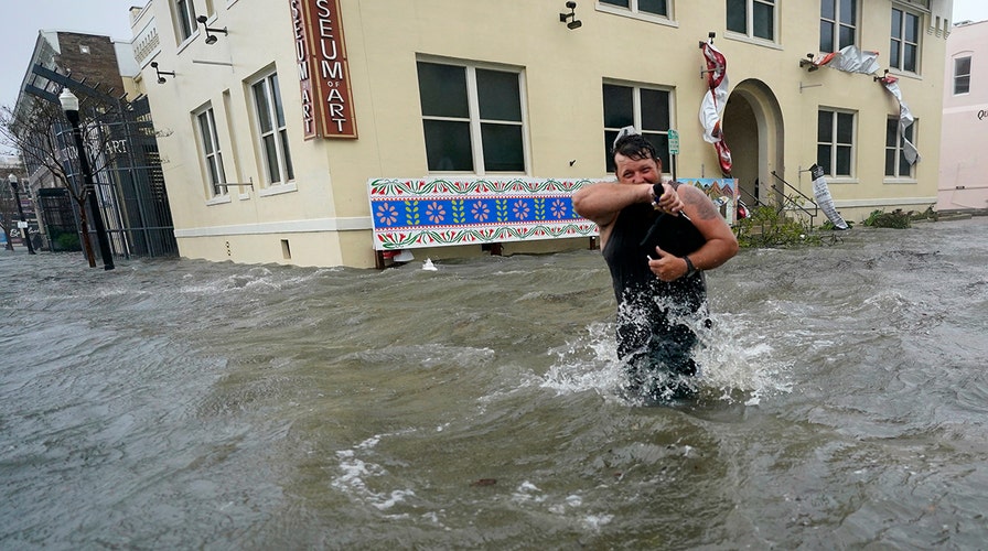
Floodwaters move on the street, Wednesday, Sept. 16, 2020, in Pensacola, Fla. Hurricane Sally made landfall Wednesday near Gulf Shores, Alabama, as a Category 2 storm, pushing a surge of ocean water onto the coast and dumping torrential rain. (AP Photo/Gerald Herbert)
Heavy rain, high winds with some isolated tornadoes will be the main risks along the trajectory of this system.
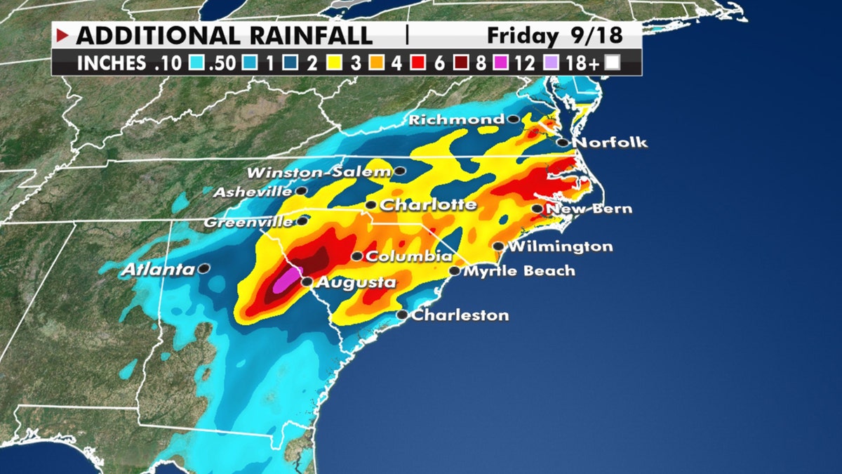
Forecast rainfall through Friday from Sally. (Fox News)
Up to 6 inches of rain is possible across parts of Georgia, while the Carolinas could see up to 10 inches of rain in some locations.
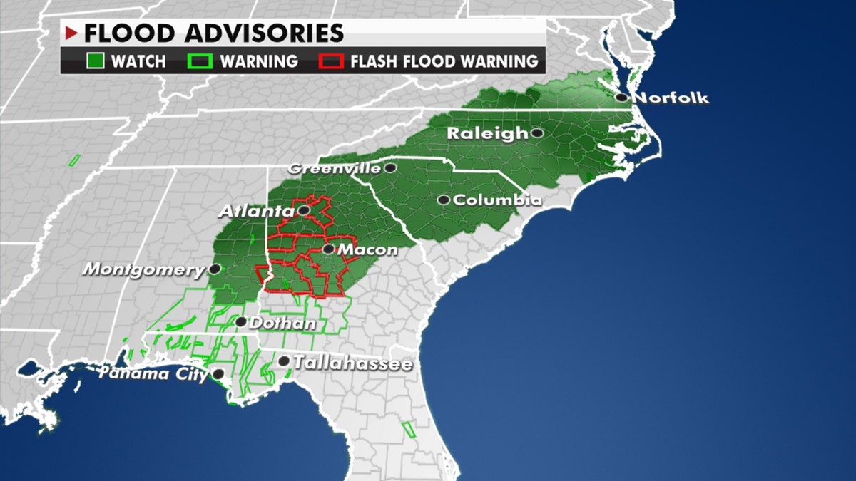
Flood advisories stretch through the Southeast as Sally treks inland. (Fox News)
The threat of tornadoes will shift from southern Georgia and northern Florida in the morning, to eastern Georgia and much of the Carolinas by Thursday night.
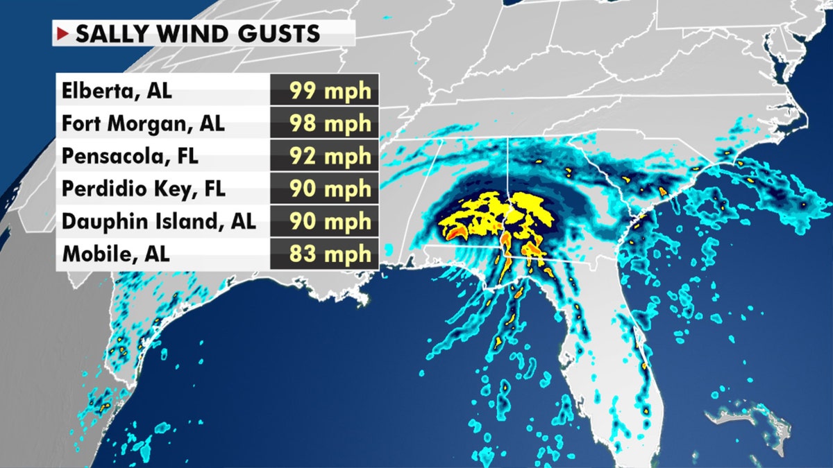
Some of the peak wind gusts from Hurricane Sally. (Fox News)
The other storm we’ll have to keep an eye on in the Atlantic is Hurricane Teddy, which is now a Category 2 storm with winds of 105 mph and is located about 625 miles east-northeast of the Lesser Antilles, according to the NHC.
ALABAMA CHURCH STEEPLE TOPPLED AS SALLY TEARS THROUGH MOBILE
Teddy is forecast to become a major hurricane as it moves closer to Bermuda this weekend perhaps taking a direct hit.
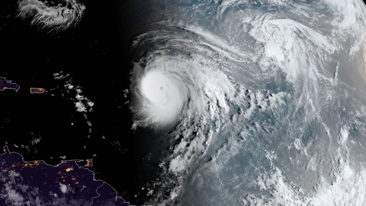
Hurricane Teddy can be seen over the Atlantic Ocean on Thursday, Sept. 17, 2020. (NOAA/GOES-East)
After that, the system could get pushed closer to the U.S., possibly by New England late next week, but for now, there are no other storms impacting the U.S. in the next five days.
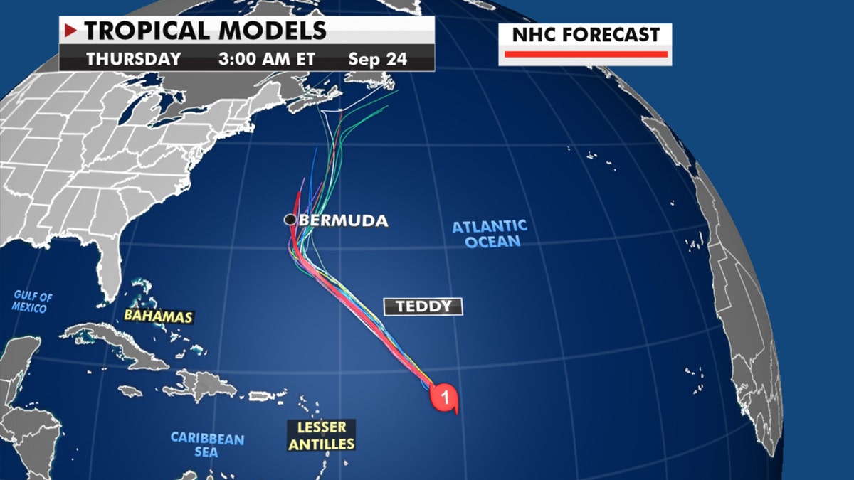
Forecast models show Hurricane Teddy could come closer to New England by next week. (Fox News)
Large swells generated by Teddy are expected to reach the East Coast by the weekend and are likely to cause life-threatening surf and rip current conditions.
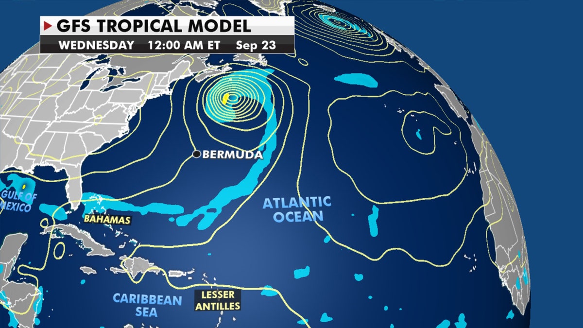
Forecast models show Hurricane Teddy could come closer to New England by next week. (Fox News)
CLICK HERE FOR MORE WEATHER COVERAGE FROM FOX NEWS
The cold front that will push Sally offshore is bringing much cooler air into the Upper Midwest, Great Lakes, and then across the Eastern U.S. this weekend.
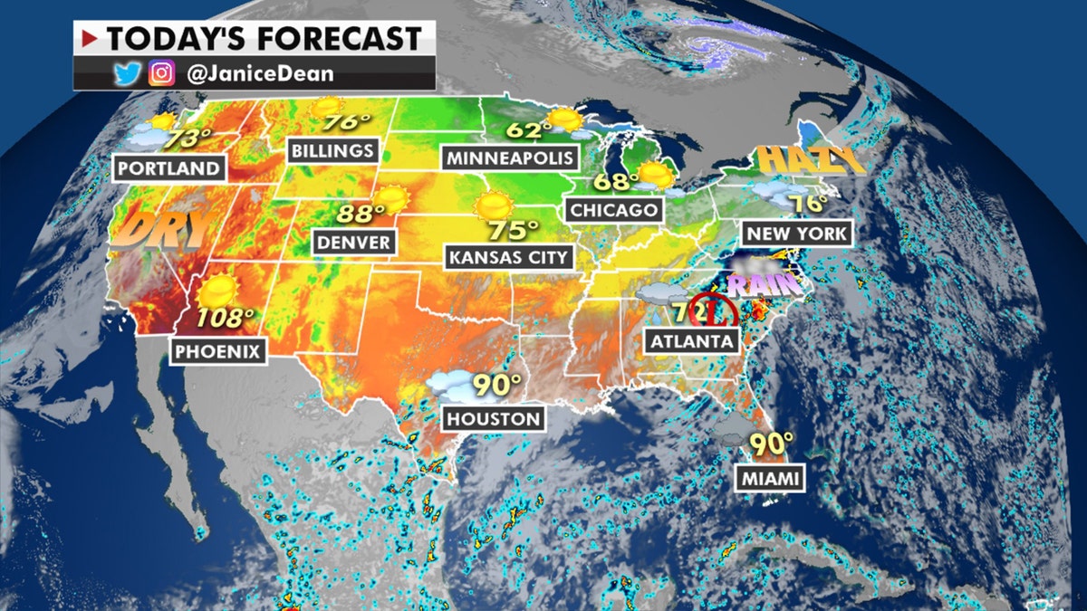
The national forecast for Sept. 17, 2020. (Fox News)
Meanwhile, the West is still up in flames with over 80 large wildfires burning across the region.
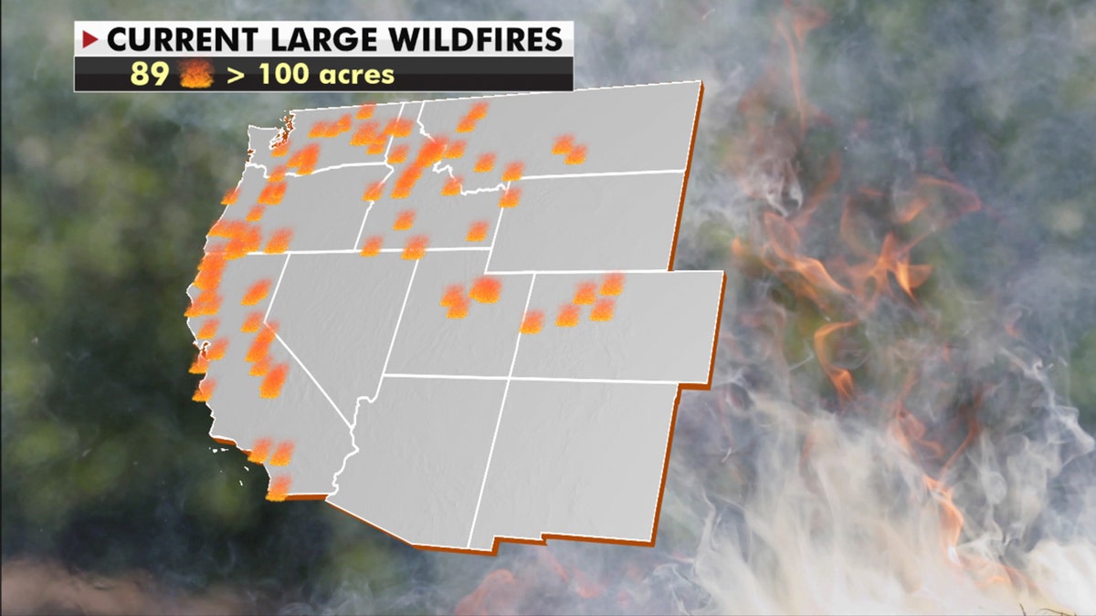
Current large wildfires burning across the West. (Fox News)
Critical fire conditions also continue for parts of Oregon, Northern California and the Great Basin.
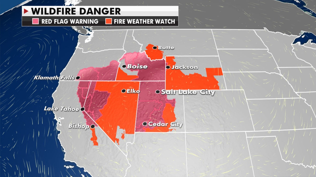
The fire danger for Thursday, Sept. 17, 2020. (Fox News)
Poor air quality and smoke are still widespread across the region stretching into the central U.S. and even into the Northeast.
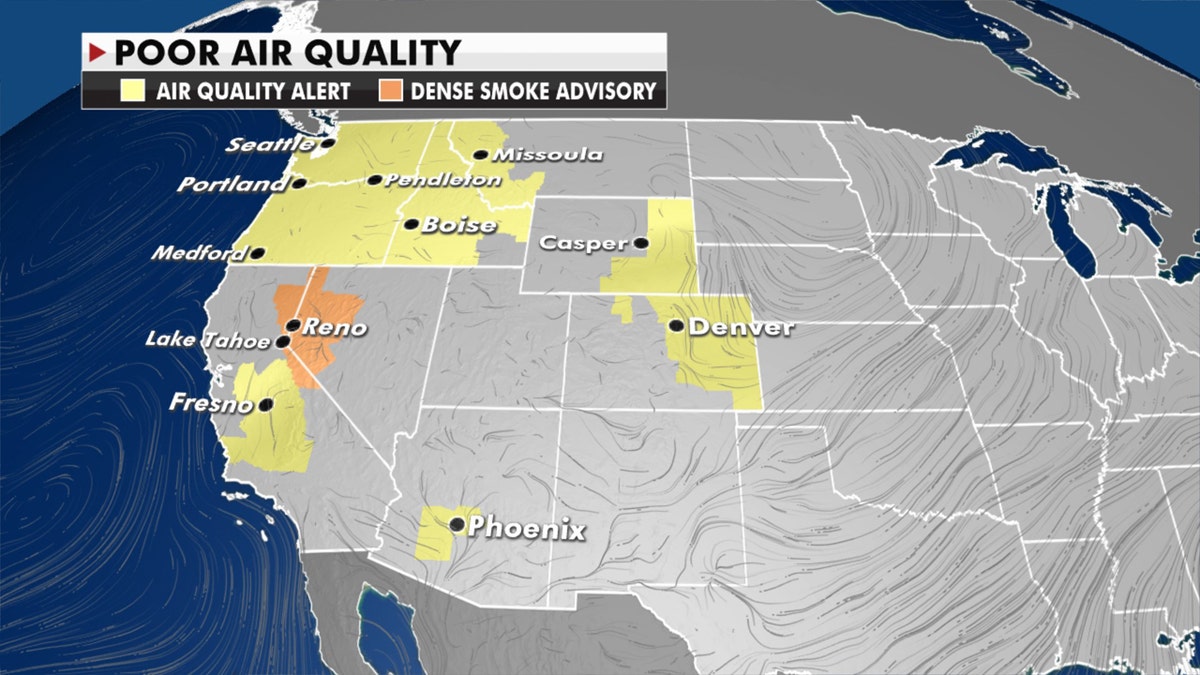
Air quality in the West is still being impacted by ongoing wildfires in the region. (Fox News)
There is some moisture moving into the Northwest in the next few days that will bring temperatures down and produce some much-needed rain for the region, however, we could also see a risk for stronger thunderstorms as well as a few tornadoes.
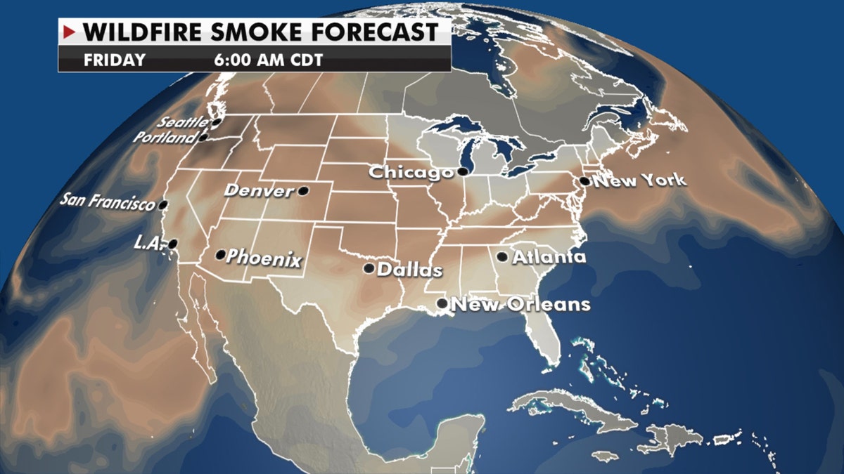
Smoke from the ongoing wildfires in the West will continue to drift eastward. (Fox News)

The hottest stories ripped from the headlines, from crime to courts, legal and scandal.
