Move Back
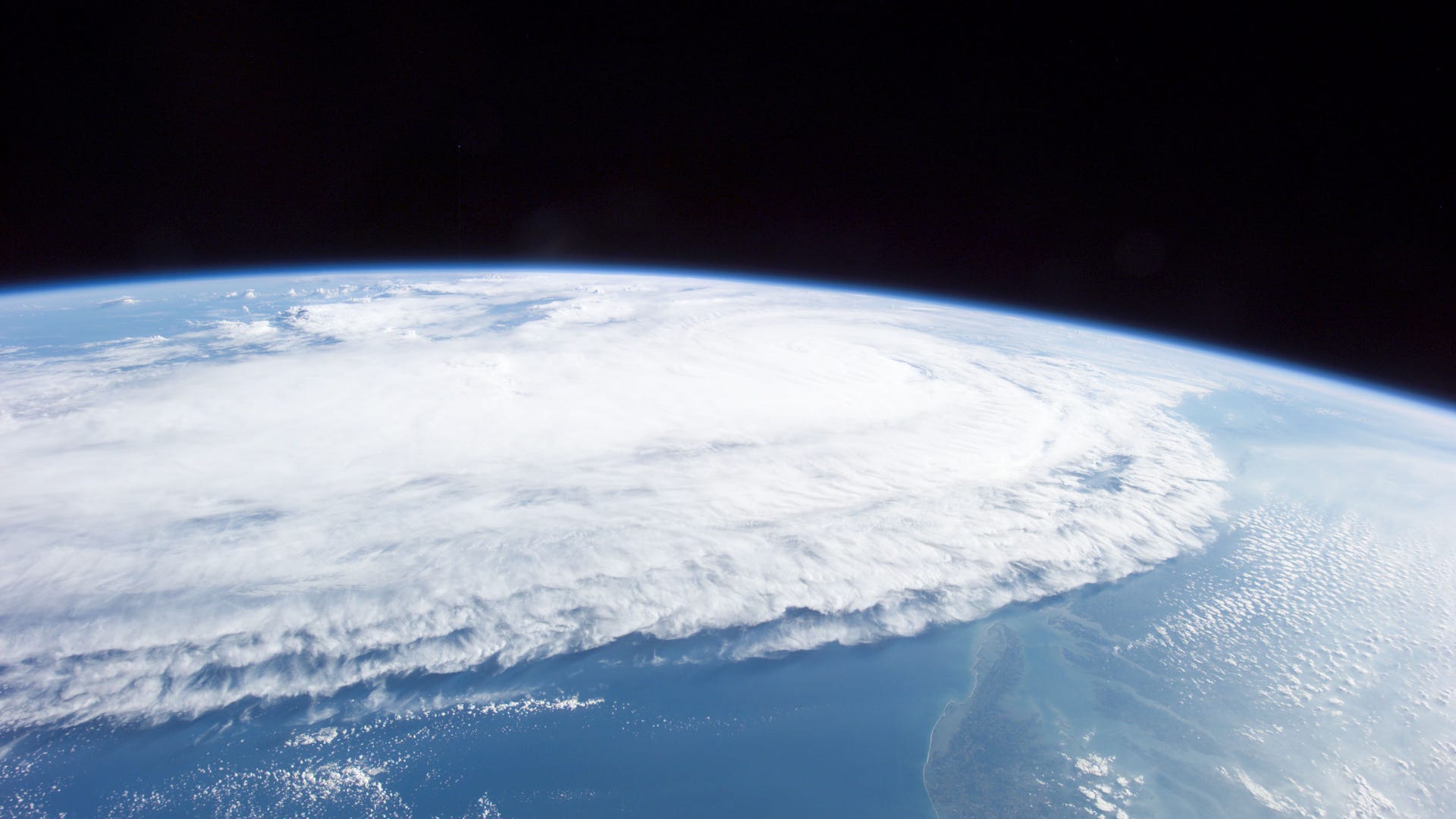
![Ivan From Afar]() This image of Hurricane Ivan, one of the strongest hurricanes on record, was taken Saturday from an altitude of about 230 miles by Astronaut Edward M. Fincke, NASA ISS science officer and flight engineer, looking out the window of the International Space Station on Sept. 11th, 2004.
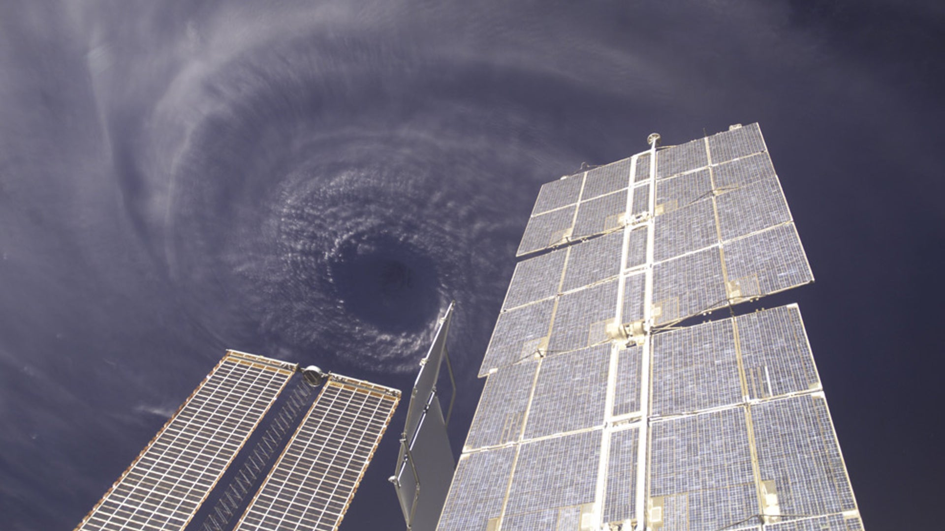
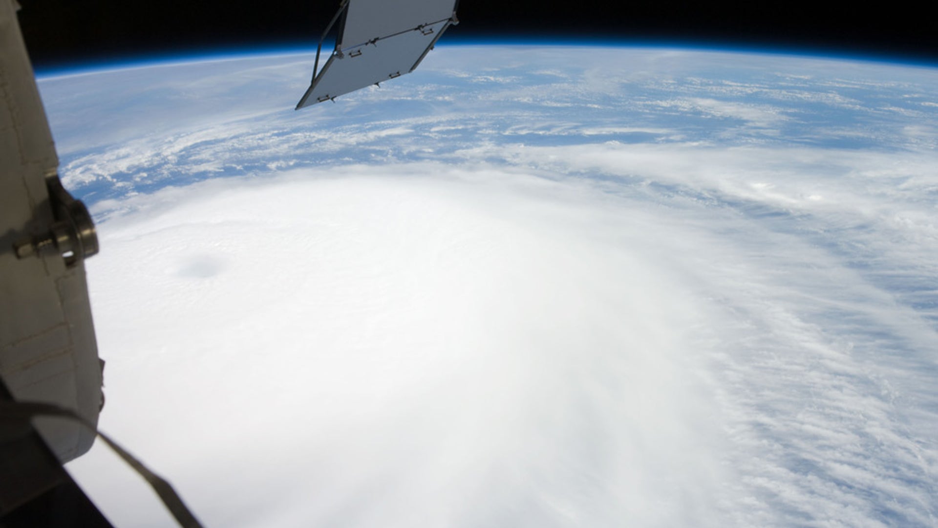
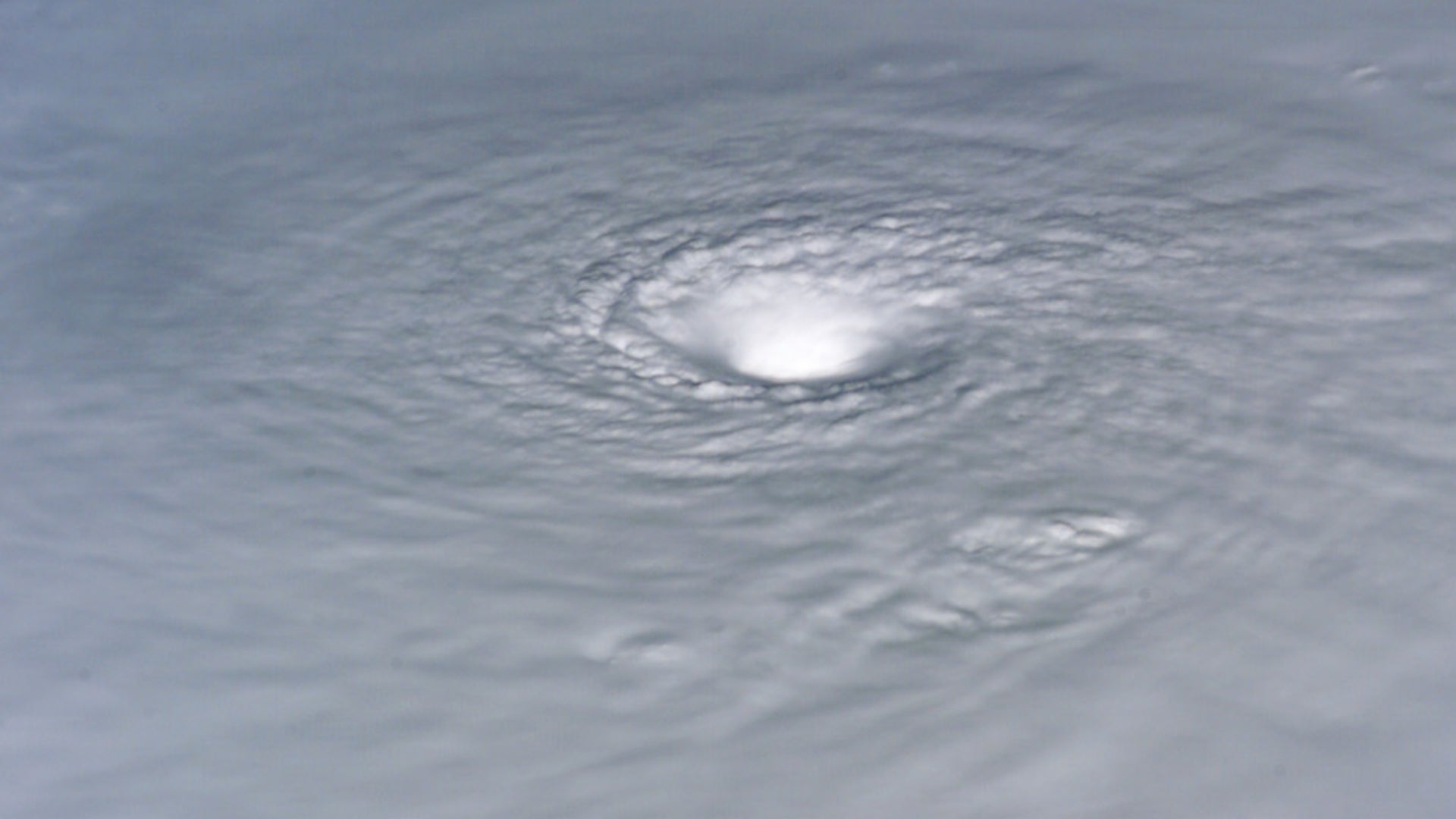
This image of Hurricane Ivan, one of the strongest hurricanes on record, was taken Saturday from an altitude of about 230 miles by Astronaut Edward M. Fincke, NASA ISS science officer and flight engineer, looking out the window of the International Space Station on Sept. 11th, 2004.![Ivan_From_the_ISS]() The eye of Hurricane Ivan, framed by solar panels on the International Space Station. Photographed from an altitude of about 230 miles by Astronaut Edward M. (Mike) Fincke, NASA ISS science officer and flight engineer, aboard the orbital outpost. At the time, Ivan was in the western Caribbean Sea and reported to have winds of 160 mph.
The eye of Hurricane Ivan, framed by solar panels on the International Space Station. Photographed from an altitude of about 230 miles by Astronaut Edward M. (Mike) Fincke, NASA ISS science officer and flight engineer, aboard the orbital outpost. At the time, Ivan was in the western Caribbean Sea and reported to have winds of 160 mph.![Ophelia]() This image of Hurricane Ophelia was captured by the Expedition 11 crew aboard the International Space Station on September 10, 2005 as the storm made the slow trek up the East Coast.
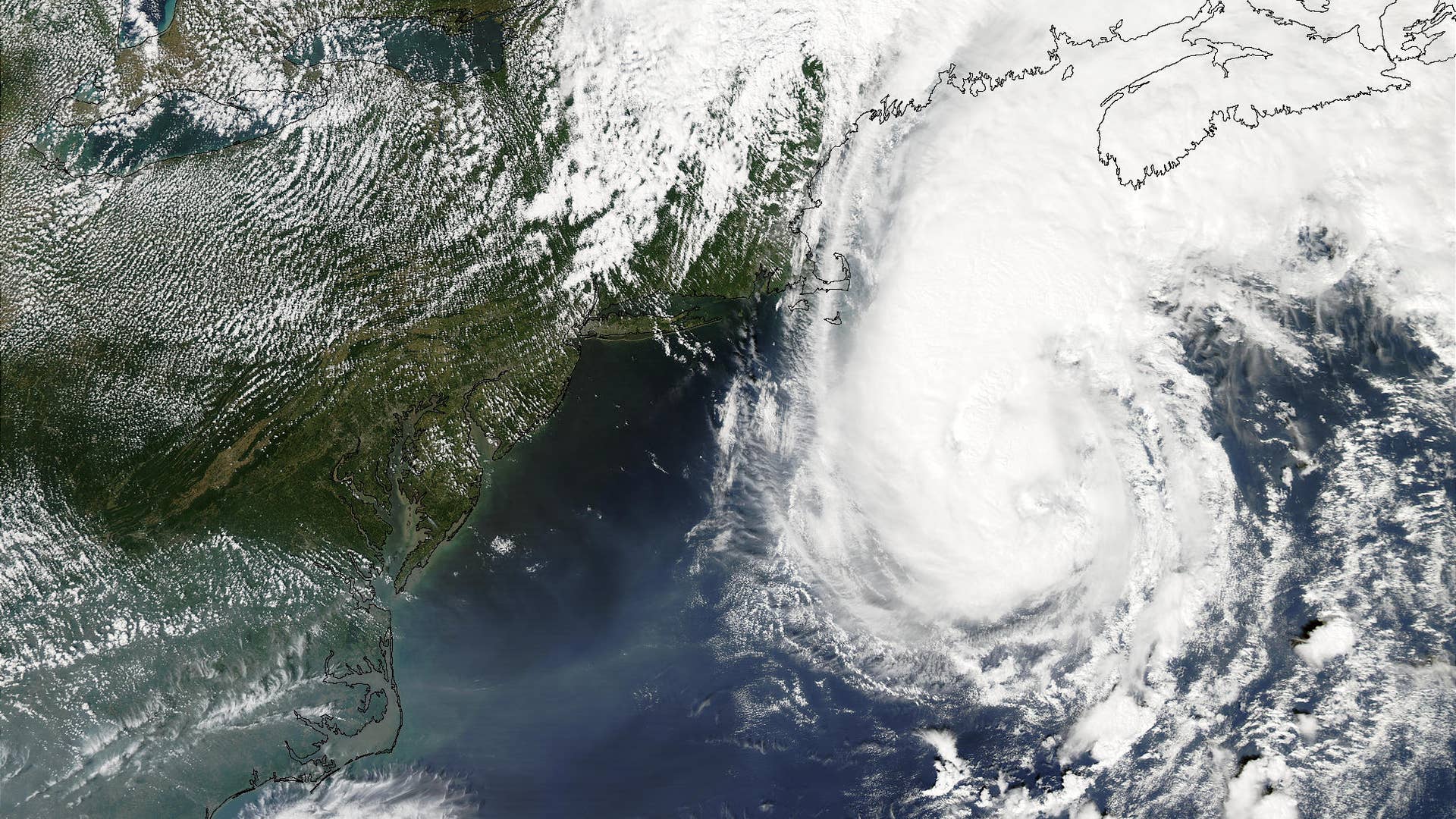
This image of Hurricane Ophelia was captured by the Expedition 11 crew aboard the International Space Station on September 10, 2005 as the storm made the slow trek up the East Coast.![Ivan_2]() Hurricane Ivan over the northern Gulf of Mexico as the storm approached landfall on the Alabama coast Wednesday afternoon, Sept. 15, 2004.
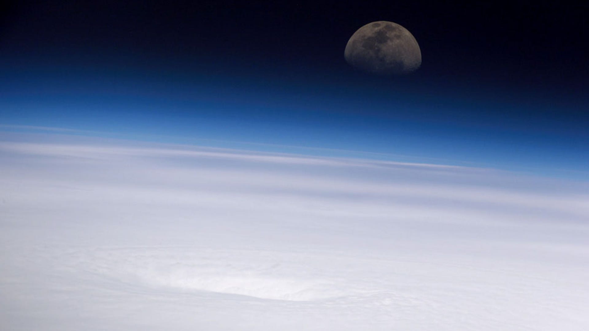
Hurricane Ivan over the northern Gulf of Mexico as the storm approached landfall on the Alabama coast Wednesday afternoon, Sept. 15, 2004.![Emily and the Moon]() This unique view of Hurricane Emily was taken on July 16, 2005 by the crew of the International Space Station over the Gulf of Mexico facing the East as the moon was rising.
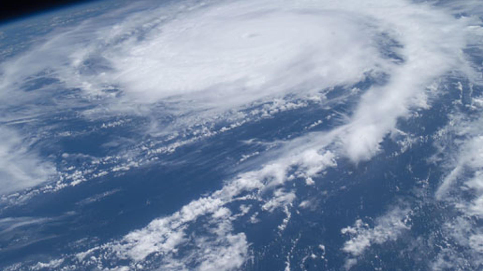
This unique view of Hurricane Emily was taken on July 16, 2005 by the crew of the International Space Station over the Gulf of Mexico facing the East as the moon was rising.![Frances]() Hurricane Frances, seen here from 230 miles above the Earth, was 820 miles east of landfall and traveling at a speed of 10 mph with maximum sustained winds of 105 mph at the time this image was taken.
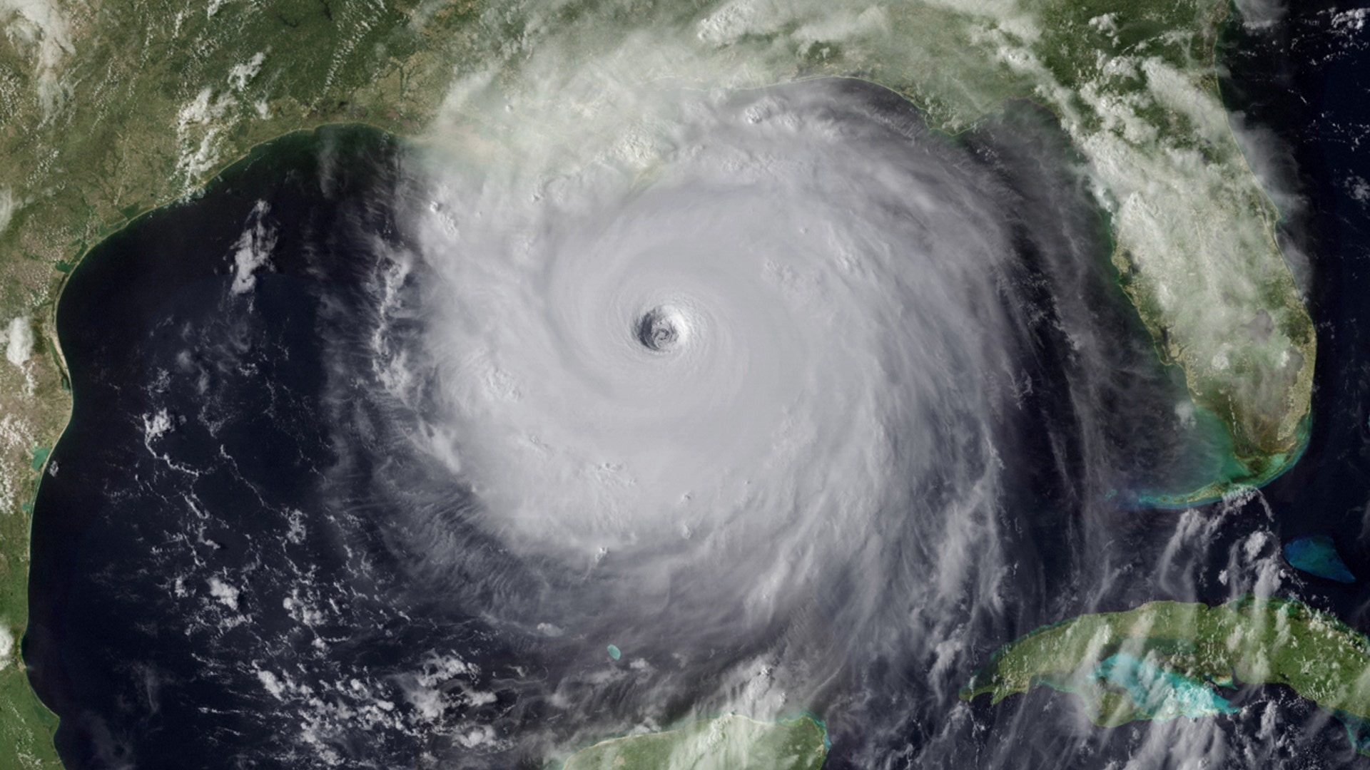
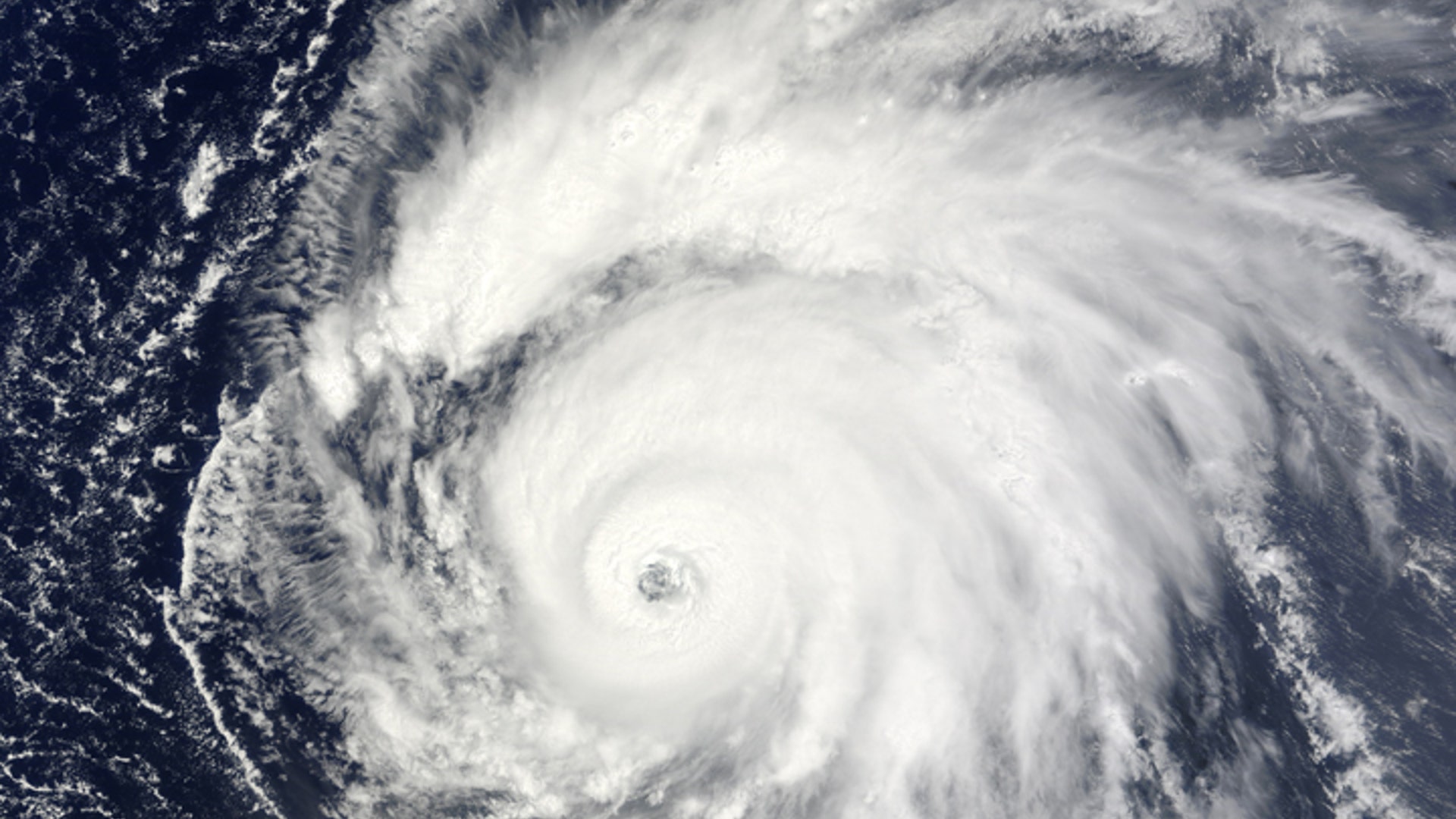
Hurricane Frances, seen here from 230 miles above the Earth, was 820 miles east of landfall and traveling at a speed of 10 mph with maximum sustained winds of 105 mph at the time this image was taken.![Katrina]() The eye of Hurricane Katrina is clearly visible in this picture as the devastating storm makes its way toward the Gulf Coast on August 28, 2005.
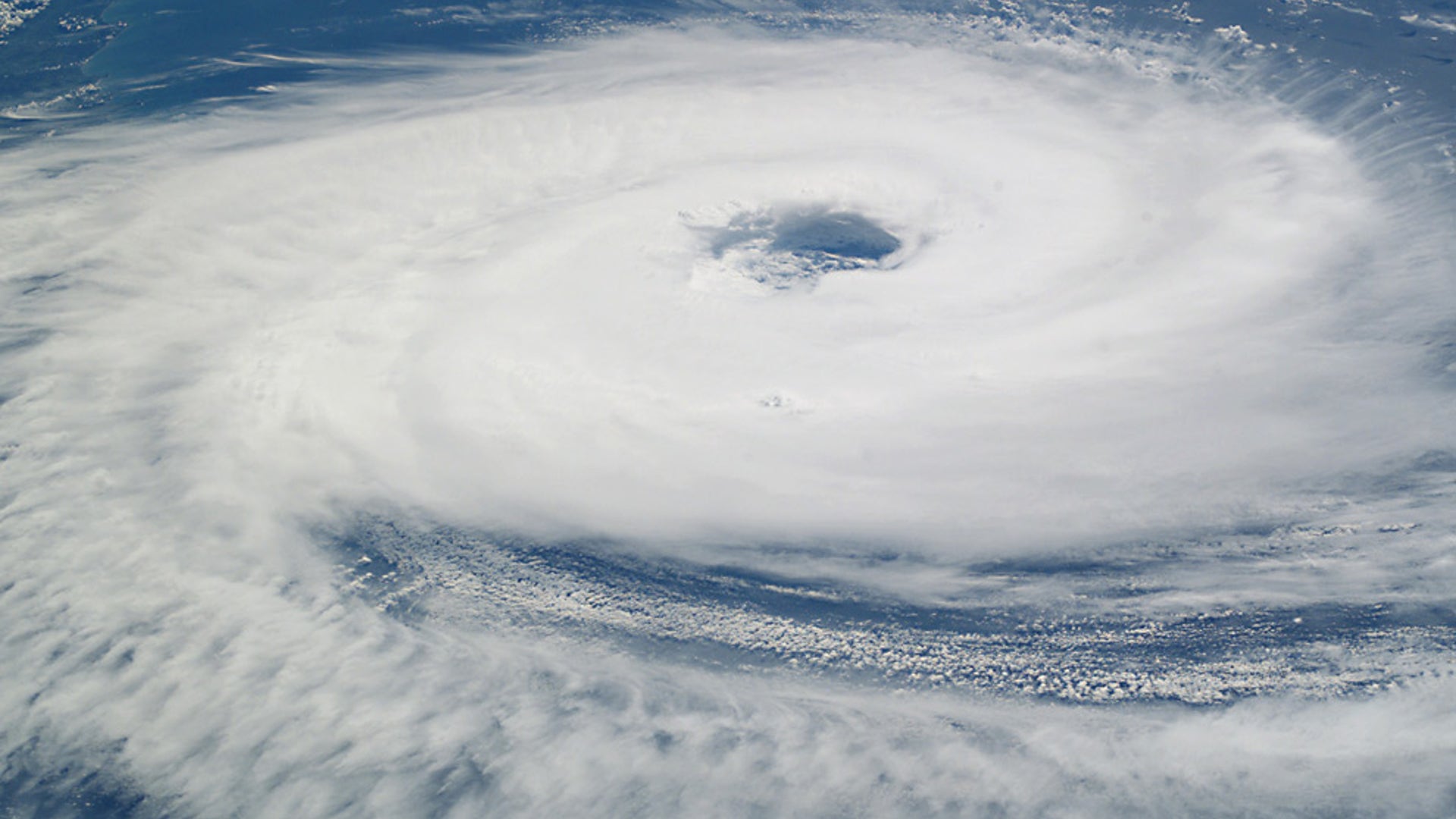
The eye of Hurricane Katrina is clearly visible in this picture as the devastating storm makes its way toward the Gulf Coast on August 28, 2005.![Isabel]() This close-up view of the eye of Hurricane Isabel was taken on Sept. 15th, 2003, by one of the Expedition 7 crewmembers on the International Space Station.
This close-up view of the eye of Hurricane Isabel was taken on Sept. 15th, 2003, by one of the Expedition 7 crewmembers on the International Space Station.![Ike]() Category 4 storm Ike on the morning of Sept. 4 from the International Space Station, 220 miles above the Earth. The storm was churning west-northwestward through the mid-Atlantic Ocean sporting winds of 120 nautical miles per hour with gusts to 145 mph.
Category 4 storm Ike on the morning of Sept. 4 from the International Space Station, 220 miles above the Earth. The storm was churning west-northwestward through the mid-Atlantic Ocean sporting winds of 120 nautical miles per hour with gusts to 145 mph.![Gordon]() A view from the Space Shuttle Atlantis on Sept. 18th, 2006 gives a good look of Hurricane Gordon. At the time the photo was taken, Gordon had sustained winds of 80 nautical miles per hour with gusts to 95 nautical miles per hour.
A view from the Space Shuttle Atlantis on Sept. 18th, 2006 gives a good look of Hurricane Gordon. At the time the photo was taken, Gordon had sustained winds of 80 nautical miles per hour with gusts to 95 nautical miles per hour.![Frances_and_Ivan_2]() This image shows both Hurricane Francis and Hurricane Ivan at work. Frances (top left) has touched down over Florida while Ivan (bottom right) is off the coast of the Lesser Antilees.
This image shows both Hurricane Francis and Hurricane Ivan at work. Frances (top left) has touched down over Florida while Ivan (bottom right) is off the coast of the Lesser Antilees.![Felix]() Hurricane Felix from the ISS, as captured by an Expedition 15 crewmember on Sept. 3, 2007. The ISS was located over the coast of eastern Honduras when this image was taken. The sustained winds were 165 miles per hour with higher gusts making it a category 5 storm.
Hurricane Felix from the ISS, as captured by an Expedition 15 crewmember on Sept. 3, 2007. The ISS was located over the coast of eastern Honduras when this image was taken. The sustained winds were 165 miles per hour with higher gusts making it a category 5 storm.![Floyd]() Triggering the third largest evacuation in US history, 1999's Hurricane Floyd made waves both literally and figuratively. Seen here just east of Florida, Floyd reached sustained wind speeds of 155 mph.
Triggering the third largest evacuation in US history, 1999's Hurricane Floyd made waves both literally and figuratively. Seen here just east of Florida, Floyd reached sustained wind speeds of 155 mph.![Catarina]() This image shows Hurricane Catarina on March 27th, 2004, taken by an Expedition 8 crewmember on the International Space Station. The photo of the storm came just as it made landfall on the southern Brazilian state of Catarina.
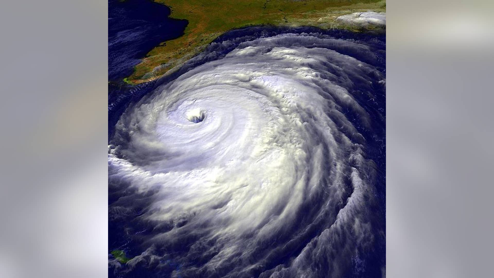
This image shows Hurricane Catarina on March 27th, 2004, taken by an Expedition 8 crewmember on the International Space Station. The photo of the storm came just as it made landfall on the southern Brazilian state of Catarina.![Wilma]() This image of Hurricane Wilma was taken by the crew aboard NASA's international space station as the complex flew 222 miles above the storm. At the time, Wilma was the strongest Atlantic hurricane in history, with winds near 175 miles per hour. The storm was located in the Caribbean Sea, 340 miles southeast of Cozumel, Mexico.
This image of Hurricane Wilma was taken by the crew aboard NASA's international space station as the complex flew 222 miles above the storm. At the time, Wilma was the strongest Atlantic hurricane in history, with winds near 175 miles per hour. The storm was located in the Caribbean Sea, 340 miles southeast of Cozumel, Mexico.![Bill]() NASA's Terra satellite captured this image of Hurricane Bill as it was just northeast of Puerto Rico on August 20, 2009. Reaching a maximum diameter of 460 miles, Bill is the fifth largest Atlantic tropical cyclone on record.
NASA's Terra satellite captured this image of Hurricane Bill as it was just northeast of Puerto Rico on August 20, 2009. Reaching a maximum diameter of 460 miles, Bill is the fifth largest Atlantic tropical cyclone on record.![Gustav]() Going from tropical storm to Hurricane status in record time, Gustav, seen here from NASA's Aqua satellite, made landfall in Canada on September 12, 2002.
Going from tropical storm to Hurricane status in record time, Gustav, seen here from NASA's Aqua satellite, made landfall in Canada on September 12, 2002.![Emily]() This image, taken from NASA's Terra satellite, shows Hurricane Emily as it begins to wreak havoc on Mexico's Yucatan peninsula.
This image, taken from NASA's Terra satellite, shows Hurricane Emily as it begins to wreak havoc on Mexico's Yucatan peninsula.Hurricanes, as Seen From Space
On the ground, a hurricane can be deadly. From space, they're works of art. Here are 18 images of hurricanes captured over the years by astronauts on the International Space Station and orbiting satellites.


Move Forward
- Hurricanes, as Seen From Space


