Hurricane Ian tracker, warnings and advisories
Hurricane Ian is a Category 3 hurricane. Fox News is updating with the latest news surrounding the storm, its impact, travel and emergency updates.
Coverage for this event has ended.
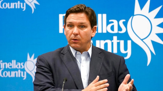
Florida Gov. Ron DeSantis provided an update to residents on Hurricane Ian during a presser with other emergency response officials late Tuesday evening.
DeSantis warned residents to exercise caution or to leave their homes if they are expected to be directly impacted by the storm.
"You need to evacuate now," the Republican governor warned as residents as the storm is set to make landfall tomorrow afternoon or evening. "Now is the time to act."
"This is a lot of nasty weather we're in store for over the next few days," he said, noting the "strong Category 3" is located about 170 miles south-southwest of Punta Gorda, Charlotte County.
Florida Division of Emergency Management Director Kevin Guthrie added: "This storm will only continue to intensify. If you want to leave, as the governor has said, now is your last chance."
The governor warned the severe storm was moving north at 10 mph and had sustained winds of 120 mph.
"The storm has had severe impacts in south Florida and those impacts are going to continue throughout the whole state," he said.
DeSantis said the government has made 176 shelters available, including 50 special needs shelters, across the state to house those displaced by the storm.
"More will likely be added," he said. "There are now over 30,000 personnel stationed and standing by to help with power restoration," the governor added.
"Right now, there are about 8,000 customers without power. But, that number will likely be in the millions shortly," he predicted.
DeSantis said he expected the storm to downgrade when it makes landfall over Florida, but cautioned it would still bring enormous rainfall. The storm is projected to cross over Florida and enter the Atlantic Ocean, where it could travel north and impact other states.
The severe storm has already caused at least two radar-indicated tornadoes in the state, including those in Palm Beach and more possible tornadoes in Broward County.
"Tornado watches are in effect in central and south Florida until 5 a.m.," DeSantis said.
Hurricane Ian is expected to leave Florida on Friday morning.
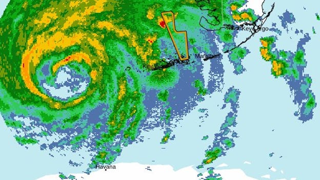
(National Hurricane Center)
Hurricane Ian was still gaining strength in the Gulf of Mexico about 180 miles south-southwest of Punta, Gorda, Florida, around 8:00 p.m. on Tuesday evening.
A hurricane warning is in effect from Chokoloskee to Anclote River, which spans about 200 miles along Florida's west coast.
The storm is expected to pass west of the Florida Keys on Tuesday evening then make landfall somewhere in the hurricane warning area on Wednesday.
The National Hurricane Center said that storm surge could reach 12 feet and up to 18 inches of rain could fall across Florida. Maximum sustained winds were about 120 mph as of 8:00 p.m.
Tornadoes are also possible in south and central Florida on Tuesday evening into Wednesday.
Tampa International Airport closed down at 5:00 p.m. on Tuesday ahead of Hurricane Ian's expected landfall on Wednesday.
There were 146 flight cancellations and 16 delays on Tuesday in Tampa, according to FlightAware.
St. Pete-Clearwater International Airport closed earlier in the day at 1:00 p.m., while Orlando International Airport said it will halt flights at 10:30 a.m. on Wednesday.
President Joe Biden spoke with Florida Gov. Ron DeSantis by phone on Tuesday evening to discuss assistance that the federal government can provide to the state ahead of Hurricane Ian, the White House said.
Biden also spoke to the mayors of Tampa, St. Petersburg, and Clearwater earlier in the day.
DeSantis said earlier in the day that he hadn't heard from the president, but thanked him for approving the pre-landfall emergency declaration request.
"I'm happy to brief the President if he's interested in hearing what we're doing in Florida," DeSantis said at a press conference on Tuesday afternoon. "My view on all this is, you’ve got people's lives at stake, you’ve got their property at stake, and we don't have time for pettiness."
The National Weather Service issued a tornado watch for much of southern Florida through 5:00 a.m. on Wednesday.
At least one tornado was impacting west metro portions of Broward County around 7:30 p.m.
Residents are advised to seek shelter in a tornado shelter, basement, or interior room and avoid mobile homes and large open rooms if possible.
Tampa Mayor Jane Castor urged residents to evacuate on Tuesday, saying that no one will be safe from the life-threatening storm surge and catastrophic flooding that is expected when Hurricane Ian makes landfall.
"When you talk about 10 to 15 foot surges, that should get everyone's attention. No one is safe from that," Castor told Fox News' Neil Cavuto. "Look at the last couple of years, the increased intensity in these hurricanes. I think we have people's attention and they're getting out while they can."
Walt Disney World and Universal Orlando Resort both announced two-day closures ahead of Hurricane Ian's expected landfall on Wednesday.
A tropical storm warning is currently in effect for Orange County, where Disney and Universal are located.
Hurricane Ian is expected to make landfall as a category 3 or potentially a category 4 storm near Tampa, then crawl across central and northern Florida, dropping huge amounts of rain.
"We are monitoring weather conditions os we can make timely decisions for the safety of our cast and guests, including when it’s safe for cast to return to the site to prepare for reopening," Disney said on Tuesday.
Florida residents have access to a wide array of emergency services, insurance hotlines, traffic links, and law enforcement resources ahead of Hurricane Ian.
Click here to read more: Emergency phone numbers, apps Florida residents should have
Florida Gov. Ron DeSantis urged the more than 2.5 million residents who are under evacuation orders to leave their homes ahead of Hurricane Ian.
“We can rebuild property, we can fix infrastructure, you can fix your home. You don't get a mulligan when your personal safety is at risk," DeSantis said Tuesday.
"We know this thing is going to be hitting the state directly sometime tomorrow evening. You still have some time but that time is rapidly running out.”
Hurricane Ian is expected to bring excessive rainfall, devastating wind damage, and life-threatening storm surge to the west coast of Florida on Wednesday.
"You must evacuate now. There will be a point in time where you will not be safe to travel the roads," Florida Division of Emergency Management Director Kevin Guthrie said Tuesday. "The time to evacuate is now. Get on the road."
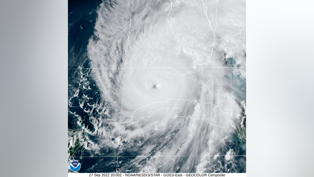
Hurricane Ian was located about 230 miles south of Sarasota, Florida, at 5:00 p.m. ET. (National Hurricane Center)
A hurricane warning was expanded to southwestern Florida on Tuesday, the National Hurricane Center said in a 5:00 p.m. update.
The center of Hurricane Ian was located about 230 miles south of Sarasota, moving north at 10 mph.
The storm is expected to move through the southeastern Gulf of Mexico and pass west of the Florida Keys on Tuesday evening, then approach the west coast of Florida on Wednesday.
Florida Gov. Ron DeSantis urged residents to prepare for Hurricane Ian on Tuesday afternoon, saying that the storm will be a major event.
"Once it makes landfall, it’s going to slow down and really kind of crawl, but that’s going to dump an inordinate amount of rain, so you’re looking at, yes, a powerful hurricane, but a lot of surge and a lot of water which is going to cause a lot of flooding," DeSantis told Fox News.
President Joe Biden and FEMA Administrator Deanne Criswell discussed preparations for Hurricane Ian with the mayors of Tampa, St. Petersburg, and Clearwater on Tuesday.
The president also issued an emergency declaration that will allow FEMA to coordinate disaster relief efforts with local authorities.
FOX Weather Meteorologist Steve Bender provides the latest on Hurricane Ida's track.
Georgia Gov. Brian Kemp declare a state of emergency from 7:00 a.m. on Thursday through midnight on Friday in anticipation of Hurricane Ida.
A storm surge watch was issued for the entire Georgia coast and a tropical storm warning was put out for multiple counties in the southern part of the state.
Southeast Georgia is forecast to get four to six inches of rainfall, while other parts of the state could get two to four inches. Flash flooding, damaging winds, and power outages are possible throughout the state.
"The best case scenario is that it continues to move off the coast, and that after it crosses Florida, it continues in that easterly pattern, and we just get some of the west side of the cone," GEMA Director James Stallings said at a press conference. "The worst case scenario is where it's at right now. It's going to dump a lot of wind and rain in our state."
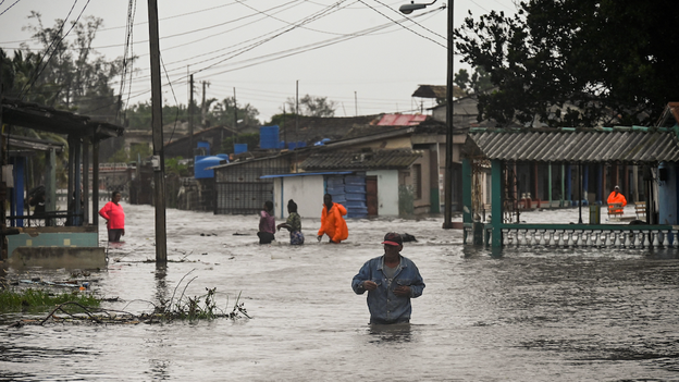
People walk through a flooded street in Batabano, Cuba, on September 27, 2022, during the passage of hurricane Ian. (YAMIL LAGE / AFP)
Hurricane Ian struck western Cuba as a Category 3 hurricane with maximum sustained winds of 125 mph on Tuesday morning.
Photos of the aftermath showed streets and neighborhoods underwater after the storm passed into the southeastern Gulf of Mexico.
Officials in the country's Pinar del Rio province had evacuated tens of thousands of people and set up 55 shelters ahead of the hurricane.
President Biden called Tampa Mayor Jane Castor while she was giving a press conference on Hurricane Ian on Tuesday.
"Don't be out there on the roads driving around, there's going to be downed trees," the mayor said as she received an incoming call, and slipped away. "I think I got a call from the president."
Hurricane Ian was in southeastern Gulf of Mexico on Tuesday afternoon ahead of expected landfall on Wednesday evening.
Click here to read more: Tampa mayor gets Biden phone call live during press conference: 'I got a call from the president'
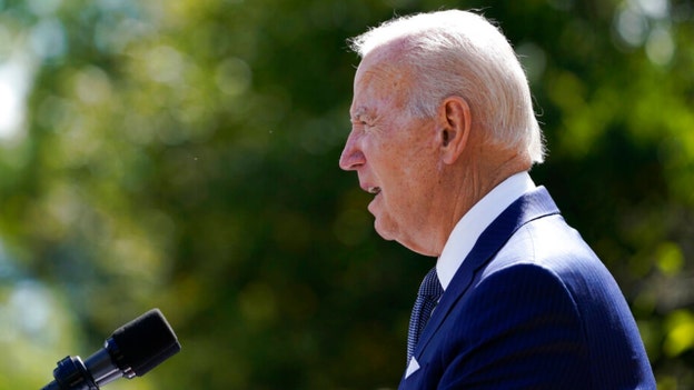
President Biden speaks during an event on health care costs, in the Rose Garden of the White House, Tuesday, Sept. 27, 2022, in Washington. (AP Photo/Susan Walsh)
President Biden said Tuesday that evacuations in Florida ahead of the impact of Hurricane Ian have been going going on "fairly orderly" Tuesday.
"Your safety is more important than anything. And, I know our hearts are with everyone who will feel the effects of this storm. And, we'll be with you every step of the way. We're not going away," he said.
The president said he had spoken with the mayors of Tampa, St. Petersburg and Clearwater earlier in the day, saying that they could contact him directly for whatever they needed in the coming days.
"I mean, this sincerely, whatever they need: 'contact me directly' and they know how to do that. I have a lot of personnel down there already. We're here to support them in every way we can," he added.
He said he had directed him team to surge federal assistance to Florida before the storm hit, with FEMA deploying thousands of personnel, in addition to members of the National Guard.
FEMA said it was prepositioning supplies and personnel to strategic locations in Georgia, Florida and Alabama.
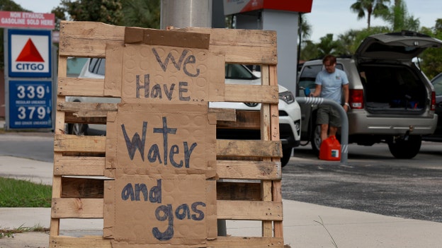
ST. PETERSBURG BEACH, FLORIDA - SEPTEMBER 27: A sign outside of a gas station reads, "we have water and gas" as residents prepare for the possible arrival of Hurricane Ian on September 27, 2022 in St Petersburg Beach, Florida. Hurricane Ian is expected to make landfall in the Tampa Bay area Wednesday night into early Thursday morning. (Photo by Joe Raedle/Getty Images)
Hurricane Ian continues to make its way toward the western coast of Florida, with millions of residents under evacuation warnings.
Images showed traffic lines and gas station pumps almost completely out of gas.
Some store shelves were empty as residents raced to pick up food and supplies.
The Category 3 storm is expected to make landfall Wednesday night.
The National Hurricane Center said Ian was growing stronger the in southeastern Gulf of Mexico.
Speaking to Fox News Digital, Fiona McFarland, of the Florida House of Representatives, noted that the hurricane's forecast track appeared to put its center through her county of Sarasota.
She said the state has been preparing for weeks.
"But, these the hurricane tracks change so quickly that I think a lot of folks who are north of us that were going to evacuate down here to Sarasota – and now we're flipping. So, it's something that changes very quickly," she remarked.
McFarland pointed out the danger of staying in mobile homes or homes in low-lying areas, urging that even just going 10 miles inland makes a "huge difference."
"I highly, highly encourage everyone in the district to make those moves now. Again, even just a couple miles really lower your risk exposure. We've got services ready to help; please don't make us use them," she urged.
McFarland said that now is the time to be cautious.
"The next 12 hours, as the storm starts to come off our coast and what we fear most is that the storm will start to slow down and sort of hover either right over us or just off the coast. Which will be something that we haven't seen in a number of years," she noted. "We have the potential for this to be a historic storm."
Fox News' Ashley Papa contributed to this report.

White House press secretary Karine Jean-Pierre, left, listens as FEMA Administrator Deanne Criswell speaks during a briefing at the White House, Tuesday, Sept 27, 2022, in Washington. (AP Photo/Evan Vucci)
The White House refused to comment on why President Biden has not spoken with Florida Gov. Ron DeSantis prior to Hurricane Ian making landfall.
Biden has spoken on the phone with multiple Florida mayors ahead of the storm but has so far snubbed the Republican governor.
Reporters repeatedly pressed FEMA chief Deanne Criswell on why Biden hadn't made the call during a White House press briefing Tuesday.
"In the past, President Biden has made calls to governors in situations like natural disasters, [such as] Kay Ivey in Alabama, Asa Hutchinson in Arkansas, or the governor in Texas," a reporter began. "Can you articulate how these determinations are made and why it hasn't been made in this case to have the president call the governor?"
"The president is very focused on making sure the federal family has the right resources to support this," Criswell responded. "That is why I contacted the governor right away, and we have a team of my senior leadership embedded with the governor to make sure that we're supporting that."
"Our focus today is making sure that we have the right measures in place to support the lifesaving activities that need to happen," she added.
"But he's made conversations with the mayors. Is there any reason why not the governor?" the reporter pressed.
"Again, we have a strong team that's in place supporting the governor right now," Criswell responded.
Multiple other reporters pressed Criswell on the issue, but she repeatedly stated that Biden and DeSantis' lack of contact will not impact the emergency response to the storm.
DeSantis' office did not immediately respond to a request for comment from Fox News Digital.
Fox News' Anders Hagstrom contributed to this report.

WASHINGTON, DC - SEPTEMBER 27: Federal Emergency Management Agency Administrator Deanne Criswell briefs reporters in the Brady Press Briefing Room at the White House on September 27, 2022 in Washington, DC. Criswell answered questions about the government's preparedness for Hurricane Ian, which is currently tracking to make landfall near St. Petersburg, Florida, on Wednesday as a Category 4 storm. (Photo by Chip Somodevilla/Getty Images)
In a White House press briefing on Tuesday, FEMA Administrator Deanne Criswell said that while Hurricane Ian's path had become more defined, it can still be unpredictable.
She said it is more important than ever that communities inside and outside of the projected track stay vigilant.
Criswell told the briefing room that Floridians are going to experience impacts from the storm for a very long time.
She said that she joined President Biden in conversations with three Florida mayors, noting that she worries when she thinks about complacency – including a part of the state that hasn't seen a major direct impact in nearly 100 years.
Criswell said she had contacted Gov. Ron DeSantis early on and that her regional administrator is with him right now.
She received multiple questions about why Biden had not yet called the governor himself.
"The president is very focused on making sure that the federal family has the right resources available to support us. That is why I contacted the governor right away. And, we have a team of my senior leadership that are embedded with the governor to make sure that we're supporting that," she replied. "Our focus today is making sure that we have the right measures in place to support the lifesaving activities that need to happen."
Florida Gov. Ron DeSantis speaks during a news conference at the Pinellas County Emergency Operations Center, Monday, Sept. 26, 2022, in Largo, Fla. DeSantis was updating residents of the path of Hurricane Ian. (AP Photo/Chris O'Meara)
In another update, Florida Gov. Ron DeSantis said Tuesday afternoon that the oncoming storm would be a "major water event" both in terms of the storm surge and flooding.
"It is going to kick up a lot of water as it comes in," he said of Hurricane Ian, "And, you're going to end up with really significant storm surge. You're going to end up with really significant flood events. And this is the type of storm surge that is life threatening."
DeSantis told reporters that, regardless of Ian's track, there would be major impacts in the Tampa Bay region.
In addition, he instructed not to leave pets behind.
"We need to make sure we're taking care of the pets," he said.
The governor's comments come as Hurricane Ian's track has shifted slightly to the south.
Devastating storm surge, rainfall and wind is still predicted to impact Florida over the next few days.
The Category 3 storm could slow down just off the coast and watches and warnings have been issued.

FLORIDA, UNITED STATES - JULY 7: Empty escalators are seen at Tampa International Airport which closed from 5:00 p.m. until 10:00 a.m. as Tropical Storm Elsa moves northward toward the Tampa Bay area on July 6, 2021 in Clearwater Beach, Florida, United States. Storm is expected to make landfall on Florida's Gulf Coast as a Category 1 hurricane early Wednesday morning. (Photo by Paul Hennessy/Anadolu Agency via Getty Images)
While Floridians prepare for the arrival of Hurricane Ian, major airlines and airports are announcing expected travel disruptions to and from the Sunshine State.
Many airlines, including American, Delta, JetBlue, Spirit, and Southwest, are allowing travelers to change their travel plans without paying additional fees or fare differences, FOX 35 Orlando reports.
Tampa International Airport (TPA) will suspend all operations on Tuesday, Sept. 27, at 5 p.m.
The airport will be closed to all visitors at that time.
St. Pete-Clearwater International (PIE) will close at 1 p.m. Sept. 27 due to mandatory evacuation orders from Pinellas County, and remain closed until the evacuation order is lifted. Contact airlines for updates.
Orlando International Airport (MCO) tweeted, "Meetings are taking place with airport leadership, airline partners and emergency offices. Whenever updates regarding operational changes become available, we'll make sure to post about it. Please continue to check with your airline in regards to your flight status at this time."
Southwest Florida International Airport (RSW) tweeted that Southwest Airlines has cancelled all flights for Sept. 28. Please go to their website for more information and to rebook.
Click here for more on travel disruptions due to Hurricane Ian.
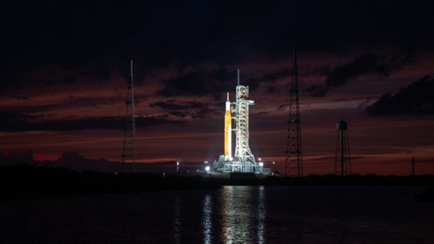
NASA’s Space Launch System (SLS) rocket with the Orion spacecraft aboard is seen atop the mobile launcher at Launch Pad 39B as teams configure systems for rolling back to the Vehicle Assembly Building, Monday, Sept. 26, 2022, at NASA’s Kennedy Space Center in Florida. NASA made the decision to rollback based on the latest weather predictions associated with Hurricane Ian. NASA’s Artemis I flight test is the first integrated test of the agency’s deep space exploration systems: the Orion spacecraft, SLS rocket, and supporting ground systems. Photo Credit: (NASA/Joel Kowsky)
NASA's Artemis I moon rocket has been secured inside the Vehicle Assembly Building at the Kennedy Space Center in Florida.
The Space Launch System rocket and its Orion spacecraft had been traveling on a four-mile journey from Launch Pad 39B that started at 11:21 p.m. EDT on Monday.
NASA managers decided to roll back based on the forecast associated with Hurricane Ian. It said the decision allowed for employees to address the needs of their families as well as protect the integrated rocket and spacecraft system.
After the storm has passed, the agency said in a blog post that teams would conduct inspections to determine impacts at the center and establish a plan for the next launch attempt.

TAMPA, FL - JUNE 27: Tampa Mayor Jane Castor looks while WWE Titus O'Neil gives a speech during the "Love Walk" at Julia B. Lane Park on June 27, 2020 in downtown Tampa, Florida. Thaddeus Bullard, also known as WWE Superstar Titus O'Neil, and actor Dave Bautista along with Tampa Bay business leaders, elected officials, and families gathered for a Love Walk across the Fortune Taylor Bridge in an effort to promote unity. (Photo by Octavio Jones/Getty Images)
Tampa, Fla. officials said late Tuesday morning that a curfew will be implemented in the city.
Mayor Jane Castor told reporters that she is working with the county on it.
Tampa General Hospital is not evacuating anyone yet, but has flood barrier in place.
"This is gonna be the test right here," she pointed out.
Tampa Police Chief Mary O'Connor added that emergency service responses stop when winds sustain at 40 miles per hour, since first responders are required to shelter in place.
"Please don't expect an emergency response," she cautioned.
Hurricane Ian continues to head toward Florida after moving over Cuba this morning.
The outer bands are already impacting southern Florida, and a Tornado Watch has been issued until 5 p.m. EDT.
Fox News' Paul Conner contributed to this report.

ORANGE COUNTY, FLORIDA, USA - MAY 30: Tourist line up and ride Guardians of the Galaxy Cosmic Rewind, the newest attraction to open at the park, during the Flower and Garden Festival at Epcot at Walt Disney World in Orange County, Florida on May 30, 2022. Walt Disney World is celebrating its 50th anniversary all of 2022. (Photo by Joseph Prezioso/Anadolu Agency via Getty Images)
Hurricane Ian is making its way toward the Sunshine State.
There is currently a hurricane warning for Hillsborough County, which is home to Busch Gardens Tampa Bay.
A tropical storm warning is in effect for Orange County, which houses major theme parks like Disney World, Universal Orlando and SeaWorld Orlando.
Here is a comprehensive list of announcements made so far about closures, preparations and plans in the days ahead:
Busch Gardens Tampa Bay
Busch Gardens will be closed Sept. 27 through Sept. 29. For additional details, please visit here.
Walt Disney World Resort
Walt Disney World Resort is currently operating under normal conditions as they prepare to make necessary adjustments based on the latest information from the National Weather Service.
The resort will continue to put the safety of our Cast Members and Guests first and will share updates as staff monitors Hurricane Ian.
Disney’s Fort Wilderness Resort & Campground, Copper Creek Cabins at Disney’s Wilderness Lodge, Treehouse Villas at Disney’s Saratoga Springs Resort & Spa and the Bungalows at Disney’s Polynesian Village Resort will temporarily close Wednesday, Sept. 28 through Friday, Sept. 30 due to the weather.
We are contacting Guests with current and upcoming reservations.
Disney’s Typhoon Lagoon will close temporarily Wednesday, Sept. 28, and Thursday, Sept. 29. (Disney’s Blizzard Beach is currently closed).
Winter Summerland Miniature Golf and Fantasia Gardens Miniature Golf will also temporarily close Wednesday, Sept. 28, and Thursday, Sept. 29.
Effective immediately, Disney will not enforce cancelation policies until further notice for dining and other experiences like Savi’s Workshop and Bibbidi Bobbidi Boutique.
Performances of Hoop-Dee-Doo Musical Revue have been canceled from Sept. 28-30 in light of the temporary closure of Disney's Fort Wilderness Resort & Campground. Guests with pre-paid reservations will be automatically canceled and refunded.
Disney Springs is currently operating under normal conditions at this time.
Universal Orlando Resort
Universal Orlando Resort said park hours would remain unchanged for the time being as the attraction monitors the latest developments with Ian.
According to Universal's severe weather policy, "In the event that a hurricane or tropical storm warning is issued by the National Hurricane Center or a state of emergency is declared for the Orlando area or in your place of residence, within seven days of your arrival, you can contact our team in advance to reschedule or cancel your Universal Parks & Resorts Vacations Package, hotel room only accommodations and Universal Orlando theme park tickets booked directly with Universal Orlando, without any cancellation or change fees imposed."
SeaWorld Orlando
No announcements at this time.
Aquatica Orlando and Discovery Cove will be closed from Sept. 28-29.
LEGOLAND Florida
No announcements at this time. Park operating hours can be found here.
ICON Park Orlando
No announcements at this time.
Central Florida Zoo
Zoo closure will take place Sept. 28-30.
"The Zoo’s main priority is the safety of its animals, staff and patrons. The Zoo is following its animal protocols for hurricanes, and staff members are closely monitoring the storm. The Zoo will reopen when it is safe to do so," a statement to FOX 35 Orlando reads.
Brevard Zoo
No announcements at this time.
Gatorland
No announcements at this time regarding operating hours, but they did post a video to social media regarding animal preparations.
Click here for additional updates.
Fox Business' Pilar Arias contributed to this report.
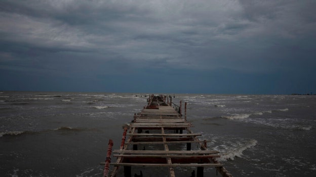
Waves kick up under a dark sky along the shore of Batabano, Cuba, Monday, Sept. 26, 2022. Hurricane Ian was growing stronger as it approached the western tip of Cuba on a track to hit the west coast of Florida as a major hurricane as early as Wednesday. (AP Photo/Ramon Espinosa)
As Hurricane Ian moved through the Gulf of Mexico, officials were warning Florida residents to be prepared and evacuate when necessary.
The National hurricane Center said Ian is expected to pass west of the Florida Keys later Tuesday and approach its western coast on Wednesday.
Daniel Kaniewski, managing director at Marsh McLennan and former FEMA deputy administrator, told Fox News that residents should heed directions because particular effects of the storm can be "highly localized."
"You want to make sure that your that your actions reflect the risk you face. And, to that end, whether it be your mayor or your local emergency manager, they're going to best know the likely impacts from where you live. And, that can be very different from someone just a few miles away," he advised, noting that particular impacts could be different from others.
The storm is expected to bring life-threatening storm surge and extreme flooding.
Kaniewski said that flooding is the most deadly aspect of a hurricane, adding that a storm's category only reflects the wind speed.
"If the number is lower than expected, or if it's anything less than a catastrophic number like a four or five, individuals can become complacent and the problem with that is that because you may not realize you're very vulnerable to either the storm surge or the inland flooding," he explained.
The wind and storm surge will prove most deadly to those on the coast, but those inland are not out of harm's way as the hurricane moves.
Kaniewski said that every hurricane is different, with factors like what houses are made of and geography making a major difference.
"All of those factors matter and what's the elevation of the area and what's the elevation of your home, if your home is elevated, as some homes in Florida are, that'll be more resistant to flooding because the water will pass under it. Or around it. But it may not be resistant to wind," he stated. "So, there are there are many factors that will determine how severe the impacts will be to any individual home."
Fox News' Ashley Papa contributed to this report.
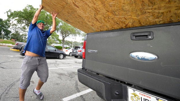
Jesus Rodrigues loads wood in his vehicle outside a Home Depot store in preparation for the arrival of Hurricane Ian, Monday, Sept. 26, 2022, in Orlando, Fla. Ian was growing stronger as it approached the western tip of Cuba on a track to hit the west coast of Florida as a major hurricane as early as Wednesday. (AP Photo/Phelan M. Ebenhack)
Manatee County emergency officials expanded the mandatory evacuation order to include Level A and Level B zones.
Residents living in Level C are encouraged to find shelter inland.
“This is worst-case scenario,” Manatee County Administrator Scott Hopes said in a release. “Those along the coast and prone to flooding need to take this seriously and evacuate.”
As of noon Tuesday, an additional two storm shelters will open in the Florida county.
Buffalo Creek Middle School will open as a pet friendly shelter, along with Haile Middle School.
In addition, signs along Cortez Blvd. and Manatee Ave. will begin instructing motorists that there is “no Westbound access” to the gulf islands beginning at 4 p.m. EDT..
Utilities crews will be shutting off the potable water service to the barrier islands by sunset on Tuesday to help maintain the integrity of the infrastructure during Hurricane Ian’s passage.
A news briefing is set for 2 p.m. EDT at the Manatee County Emergency Operations Center.
Manatee and Citrus Counties join the list of those with mandatory evacuation orders.
Key West, Fla., Mayor Teri Johnston told "Fox & Friends" on Tuesday that residents there are starting to see impacts from Hurricane Ian.
On Monday evening, residents there were under a tornado watch until early Tuesday.
"We're starting to see the winds pick up. We've had rain squalls. And, certainly, we've been preparing for this for the last two days in Key West," she explained.
City Hall there is closed and emergency services will operating as long as they can.
"Very few" people have evacuated ahead of the storm.
"So, we are preparing for the worst and hoping for the best," Johnston added, noting that they were prepared for flooding and high winds.
Florida is already getting heavy rain from Ian, which is expected to intensify into a catastrophic Category 4 hurricane.
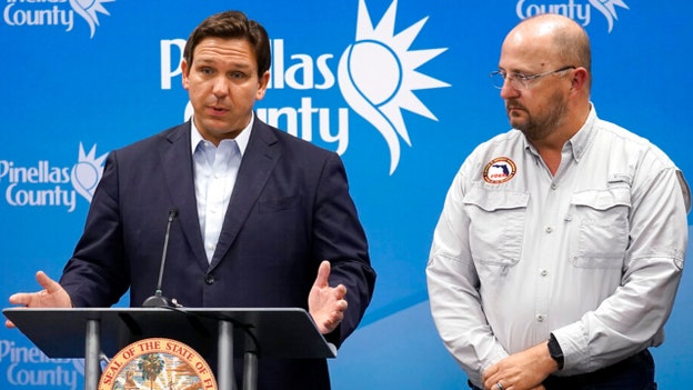
Florida Gov. Ron DeSantis, left, speaks as he stands with Kevin Guthrie, director of the Florida Division of Emergency Management, during a news conference, Monday, Sept. 26, 2022, in Largo, Fla. DeSantis was keeping residents updated on the track of Hurricane Ian. (AP Photo/Chris O'Meara)
"You still have time today to execute what you need to do," Gov. Ron DeSantis advised Floridians in a Tuesday morning news briefing.
He warned that Hurricane Ian would bring interruptions in power, fuel and possibly communications.
DeSantis said there have been about 500 requests for assistance from Florida counties and that a state of emergency was in place for all 67 counties.
The governor added that 300 ambulance supporting special needs evacuations had been deployed and that hundreds of generators and pumps were staged – as well as food and water –primarily in the Tampa Bay region.
FDEM Dir. Kevin Guthrie, speaking next, said that landfall was predicted to be in Venice, Fla., in 35 hours, with maximum winds of 125 mils per hour.
He noted that power impacts could last for as many as seven days and that Tampa would "not be out of the woods yet" as the track shifts due to a storm surge event in the region.
Guthrie told Floridians to make sure they have enough supplies and that those who are evacuating should not go north, instructing to evacuate across the state instead.
"Here’s what it looked like at 1:45am outside the @cayCompass building in George Town," Reshma Ragoonath tweeted early Monday.
The storm is forcing Florida officials to take action, as it moves toward the Keys.
Florida Gov. Ron DeSantis said Tuesday that there was a state of emergency for all 67 counties.
School districts in 24 Florida counties have announced school closures and more are expected.
A video posted to social media shows the effects of Hurricane Ian.
Palm trees blow amidst strong winds and heavy rainfall.
The Category 3 storm was battering western Cuba mid-Tuesday morning, with strengthening expected as the storm moves over warm Gulf of Mexico waters.
As Hurricane Ian nears and Florida residents take precaution, knowing how to prepare and respond increases a person's chance of survival, according to the National Weather Service.
Before the start of hurricane season, the NWS recommends building a basic emergency supply kit and periodically making sure emergency equipment works correctly, including flashlights, generators and storm shutters.
The weather service refers residents of hurricane zones to the U.S. Department of Homeland Security’s "Basic Disaster Supplies" list on ready.gov, which has a breakdown of basic and additional supplies approved by the Federal Emergency Management Agency (FEMA).
Basic emergency items include non-perishable food and water (gallon per person) that can last for several days, backup batteries and chargers for cellphones, extra packs of batteries for other emergency items, a battery-operated or hand crank radio, flashlights and a first aid kit.
Other basic disaster supplies that ready.gov names include a whistle to signal for help, dust masks to filter contaminated air, plastic sheeting and duct tape for sheltering in place, sanitation materials (moist towelettes, garbage bags and plastic ties), a wrench or pliers for turning off utilities, a manual can opener and local maps.
Additional emergency supply include prescribed medications and eyewear, infant or pet care supplies and copies of important family documents (IDs, bank accounts, insurance policies, etc.). People should keep these documents in a portable waterproof container, according to ready.gov.
More items include cash, emergency reference materials like first aid books and evacuation information, sleeping bags or warm blankets for each family member, extra clothes, fire extinguishers, matches (stored in a waterproof container), feminine and personal hygiene supplies, hand sanitizers, mess kits, disposable dinnerware, paper, pencil and non-electric entertainment activities.
The NWS and ready.gov both advise residents living in hurricane zones to research their area’s risk level and their nearest evacuation zone.
With this information in hand, residents who are at risk are urged to put together an emergency plan and review the plan with family members before disaster strikes.
Both agencies state that preparing "go bags" or packing a car trunk with basic emergency supplies should be a part of each family’s emergency planning, and it must be done before a hurricane arrives.
Residents in hurricane zones should consider having materials to fortify their homes, such as wood planks for boarding windows, according to the NWS’s What to Do Before the Tropical Storm or Hurricane.
Homeowners should also keep trees trimmed, declutter gutters, bring loose outdoor furniture indoors, secure all doors and move cars into garages or another secure location, according to the NWS and ready.gov.
Storm forecasts and updates should be monitored before, during and after a hurricane passes.
The NWS said information can be found through local TV news stations, mobile phones, radio broadcasts, social media and weather.gov.
If evacuations are ordered by local officials, the NWS and ready.gov strongly encourage residents to follow instructions and leave immediately. Returns can be made if officials deem areas to be inhabitable post-hurricane.
Residents who aren't ordered to evacuate can take refuge in small interior rooms, closets or hallways for safety, according to the NWS.
"Stay away from windows, skylights and glass doors," the NWS warns. "If the eye of the storm passes over your area, there will be a short period of calm, but at the other side of the eye, the wind speed rapidly increases to hurricane force winds coming from the opposite direction."
Ready.gov recommends avoiding floodwaters outside and moving to higher levels if floodwaters enter a building or house.
Homeowners shouldn't hide in closed attics because they can become trapped by rising floodwater, according to the disaster preparedness website.
Cleaning up after a hurricane might require wearing protective clothing, including face coverings or masks if mold is present and being extra cautious around electrical equipment that may have gotten wet during the storm, ready.gov warns.
The NWS says residents should also be wary of weakened roads, bridges, sidewalks and walls, structural damage from floods or fires, loose power lines, gas leaks and carbon monoxide poisoning from generators or another source.
Fox News' Courtney Moore contributed to this report.
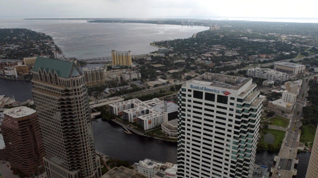
In this aerial image, the city of Tampa, Fla., is seen Monday, Sept. 26, 2022. Hurricane Ian was growing stronger as it barreled toward Cuba on a track to hit Florida's west coast as a major hurricane as early as Wednesday. It's been more than a century since a major storm like Ian has struck the Tampa Bay area, which blossomed from a few hundred thousand people in 1921 to more than 3 million today. (DroneBase via AP)
A strengthening Hurricane Ian’s rain and winds lashed Cuba’s western tip, where authorities have evacuated 50,000 people.
Officials set up 55 shelters and rushed in emergency personnel.
After passing over Cuba, Ian was forecast to strengthen further over warm Gulf of Mexico waters.
The major Category 3 storm could hit Florida’s west coast as a Category 4 hurricane.
As many as 300,000 people may be evacuated from low-lying areas in Hillsborough County alone, county administrator Bonnie Wise said.
Gov. Ron DeSantis said the state has suspended tolls around the Tampa Bay area and mobilized 5,000 Florida state national guard troops, with another 2,000 on standby in neighboring states.
President Biden also declared an emergency due to the hurricane.
The Associated Press contributed to this report.
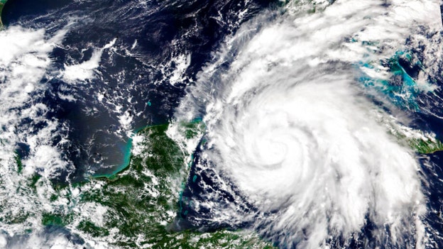
This Sept. 26, 2022, satellite image released by NASA shows Hurricane Ian growing stronger as it barreled toward Cuba. Ian was forecast to hit the western tip of Cuba as a major hurricane and then become an even stronger Category 4 with top winds of 140 mph (225 km/h) over warm Gulf of Mexico waters before striking Florida. (NASA Worldview/Earth Observing System Data and Information System (EOSDIS) via AP)
Significant wind and storm surge impacts are occurring over western Cuba as Category 3 Hurricane Ian moves over the region.
The National Hurricane Center said early Tuesday that life-threatening storm surge, hurricane-force winds, flash flooding and mudslides are expected in western Cuba.
Damaging wind is also forecast where the core of the storm moves across the area.
On Florida's west coast, there is a danger of life-threatening storm surge and a warning has been issued.
The highest risk is for residents from Fort Myers to Tampa Bay.
In addition, heavy rainfall will increase across the Florida Keys and South Florida on Tuesday and hurricane-force winds are expected in west-central Florida beginning late Wednesday morning.
Live Coverage begins here