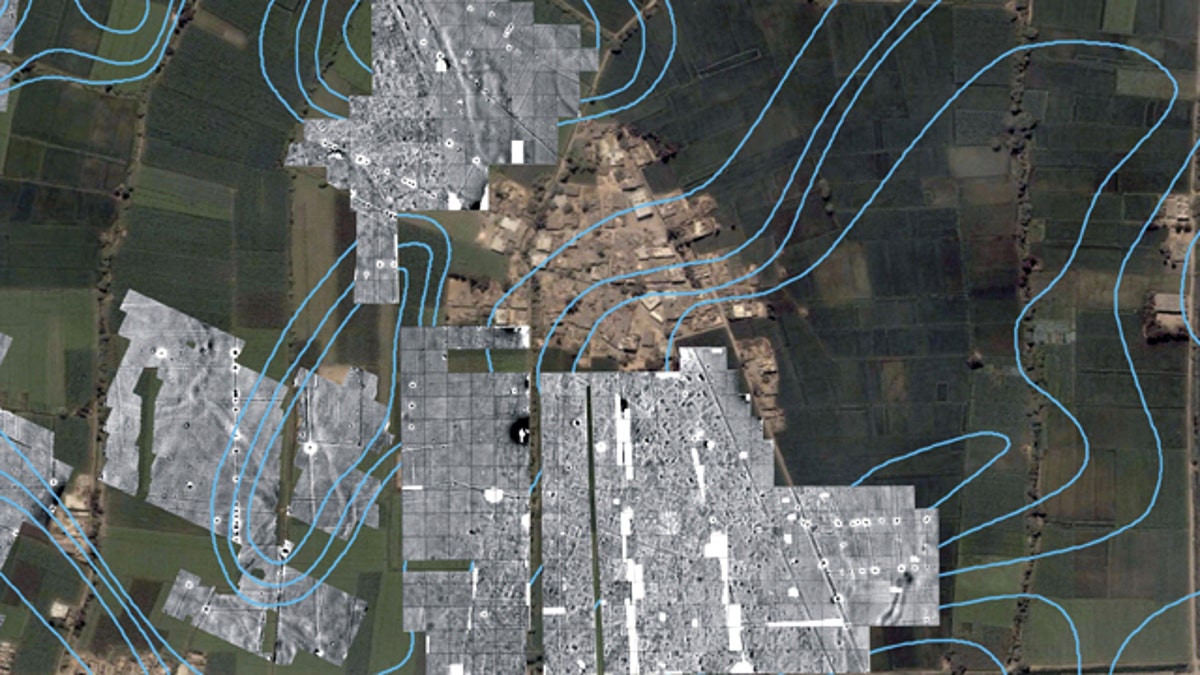
A color satellite image with radar imaging in monochrome showing the outlines of streets, houses and temples underneath the green farm fields and modern town of Tel al-Dabaa, in Egypt. An Austrian archaeological team has used radar imaging to determine the size of the 3,500-year-old capital of Egypt's foreign occupiers, the Hyksos warrior people from Asia, the antiquities department said Sunday. (AP Photo/Supreme Council of Antiquities)
CAIRO — An Austrian archaeological team has used radar imaging to determine the extent of the ruins of the one time 3,500-year-old capital of Egypt's foreign occupiers, said the antiquities department Sunday.
Egypt was ruled for a century from 1664-1569 B.C. by the Hyksos, a warrior people from Asia, possibly Semitic in origin, whose summer capital was in the northern Delta area.
Irene Mueller, the head of the Austrian team, said the main purpose of the project is to determine how far the underground city extends.
The radar imaging showed the outlines of streets, houses and temples underneath the green farm fields and modern town of Tel al-Dabaa.
Archaeology chief Zahi Hawass said in the statement that such noninvasive techniques are the best way define the extent of the site. Egypt's Delta is densely populated and heavily farmed, making extensive excavation difficult, unlike in southern Egypt with its more famous desert tombs and temples.
The Austrian team of archaelogists has been working on the site since 1975.

Get a daily look at what’s developing in science and technology throughout the world.